Trussville in Jefferson County, Alabama — The American South (East South Central)
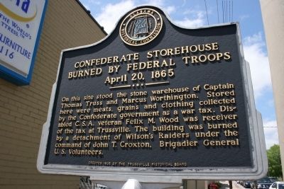
Confederate Storehouse Burned By Federal Troops
April 20, 1865
Erected 1995 by Alabama Historical Commission / Trussville Historical Board.
Topics and series. This historical marker is listed in this topic list: War, US Civil. In addition, it is included in the Alabama Historical Commission series list.
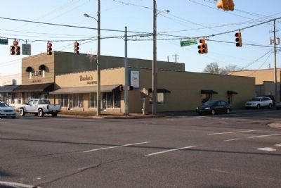
Location. 33° 37.182′ N, 86° 36.51′ W. Marker is in Trussville, Alabama, in Jefferson County. Marker is at the intersection of North Chalkville Road and Main Street (U.S. 11), on the right when traveling south on North Chalkville Road. Touch for map. Marker is in this post office area: Trussville AL 35173, United States of America. Touch for directions.
Other nearby markers. At least 8 other markers are within 5 miles of this marker, measured as the crow flies. First Baptist Church of Trussville (approx. 0.3 miles away); Trussville (approx. 0.3 miles away); Cahaba Project (approx. 0.4 miles away); Trussville, Alabama (approx. half a mile away); Trussville Furnace (approx. 0.7 miles away); Mt. Nebo Cemetery (approx. 0.9 miles away); Center Point, Alabama (approx. 4.6 miles away); Pioneer Massey Cemetery (approx. 5 miles away). Touch for a list and map of all markers in Trussville.
Credits. This page was last revised on June 16, 2016. It was originally submitted on December 24, 2009, by Timothy Carr of Birmingham, Alabama. This page has been viewed 2,134 times since then and 31 times this year. Photos: 1, 2. submitted on December 24, 2009, by Timothy Carr of Birmingham, Alabama. • Craig Swain was the editor who published this page.

