Chambersburg in Franklin County, Pennsylvania — The American Northeast (Mid-Atlantic)
The Colhoun House
circa 1782
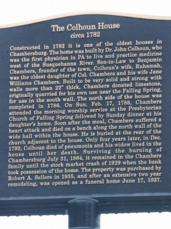
Photographed by Duane and Tracy Marsteller, September 26, 2024
1. The Colhoun House Marker
this page online
Topics. This historical marker is listed in these topic lists: Architecture • Industry & Commerce • Science & Medicine • Settlements & Settlers. A significant historical year for this entry is 1782.
Location. 39° 56.489′ N, 77° 39.606′ W. Marker is in Chambersburg, Pennsylvania, in Franklin County. It is at the intersection of Philadelphia Avenue (U.S. 11) and Chambers Street, on the right when traveling south on Philadelphia Avenue. Touch for map. Marker is at or near this postal address: 297 Philadelphia Ave, Chambersburg PA 17201, United States of America. Touch for directions.

Regionally, this marker is in South-Central Pennsylvania. It is also in the American Northeast, in the Mid-Atlantic, in Appalachia, and specifically in Northern Appalachia. Globally, it is in North America, the Western Hemisphere, the Western World, and the Anglosphere. Historically,

Photographed by Duane and Tracy Marsteller, September 26, 2024
2. The Colhoun House Marker
Other nearby markers. At least 8 other markers are within walking distance of this marker: Falling Spring Church (about 300 feet away, measured in a direct line); Benjamin Chambers (approx. 0.2 miles away); Joseph Winters (approx. 0.2 miles away); Old Franklin County Jail (approx. 0.2 miles away); Fort Chambers (approx. 0.2 miles away); This Dwight D. Eisenhower Green Ash (approx. 0.2 miles away); King Street Church (approx. 0.2 miles away); John Brown (approx. 0.2 miles away). Touch for a list and map of all markers in Chambersburg.
Credits. This page was last revised on October 8, 2024. It was originally submitted on October 8, 2024, by Duane and Tracy Marsteller of Murfreesboro, Tennessee. This page has been viewed 420 times since then and 77 times this year. Photos: 1, 2. submitted on October 8, 2024, by Duane and Tracy Marsteller of Murfreesboro, Tennessee.
