
Picpus in Paris in Département de Paris, Île-de-France, France — Western Europe
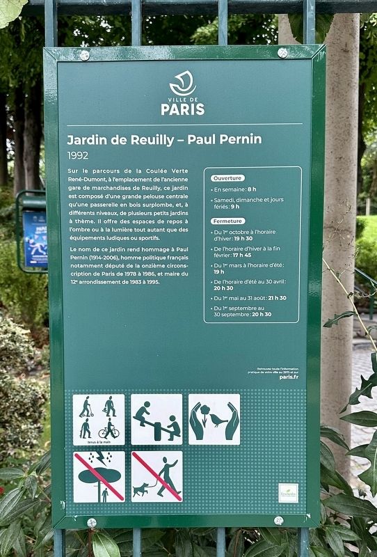
Jardin de Reuilly - Paul Pernin (1992)
Photographed by Andrew Ruppenstein, September 10, 2024
1. Jardin de Reuilly - Paul Pernin (1992) Marker

Le nom de ce jardin rend hommage à Paul Pernin (1914-2006), homme politique français notamment député de la onzième circons cription de Paris de 1978 à 1986, et maire du 12° arrondissement de 1983 à 1995.
Situated on the Coulée Verte René-Dumont route, on the site of the former Reuilly freight station, this garden is made up of a large central lawn overlooked by a wooden footbridge, and, at different levels, several small themed gardens. It offers rest areas in the shade or in the light as well as play or sports facilities.
The name of this garden pays homage to Paul Pernin (1914-2006), a French politician, notably deputy for the eleventh district of Paris from 1978 to 1986, and mayor of the 12th arrondissement from 1983 to 1995.
Erected by Ville de Paris.
Topics and series. This historical marker is listed in these topic lists: Government & Politics • Parks & Recreational Areas. In addition, it is included in the Parks and Squares of Paris series list. A significant historical year for this entry is 1978.
Location. 48° 50.497′ N, 2° 23.259′ E. Marker is in Paris, Île-de-France, in Département de Paris. It is in Picpus. It is on Avenue Daumesnil south of Rue Montgallet, on the right when traveling north. Touch for map. Marker is in this post office area: Paris, Île-de-France 75012, France. Touch for directions.

Regionally, it is in the North Atlantic Region, Europe, the European
this page online
Other nearby markers. At least 8 other markers are within walking distance of this marker: Square Eugène-Thomas (1877) (within shouting distance of this marker); Enfants du 12ème arrondissement déportés / 12th Arrondissement Deported Jewish Children Memorial (within shouting distance of this marker); Juifs du 12ème arrondissement raflés / Jews of the 12th Arrondissement rounded up Memorial (about 90 meters away, measured in a direct line); Caserne, août 1944 / Barracks, August 1944 (about 120 meters away); École Élémentaire Publique Bignon Deported Jewish Students Memorial (about 150 meters away); École maternelle Elisa Lemmonier Deported Jewish Students Memorial (about 150 meters away); August 1944 12th Arrondissement Police Memorial (approx. 0.6 kilometers away); 46ème Regiment d’Infanterie Caserne / 46th Infantry Regiment Barracks (approx. 0.7 kilometers away). Touch for a list and map of all markers in Paris.

Photographed by Andrew Ruppenstein, September 10, 2024
2. Jardin de Reuilly - Paul Pernin (1992) Marker at entrance to the garden

Photographed by Andrew Ruppenstein, September 10, 2024
3. Jardin de Reuilly - Paul Pernin - large central lawn with wooden footbridge visible
Photographed by Andrew Ruppenstein, September 10, 2024
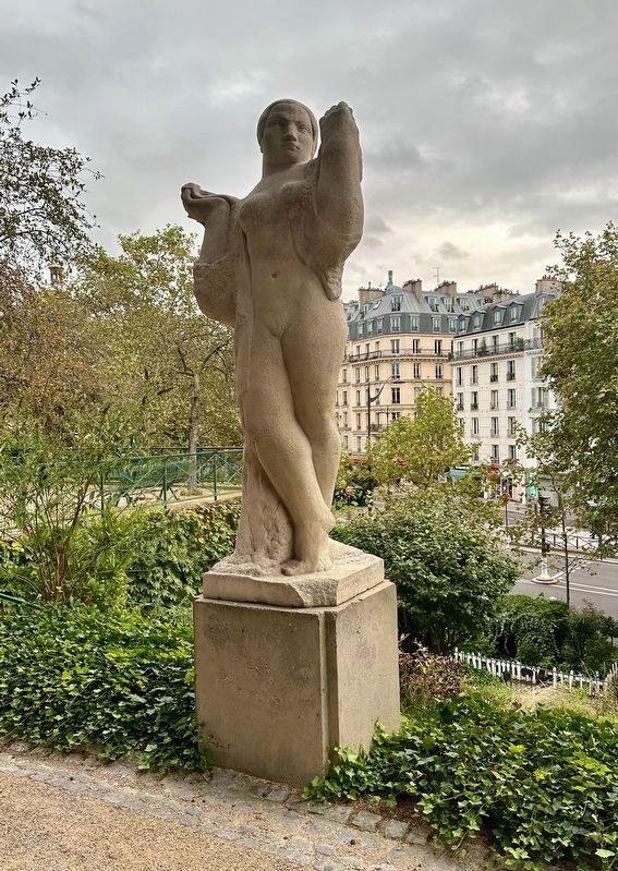
4. Jardin de Reuilly - Paul Pernin - statue
Along the upper level of the park there are a number of statues, such as this one.
Credits. This page was last revised on October 9, 2024. It was originally submitted on October 8, 2024, by Andrew Ruppenstein of Lamorinda, California. This page has been viewed 145 times since then and 10 times this year. Photos: 1, 2, 3, 4. submitted on October 8, 2024, by Andrew Ruppenstein of Lamorinda, California.
