Near Henrico in Henrico County, Virginia — The American South (Mid-Atlantic)
Willis Church Parsonage
The Confederates Move Toward Malvern Hill
| — | Malvern Hill Battlefield – Richmond Nat'l Battlefield Park | — |
Photographed by Bill Coughlin, April 24, 2007
1. Willis Church Parsonage Marker
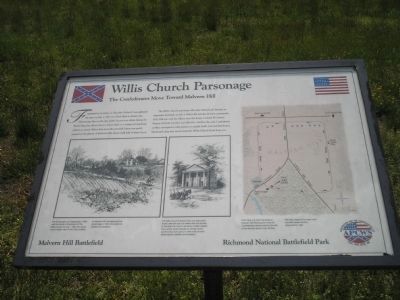
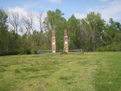
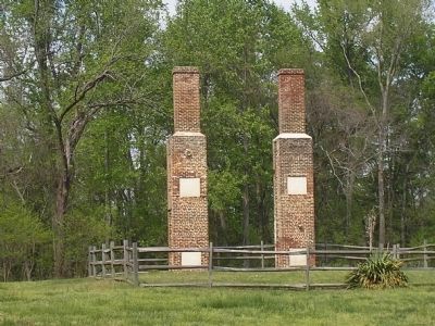
The Willis Church parsonage (the ruins behind you) became an important landmark on July 1. Before the attacks, division commander D.H. Hill met with his officers near the house. Colonel W. Gaston Meares of North Carolina was killed by a shell in the yard. Confederate artillery attempted to take position in nearby fields. Lee watched from a blacksmith shop that stood across the Willis Church from you.
Erected by Association for the Preservation of Civil War Sites, Inc.
Topics. This historical marker is listed in this topic list: War, US Civil. A significant historical date for this entry is July 1, 1862.
Location. 37° 25.118′ N, 77° 14.827′ W. Marker is near Henrico, Virginia, in Henrico County. It is on Willis Church Road 0.2 miles Carter
this page online

Regionally, this marker is in the Piedmont, in Central Virginia, and in the Richmond Metropolitan Area. It is also in the American South, specifically in the Upper South, and on the Eastern Seaboard. Globally, it is in the North Atlantic Region, North America, the Western Hemisphere, the Western World, and the Anglosphere. Historically, it finds itself in what was once the territory of the Mississippian Culture, one of the original Thirteen Colonies, one of the Confederate States of America, and the Antebellum South.
Other nearby markers. At least 8 other markers are within walking distance of this marker: The Gathering Storm (here, next to this marker); Battle Commences (a few steps from this marker); Methodist Parsonage (within shouting distance of this marker); Malvern Hill Trail (within shouting distance of this marker); Twilight Action (within shouting distance

2. Malvern Hill - CWPT
Civil War Preservation Trust's efforts to preserve portions of the battlefield.
Click for more information.
Click for more information.
Another marker is no longer nearby. Battle of Malvern Hill Trail (was within shouting distance of this marker but has been replaced with another marker now near it).
More about this marker. The bottom left of the marker contains a picture of the Willis Church Parsonage with the caption, “The Parsonage, as it appeared in 1885, was the home of the pastor of the Willis Church. On July 1, 1862, the house stood in plain view of the Union artillery on Malvern Hill. Fire destroyed the parsonage in 1988. (Drawing from Battles and Leaders.) Next to this is a picture of the church with the caption, “The Willis Church is shown here as it appeared shortly after the war. For weeks after the battles in this area the church served as a field hospital. The current church stands on the site of the wartime structure, about a mile north of here. (Drawing from Battles and Leaders.)
Photographed by Bill Coughlin, April 24, 2007
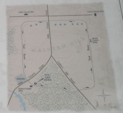
3. Malvern Hill Hiking Trail Map from Marker
Also see . . .
1. Malvern Hill. CWSAC Battle Summaries. (Submitted on January 1, 2009, by Bill Coughlin of Woodland Park, New Jersey.)
2. Malvern Hill Battlefield Podcast. National Park Service website. (Submitted on January 1, 2009, by Bill Coughlin of Woodland Park, New Jersey.)
Photographed by Craig Swain, March 21, 2010
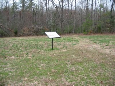
4. Willis Church Parsonage Marker
Photographed by Bill Coughlin, April 24, 2007
5. Marker at Willis Church Parsonage
The marker is located in front of the ruins of the Willis Church Parsonage.
Photographed by Bill Coughlin, April 24, 2007
6. Willis Church Parsonage
Credits. This page was last revised on October 13, 2024. It was originally submitted on January 1, 2009, by Bill Coughlin of Woodland Park, New Jersey. This page has been viewed 2,507 times since then and 90 times this year. Last updated on October 13, 2024, by Carl Gordon Moore Jr. of North East, Maryland. Photos: 1. submitted on January 1, 2009, by Bill Coughlin of Woodland Park, New Jersey. 2. submitted on March 28, 2010, by Craig Swain of Leesburg, Virginia. 3. submitted on January 1, 2009, by Bill Coughlin of Woodland Park, New Jersey. 4. submitted on April 1, 2010, by Craig Swain of Leesburg, Virginia. 5, 6. submitted on January 1, 2009, by Bill Coughlin of Woodland Park, New Jersey. • Bernard Fisher was the editor who published this page.
