Near Crisfield in Somerset County, Maryland — The American Northeast (Mid-Atlantic)
Daugherty Creek Canal
Janes Island State Park—White Tail Trail
| — | Maryland Park Service | — |
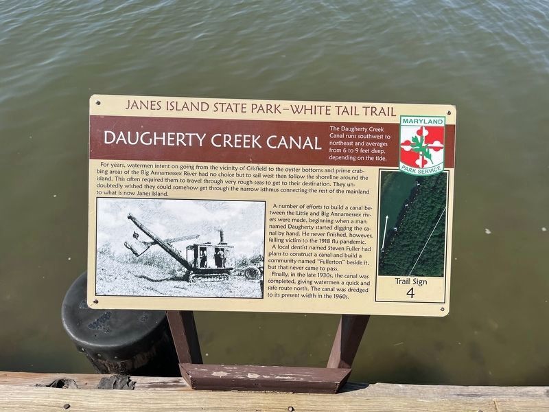
The Daugherty Creek Canal runs southwest to northeast and averages from 6 to 9 feet deep, depending on the tide.
For years, watermen intent on going from the vicinity of Crisfield to the oyster bottoms and prime crabbing areas of the Big Annamessex River had no choice but to sail west then follow the shoreline around the island. This often required them to travel through very rough seas to get to their destination. They undoubtedly wished they could somehow get through the narrow isthmus connecting the rest of the main land to what is now Janes Island.
A number of efforts to build a canal between the Little and Big Annamessex rivers were made, beginning when a man named Daugherty started digging the canal by hand. He never finished, however, falling victim to the 1918 flu pandemic.
A local dentist named Steven Fuller had plans to construct a canal and build a community named "Fullerton" beside it, but that never came to pass.
Finally, in the 1930s, the canal was completed, giving watermen a quick and safe route north. The canal was dredged to its present width in the 1960s.
Erected by Maryland Park Service.
this page online
Topics. This historical marker is listed in these topic lists: Industry & Commerce • Waterways & Vessels. A significant historical year for this entry is 1918.
Location. 38° 0.77′ N, 75° 50.851′ W. Marker is near Crisfield, Maryland, in Somerset County. It can be reached from Canal Drive north of Alfred J Lawson Drive, on the left when traveling north. Touch for map. Marker is at or near this postal address: 4923 Canal Dr, Crisfield MD 21817, United States of America. Touch for directions.

Regionally, this marker is on the Eastern Shore. It is also in the American Mid-Atlantic, on the Delmarva Peninsula, in the Tidewater, in the Chesapeake Bay Region, and on the Eastern Seaboard. Globally, it is in the North Atlantic Region, North America, the Western Hemisphere, the Western World, and the Anglosphere. Historically, it finds itself in what was once one of the original Thirteen Colonies and also the Antebellum South.
Other nearby markers. At least 8 other markers are within 2 miles of this marker, measured as the crow flies: Fields and Pastures (about 500 feet away, measured in a direct line); Loblolly Pine

Photographed by Devry Becker Jones (CC0), October 12, 2024
3. The Blue Crab sign
This sign is a nature marker and does not offer any historical information.
Credits. This page was last revised on October 13, 2024. It was originally submitted on October 13, 2024, by Devry Becker Jones of Washington, District of Columbia. This page has been viewed 634 times since then and 50 times this year. Photos: 1, 2, 3. submitted on October 13, 2024, by Devry Becker Jones of Washington, District of Columbia.
