Kennebunk in York County, Maine — The American Northeast (New England)
Shipbuilding along the Kennebunk River
Hundreds of sailing ships built upstream passed through the bridge here
Photographed by Thomas Smith, September 30, 2024
1. Shipbuilding along the Kennebunk River Marker
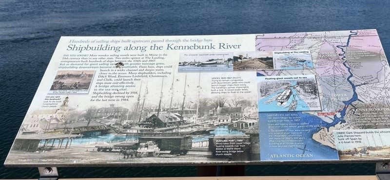
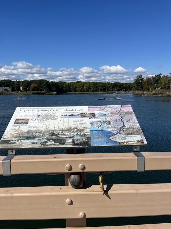
Did you know? More wooden sailing vessels were built in Maine in the 19th century than any other state. Two miles upriver at The Landing., entrepreneurs built hundreds of ships between 1760's and 1867. But as demand for giant vessels with greater tonnage grew, shipbuilding downstream became more profitable. From here ships could launch in a wider channel and deeper water, closer to, the ocean. many shipbuilders , including D&S Ward Emmons Littlefield, Christensen, and Clark, could lunch their ships more cost - effectively. A bridge allowing access to the sea was vital. Shipbuilding declined by 1918, and the bridge swung open for the last time in 1984
Topics. This historical marker is listed in these topic lists: Industry & Commerce • Waterways & Vessels. A significant historical year for this entry is 1867.
Location. 43° 21.67′ N, 70° 28.694′ W. Marker is in Kennebunk, Maine, in York County. It is on Dock Square south of Ocean Avenue, on the right when traveling south. Located on the bridge over the Kennebunk River. Touch for map. Marker is at or near this postal address: 2 Western Ave, Kennebunk ME 04043, United States
this page online

Regionally, this marker is on Southern Maine Coast. It is also in the American Northeast, in New England, and on the Eastern Seaboard. Globally, it is in the North Atlantic Region, North America, the Western Hemisphere, the Western World, and the Anglosphere.
Other nearby markers. At least 8 other markers are within 2 miles of this marker, measured as the crow flies: Kennebunk River Drawbridge (a few steps from this marker); Bridge changes as town evolves (within shouting distance of this marker); Soldiers and Sailors Memorial (about 300 feet away, measured in a direct line); Vatican Pavilion Sculpture (approx. 0.4 miles away); Anchor to Windward Monument (approx. 1.4 miles away); Our President George H. W. Bush (approx. 1.4 miles away); The McCulloch House (approx. 1.9 miles away); Hugh McCulloch Home / La demeure Hugh McCulloch (approx. 1.9 miles away). Touch for a list and map of all markers in Kennebunk.
Photographed by Thomas Smith, September 30, 2024
2. Shipbuilding along the Kennebunk River Marker
Credits. This page was last revised on July 7, 2025. It was originally submitted on October 13, 2024, by Thomas Smith of Waterloo, Ill. This page has been viewed 335 times since then and 38 times this year. Photos: 1, 2. submitted on October 13, 2024, by Thomas Smith of Waterloo, Ill. • Michael Herrick was the editor who published this page.
