Near Wells in York County, Maine — The American Northeast (New England)
The 2005 Landslide

Photographed by Steve Stoessel, October 13, 2024
1. The 2005 Landslide Marker
What Happened?
In May of 2005, a landslide changed the face of the Rachel Carson Trail near Outlook 1. This singular event not only altered the appearance of the present landscape, but also changed the surrounding ecosystem permanently. Nevertheless, this landslide was not a sporadic event, It occurred as the result of four factors affecting banks of the Merriland River:
• winding river channel
• unconsolidated sediments
• high groundwater table
• a fault
The natural current along the outside edge of the Merriland River channel steadily removed sediment from the base of the cliff over a period of many years.
Steep, unstable riverbank cliffs made up of heavy sediments, not bedrock, added to the unpredictability of the area. Cliff sediments were composed of a sand layer and a deeper marine clay layer that lacked any real cohesion. High water tables, prevalent in the record wet spring of 2005, kept the pore space in sediments saturated. This weakened the bond between particles. Increased pressure from penetrating rainfall forced the soil apart and created greater instability.
These combined factors
this page online
What You Will See
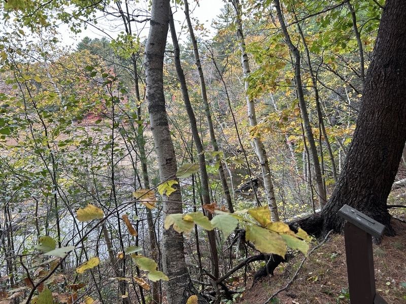
Besides the obvious steepness of the area next to the Outlook 1 portion of the trail, additional evidence of the landslide can be found. Further along the trail, walkers will notice areas along the plateau where trees are leaning toward the bluff and are growing on a ledge well below the level of the trail. This is evidence of past landslides and demonstrates how the area will be transformed over time.
So Now What?
A remaining question is how the course of the river and the existing marsh will be altered by the damming effect of the landslide. The tidal river patiently dredges new channels and seeks the path of least resistance to the open ocean. Years from now, visitors more than likely will be looking out across a new channel as the river continues its seaward flow.
Water-Saturated Sediment
Water fills in the pore space between grains. Friction between grains holds sediment together.
Liquefaction
Water completely surrounds all grains and eliminates all grain to grain contact. Sediment flows like a fluid.
Erected by National

Photographed by Steve Stoessel, October 13, 2024
2. The 2005 Landslide Marker
Topics. This historical marker is listed in this topic list: Environment. A significant historical month for this entry is May 2005.
Location. 43° 20.818′ N, 70° 32.926′ W. Marker is near Wells, Maine, in York County. It can be reached from Port Road (Maine Route 9). Marker is the first stop on trail at the refuge. Touch for map. Marker is in this post office area: Wells ME 04090, United States of America. Touch for directions.

Regionally, this marker is on Southern Maine Coast. It is also in the American Northeast, in New England, and on the Eastern Seaboard. Globally, it is in the North Atlantic Region, North America, the Western Hemisphere, the Western World, and the Anglosphere.
Other nearby markers. At least 8 other markers are within walking distance of this marker: Rachel Carson National Wildlife Refuge (within shouting distance of this marker); Rachel Carson (within shouting distance of this marker); Welcome to the 'Sense of Wonder' Rain Garden… (within shouting distance of this marker); Laudholm Farm: The foundation of the Wells Reserve (approx. 0.6 miles away); Hay and Horse Barn (approx. 0.6 miles
Photographed by Steve Stoessel, October 13, 2024
3. View from Outlook #1
Credits. This page was last revised on October 14, 2024. It was originally submitted on October 14, 2024, by Steve Stoessel of Niskayuna, New York. This page has been viewed 149 times since then and 18 times this year. Photos: 1, 2, 3. submitted on October 14, 2024, by Steve Stoessel of Niskayuna, New York.
