Near Kennebunk in York County, Maine — The American Northeast (New England)
Fire, People & Resources
North Atlantic Fire Learning Trail
Photographed by Steve Stoessel, October 13, 2024
1. Fire, People & Resources Marker
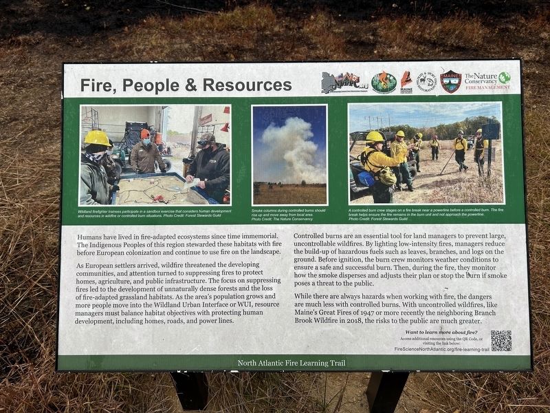
As European settlers arrived, wildfire threatened the developing communities, and attention turned to suppressing fires to protect homes, agriculture, and public infrastructure. The focus on suppressing fires led to the development of unnaturally dense forests and the loss of fire-adapted grassland habitats. As the area's population grows and more people move into the Wildland Urban Interface or WUI, resource managers must balance habitat objectives with protecting human development, including homes, roads, and power lines.
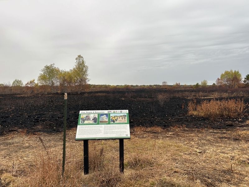
Controlled burns are an essential tool for land managers to prevent large, uncontrollable wildfires. By lighting low-intensity fires, managers reduce the build-up of hazardous fuels such as leaves, branches, and logs on the ground. Before ignition, the burn crew monitors weather conditions to ensure a safe and successful burn. Then, during the fire, they monitor how the smoke disperses and
this page online
While there are always hazards when working with fire, the dangers are much less with controlled burns. With uncontrolled wildfires, like Maine's Great Fires of 1947 or more recently the neighboring Branch Brook Wildfire in 2018, the risks to the public are much greater.
[photo captions, left to right]
Wildland firefighter trainees participate in a sandbox exercise that considers human development and resources in wildfire or controlled burn situations.
Smoke columns during controlled burns should rise up and move away from local area.
A controlled burn crew stages on a fire break near a powerline before a controlled burn. The fire break helps ensure the fire remains in the burn unit and not approach the powerline.
Erected by North Atlantic Fire Science Exchange.
Topics. This historical marker is listed in these topic lists: Disasters • Environment.
Location. 43° 24.188′ N, 70° 37.358′ W. Marker is near Kennebunk, Maine, in York County. It is on Kennebunk Plains Trail north of Webber Hill
Photographed by Steve Stoessel, October 13, 2024
2. Fire, People & Resources Marker

Regionally, this marker is on Southern Maine Coast. It is also in the American Northeast, in New England, and on the Eastern Seaboard. Globally, it is in the North Atlantic Region, North America, the Western Hemisphere, the Western World, and the Anglosphere.
Other nearby markers. At least 8 other markers are within 5 miles of this marker, measured as the crow flies: Partnership in Stewardship (approx. 0.3 miles away); Memorial Athletic Field (approx. 3.7 miles away); Wallingford Hall (approx. 4.1 miles away); Lafayette Elm Site (approx. 4.1 miles away); Kennebunk Rotary Club (approx. 4.2 miles away); The Lafayette Center / Le Centre Lafayette (approx. 4.2 miles away); Kennebunk, Maine (approx. 4.2 miles away); The Mousam River / Le Fleuve Mousam (approx. 4.3 miles away). Touch for a list and map of all markers in Kennebunk.
Another marker is no longer nearby. The Storer Residence / La Résidence Storer (was approx. 4.2 miles away but has been replaced with another marker now near it).
Also see . . . Trail Link. (Submitted on October 15, 2024, by Steve Stoessel of Niskayuna, New York.)
Credits. This page was last revised on October 15, 2024. It was originally submitted on October 14, 2024, by Steve Stoessel of Niskayuna, New York. This page has been viewed 155 times since then and 9 times this year. Photos: 1. submitted on October 14, 2024, by Steve Stoessel of Niskayuna, New York. 2. submitted on October 15, 2024, by Steve Stoessel of Niskayuna, New York.
