Near Kennebunk in York County, Maine — The American Northeast (New England)
Partnership in Stewardship
Photographed by Steve Stoessel, October 13, 2024
1. Partnership in Stewardship Marker
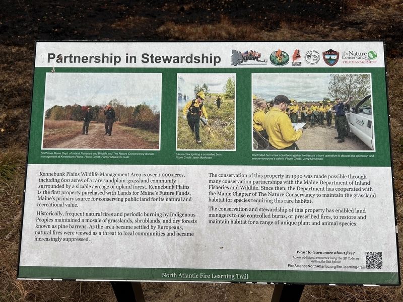
Kennebunk Plains Wildlife Management Area is over 1,000 acres, including 600 acres of a rare sandplain-grassland community surrounded by a sizable acreage of upland forest. Kennebunk Plains is the first property purchased with Lands for Maine's Future Funds, Maine's primary source for conserving public land for its natural and recreational value.
Historically, frequent natural fires and periodic burning by Indigenous Peoples maintained a mosaic of grasslands, shrublands, and dry forests known as pine barrens. As the area became settled by Europeans, natural fires were viewed as a threat to local communities and became increasingly suppressed.
The conservation of this property in 1990 was made possible through many conservation partnerships with the Maine Department of Inland Fisheries and Wildlife. Since then, the Department has cooperated with the Maine Chapter of The Nature Conservancy to maintain the grassland habitat for species requiring this rare habitat.
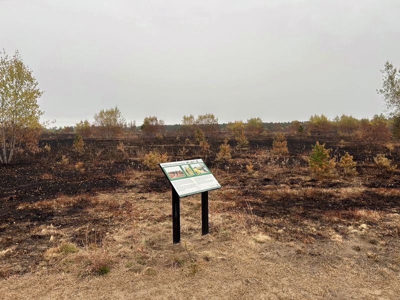
The conservation and stewardship of this property has enabled land managers to use controlled burns, or prescribed fires, to restore and maintain habitat for
this page online
Want to learn more about fire? Access additional resources using the QR Code, or visiting the link below:
FireScienceNorthAtlantic.org/fire-learning-trail
[photo captions, left to right:]
Staff from Maine Dept. of Inland Fisheries and Wildlife and The Nature Conservancy discuss management at Kennebunk Plains. Photo Credit: Forest Stewards Guild
A burn crew igniting a controlled burn. Photo Credit: Jerry Monkman.
Controlled burn crew volunteers gather to discuss a burn operation to discuss the operation and ensure everyone's safety. Photo Credit: Jerry Monkman
Erected by North Atlantic Fire Science Exchange.
Topics. This historical marker is listed in this topic list: Environment. A significant historical year for this entry is 1990.
Location. 43° 24.281′ N, 70° 37.694′ W. Marker is near Kennebunk, Maine, in York County. It is on Kennebuck Plains Preserve Trail 0.1 miles north of Webber Hill Road (Route 99), on the right when traveling north. Touch for map. Marker is in this post office area: Kennebunk ME 04043, United States of America. Touch for directions.

Regionally, this marker

Photographed by Steve Stoessel, October 13, 2024
2. Partnership in Stewardship Marker
Other nearby markers. At least 8 other markers are within 5 miles of this marker, measured as the crow flies: Fire, People & Resources (approx. 0.3 miles away); Memorial Athletic Field (approx. 3.9 miles away); Wallingford Hall (approx. 4.4 miles away); Lafayette Elm Site (approx. 4.4 miles away); Kennebunk Rotary Club (approx. 4½ miles away); The Lafayette Center / Le Centre Lafayette (approx. 4½ miles away); Kennebunk, Maine (approx. 4½ miles away); The Mousam River / Le Fleuve Mousam (approx. 4.6 miles away). Touch for a list and map of all markers in Kennebunk.
Another marker is no longer nearby. The Storer Residence / La Résidence Storer (was approx. 4½ miles away but has been replaced with another marker now near it).
Photographed by Steve Stoessel, October 13, 2024
3. Partnership in Stewardship Marker
Credits. This page was last revised on October 15, 2024. It was originally submitted on October 15, 2024, by Steve Stoessel of Niskayuna, New York. This page has been viewed 126 times since then and 6 times this year. Photos: 1, 2, 3. submitted on October 15, 2024, by Steve Stoessel of Niskayuna, New York.
