Gulf Shores in Baldwin County, Alabama — The American South (East South Central)
Alabama’s Coastal Connection
Bon Secour National Wildlife Refuge
| — | Little Lagoon and Gator Lake | — |

Photographed by Connor Olson, July 29, 2024
1. Alabama’s Coastal Connection Marker
Bald eagles, red-breasted mergansers, and cormorants frequent the west end of the Lagoon near Bon Secour National Wildlife Refuge during winter. The Dauphin Island Sea Lab, Mobile Bay National Estuary Program, and other Refuge partners are currently restoring seagrass beds in the Lagoon to provide habitat for native wildlife including the endangered West Indian manatee, which occasionally visit the Lagoon.
Gator Lake was formed by a sand spit that developed in Little Lagoon many years ago. A narrow creek connects the 32-acre lake to the Lagoon and brings in saltwater during strong tides. In the absence of major hurricanes, Gator Lake is a mostly freshwater
this page online
Over time, Gator Lake should gradually revert to freshwater with normal rainfall until the next storm starts the natural cycle over again. As its name suggests alligators are occasionally spotted in the lake lake along with herons, grebes, kingfishers, and other native wildlife.
Erected by Fish and Wildlife Service; National Oceanic and Atmospheric Administration.
Topics. This historical marker is listed in these topic lists: Animals • Environment. A significant historical year for this entry is 2004.
Location. 30° 14.383′ N, 87° 49.206′ W. Marker is in Gulf Shores, Alabama, in Baldwin County. It can be reached from Fort Morgan Road (State Road 180) east of Mobile Street. The marker is accessed from the Pine Beach Trail. Touch for map. Marker is in this post office area: Gulf Shores AL 36542, United States of America. Touch for directions.

Regionally, this marker is
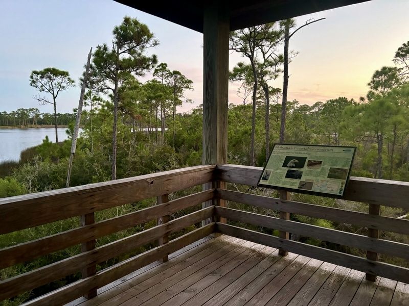
Photographed by Connor Olson, July 29, 2024
2. Alabama’s Coastal Connection Marker
Other nearby markers. At least 8 other markers are within 12 miles of this marker, measured as the crow flies: Indian Village Achuse (approx. 0.9 miles away); Vicinity of Salt Works and Camp Anderson (approx. 6½ miles away); The Charles Swift Family / Swift Coles Historic Home (approx. 7½ miles away); Camp Withers (approx. 7.7 miles away); Gulf Shores Community (approx. 7.8 miles away); Navy Cove / Pilot Town (approx. 8½ miles away); Battery Dearborn (1900-1924) (approx. 11½ miles away); Magnolia Springs, Alabama (approx. 11.6 miles away). Touch for a list and map of all markers in Gulf Shores.
Credits. This page was last revised on October 20, 2024. It was originally submitted on October 16, 2024, by Connor Olson of Menomonee Falls, Wisconsin. This page has been viewed 442 times since then and 69 times this year. Photos: 1, 2. submitted on October 16, 2024, by Connor Olson of Menomonee Falls, Wisconsin. • James Hulse was the editor who published this page.
