Elkin in Surry County, North Carolina — The American South (South Atlantic)
Elkin Transportation

Photographed by Mark Parker, October 12, 2024
1. Elkin Transportation Marker
Topics. This historical marker is listed in these topic lists: Bridges & Viaducts • Industry & Commerce • Railroads & Streetcars • Roads & Vehicles. A significant historical year for this entry is 1891.
Location. 36° 14.574′ N, 80° 50.98′ W. Marker is in Elkin, North Carolina, in Surry County. It is at the intersection of Standard Street and South Bridge Street (Business U.S. 21), on the left when traveling east on Standard Street. The marker is at the far right of the mural. Touch for map.
this page online

Regionally, this marker is in the Piedmont. It is also in the American South, specifically in the Upper South, in Appalachia, and specifically in Southern Appalachia. Globally, it is in North America, the Western Hemisphere, the Western World, and the Anglosphere. Historically, it finds itself in what was once the territory of the Mississippian Culture, one of the original Thirteen Colonies, one of the Confederate States of America, and the Antebellum South.
Other nearby markers. At least 8 other markers are within walking distance of this marker: Bank of Elkin (about 500 feet away, measured in a direct line); Boone Trail Highway (about 700 feet away); N.C. Mountains-to-Sea Trail (MST) (about 700 feet away); Daniel Boone Highway Marker (about 700 feet away); Elkin & Alleghany Railway Depot (approx. 0.2 miles away); Elkin & Alleghany Railroad Depot (approx. ¼ mile away); Elkin & Alleghany Engine 100 (approx. ¼ mile away); Elkin Manufacturing Company (approx. ¼ mile away). Touch for a list and map

Photographed by Mark Parker, October 12, 2024
2. Elkin Transportation Mural
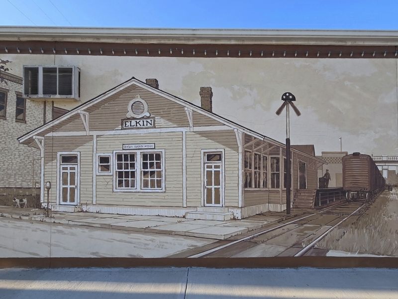
Photographed by Mark Parker, October 12, 2024
3. Elkin Railroad Depot

Photographed by Mark Parker, October 12, 2024
4. Hugh G. Chatham Memorial Bridge, which formerly crossed the Yadkin River
Credits. This page was last revised on October 22, 2024. It was originally submitted on October 18, 2024, by Mark Parker of Hickory, North Carolina. This page has been viewed 188 times since then and 61 times this year. Photos: 1, 2, 3, 4. submitted on October 18, 2024, by Mark Parker of Hickory, North Carolina. • Bernard Fisher was the editor who published this page.
