Sleepy Hollow in Westchester County, New York — The American Northeast (Mid-Atlantic)
Sleepy Hollow Cemetery
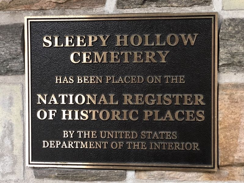
Photographed by Duane and Tracy Marsteller, September 29, 2024
1. Sleepy Hollow Cemetery Marker
Topics and series. This historical marker is listed in these topic lists: Architecture • Arts, Letters, Music • Cemeteries & Burial Sites. In addition, it is included in the National Register of Historic Places (NRHP) series list. A significant historical month for this entry is October 1849.
Location. 41° 5.814′ N, 73° 51.673′ W. Marker is in Sleepy Hollow, New York, in Westchester County. It can be reached from North Broadway (U.S. 9) north of Harwood Avenue, on the right when traveling north. Marker is in the porch of the Washington Irving Memorial Chapel at the cemetery's main gate. Touch for map. Marker is at or near this postal address: 540 N Broadway, Tarrytown NY 10591, United States of America. Touch for directions.

Regionally, this marker is in the Hudson Valley and in the New York City Metropolitan Area. It is also in the American Northeast, in the Mid-Atlantic, and on the Eastern Seaboard. Globally, it is in the North Atlantic Region, North America, the Western Hemisphere, the Western World,
this page online
Other nearby markers. At least 8 other markers are within walking distance of this marker: A different marker also named Sleepy Hollow Cemetery (a few steps from this marker); Cold Spring (approx. 0.2 miles away); a different marker also named Cold Spring (approx. ¼ mile away); The Old Dutch Church (approx. 0.4 miles away); Our Union Soldiers (approx. half a mile away); Headless Horseman (approx. half a mile away); The Headless Horseman Bridge (approx. half a mile away); Philipsburg Manor (approx. 0.6 miles away). Touch for a list and map of all markers in Sleepy Hollow.
Regarding Sleepy Hollow Cemetery. Excerpts from the National Register nomination:
Sleepy Hollow Cemetery, established in 1849, is significant in the areas of landscape architecture, architecture, sculpture, and funerary art as an important example of a mid-19th century rural cemetery in New York State. …
Sleepy Hollow Cemetery was the brainchild of Washington Irving and Captain Jacob Storm, who both recognized the need for moreburial space in the growing villages of Tarrytown and North Tarrytown and for a formal organization which would provide better record-keeping of burials. The cemetery was formally established as the Tarrytown Cemetery in October of 1849. …Photographed by Duane and Tracy Marsteller, September 29, 20242. Sleepy Hollow Cemetery Marker
[A]ccording to Irving’s wishes, the cemetery was renamed Sleepy Hollow Cemetery in 1865. The cemetery originally had 39 acres, directly north of the graveyard of the Sleepy Hollow Church. Approximately 41 acres was added in 1886 and another 10 acres were added in 1890.

Also see . . . Sleepy Hollow Cemetery (PDF). National Register nomination for the burial ground, which was listed in 2009. (Prepared by Marjory Gilbert and Peter D. Shayer; via National Archives) (Submitted on October 19, 2024, by Duane and Tracy Marsteller of Murfreesboro, Tennessee.)
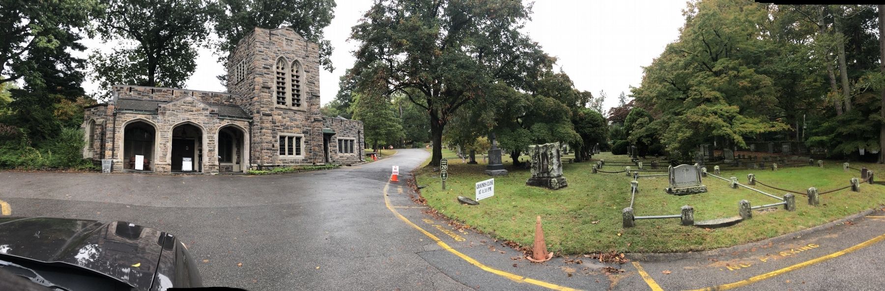
Photographed by Duane and Tracy Marsteller, September 29, 2024
3. Sleepy Hollow Cemetery Main Entrance
The Washington Irving Memorial Chapel (left) was built in 1922.
Credits. This page was last revised on October 19, 2024. It was originally submitted on October 19, 2024, by Duane and Tracy Marsteller of Murfreesboro, Tennessee. This page has been viewed 279 times since then and 35 times this year. Photos: 1, 2, 3. submitted on October 19, 2024, by Duane and Tracy Marsteller of Murfreesboro, Tennessee.
