
Ajax in Durham Region, Ontario — Central Canada (North America)
Site of the Women’s Residences
Defence Industries Limited

Photographed by Tim Boyd, October 3, 2024
1. Site of the Women’s Residences Marker
To accommodate the female staff, 21 residences were built to hold 100 people, two women per room. Each residence had a common room and came with a designated 'housemother'. The site included a large cafeteria and a beauty shop. The entire women's compound was surrounded by an eight foot high fence, topped by three strands of barbed wire. Though not luxurious by any means, the residences provided a comfortable home for the women brought in to work at the plant.
After the plant closed in 1945, the site and buildings were used by the University of Toronto as the university's Ajax Campus until 1949. From 1950 until 1953, the government used the site as a Displaced Person Camp to house thousands of refugees from post war Europe. The land was then turned over to the Central Mortgage and Housing
this page online
Erected by Town of the Ajax.
Topics. This historical marker is listed in these topic lists: Education • Industry & Commerce • War, World II • Women. A significant historical year for this entry is 1945.
Location. 43° 50.982′ N, 79° 1.023′ W. Marker is in Ajax, Ontario, in Durham Region. It is on Churchill Road 0.1 kilometers south of Kings Crescent, on the right when traveling east. Touch for map. Marker is at or near this postal address: 37 Churchill Road, Ajax ON L1S 2K8, Canada. Touch for directions.

Regionally, this marker is in Greater Toronto, specifically on the Golden Horseshoe, in the York, Durham and Headwaters Area, and in the Toronto Metropolitan Area. It is also in Central Canada. Globally, it is in North America, on the Great Lakes, in the Western Hemisphere, in the Western World, and in the Anglosphere. Historically, it finds itself in what was once a British colony, the Viceroyalty of New France, the Haudenosaunee (Iroquois) Confederacy, and Rupert’s Land.
Other nearby markers. At

Photographed by Tim Boyd, October 3, 2024
2. Site of the Women’s Residences Marker
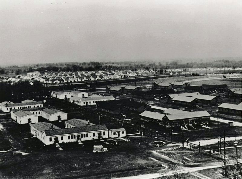
3. University of Toronto Ajax Campus, ca 1946-9
Public domain
Credits. This page was last revised on October 23, 2024. It was originally submitted on October 20, 2024, by Tim Boyd of Hamilton, Ontario. This page has been viewed 155 times since then and 17 times this year. Photos: 1, 2, 3. submitted on October 20, 2024, by Tim Boyd of Hamilton, Ontario. • Andrew Ruppenstein was the editor who published this page.
