Leesburg in Loudoun County, Virginia — The American South (Mid-Atlantic)
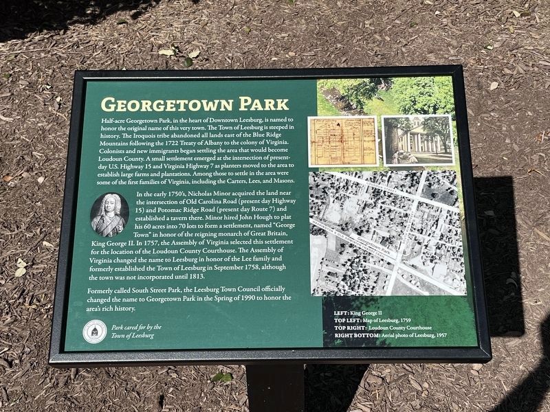
Georgetown Park
Photographed by Craig Swain, October 1, 2023
1. Georgetown Park Marker
On the left side of the marker is a portrait of King George II.
In the early 1750's, Nicholas Minor acquired the land near the intersection of Old Carolina Road (present day Highway 15) and Potomac Ridge Road (present day Route 7) and established a tavern there. Minor hired John Hough to plat his 60 acres into 70 lots to form a settlement, named "George Town" in honor of the reigning monarch of Great Britain, King George II. In 1757, the Assembly of Virginia selected this settlement for the location of the Loudoun County
this page online
Formerly called South Street Park, the Leesburg Town Council officially changed the name to Georgetown Park in the Spring of 1990 to honor the area's rich history.
Park cared for by the Town of Leesburg
Erected 2023.
Topics. This historical marker is listed in this topic list: Settlements & Settlers. A significant historical month for this entry is September 1758.
Location. 39° 6.743′ N, 77° 33.962′ W. Marker is in Leesburg, Virginia, in Loudoun County. It is at the intersection of South Street Southwest and South King Street (Business U.S. 15), on the right when traveling west on South Street Southwest. Touch for map. Marker is at or near this postal address: 1 S St SW, Leesburg VA 20175, United States of America. Touch for directions.

Regionally, this marker is in the Washington Metropolitan Area and in Northern Virginia. It is also in the American South, specifically in the Upper South, and in the Mid-Atlantic. Globally,
Photographed by Craig Swain, 11
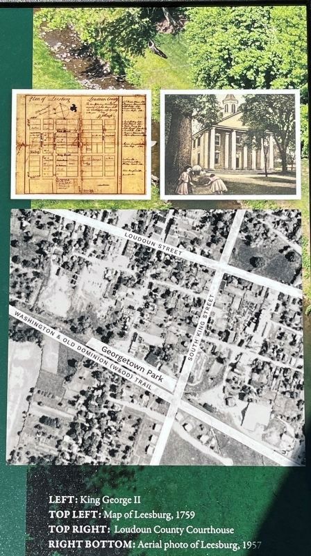
2. Illustrations on Right Side of Marker
Top Left: Map of Leesburg, 1759
Top Right: Loudoun County Courthouse
Right Bottom: Aerial photo of Leesburg, 1957
Top Right: Loudoun County Courthouse
Right Bottom: Aerial photo of Leesburg, 1957
Other nearby markers. At least 8 other markers are within walking distance of this marker: Leesburg Passenger Station (within shouting distance of this marker); The W&OD Railway and Jim Crow Laws (within shouting distance of this marker); The Tolbert Building (about 500 feet away, measured in a direct line); 7 Loudoun Street Southeast (about 700 feet away); Norman-Harding Barn (about 800 feet away); Dairy Barn (about 800 feet away); Log House (about 800 feet away); Leesburg (approx. 0.2 miles away). Touch for a list and map of all markers in Leesburg.

Photographed by Craig Swain, October 1, 2023
3. Georgetown Park Marker
Credits. This page was last revised on October 20, 2024. It was originally submitted on October 20, 2024, by Craig Swain of Leesburg, Virginia. This page has been viewed 184 times since then and 45 times this year. Photos: 1, 2, 3. submitted on October 20, 2024, by Craig Swain of Leesburg, Virginia.
