Wiscasset in Lincoln County, Maine — The American Northeast (New England)
Lower Main Street and Wiscasset Bridges 1847 - 1939
Wiscasset, Maine
| — | The Museum in the Streets | — |

Photographed by Darren Jefferson Clay, October 14, 2024
1. Lower Main Street and Wiscasset Bridges
1847 - 1939 Marker
1847 - 1939 Marker
From the early 18th century through the mid-19th century, the only way to cross the Sheepscot River from Wiscasset was by boat. The first ferries began in 1785. These ran until 1832, when the Sheepscot Ferry Company was chartered to run a larger horse ferry from the southeastern point of Wiscasset to near Fort Edgecomb across the river.
The first Wiscasset bridge was built in 1847. It was the longest wooden span over deep water in Maine. Half the width of the bridge was made of finished planks. The other half was unfinished, with two rough vertical wooden tracks down the center. It had a draw to accommodate boats, and a toll house to the left of the bridge at the foot of Main Street. Fares were 3 cents for people, 10 cents for a horse and rider, 15 cents for a one-horse wagon or sleigh, 3 cents per beast not in harness and a cent each for sheep and swine.
At first, there was not a lot of traffic at any one time. In summer, most people traveled by boat. Throughout the year, there were regular stage coach routes that crossed the bridge several times a day. However, any traffic was somewhat risky. The wooden structure was
this page online
By the late 19th and early 20th century, summer traffic over the bridge had increased with more frequent coach and wagon trips and early automobiles driving to points down east. The bridge was not built to support heavier vehicles, and it was not well maintained. There were at least 3 major disasters, in 1864, 1878 and 1882, amazingly, none fatal. Two occurred when the bridge broke under stagecoaches, throwing passengers and horses into the water, the third when it broke under a team of oxen.
In 1904, the bridge was partially destroyed by ice. Major repairs were completed in 1906. The celebration for the re-opening drew large crowds to Lower Main Street, as can be seen in the photograph here.
In 1932, a new wooden bridge was built, unfortunately, with many of the same problems as its predecessor. People still remember the terrifying experience of riding over the bridge with it shaking and creaking below them. That bridge became part of the Atlantic Highway, later U.S. Route 1-the major coastal
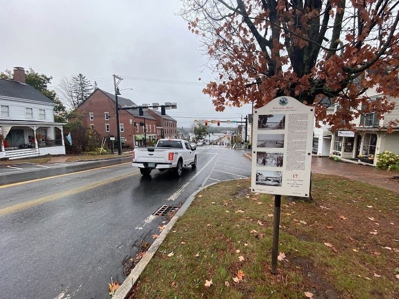
Photographed by Darren Jefferson Clay, October 14, 2024
2. Lower Main Street and Wiscasset Bridges
1847 - 1939 Marker
1847 - 1939 Marker
A new concrete segmental bridge was finally installed in 1983, the first one built in New England.
Lower Main Street changed along with transportation and technology. By 1877, telegraph wires were installed. These can be seen in the photo from the Edgecomb side of the bridge. Telephone service, with wires and poles along Main Street, came in 1898. The old toll house made way for larger industrial buildings and new businesses.
Erected by The Museum in the Streets. (Marker Number 17.)
Topics. This historical marker is listed in these topic lists: Bridges & Viaducts • Roads & Vehicles.
Location. 44° 0.159′ N, 69° 39.93′ W. Marker is in Wiscasset, Maine, in Lincoln County. It is on Main Street (U.S. 1) east of Fort Hill Street, on the right when traveling east. Touch for map. Marker is at or near this postal address: 106 Main Street, Wiscasset ME 04578, United States of America. Touch for directions.

Regionally, this marker is in Midcoast Maine. It is also in the American Northeast, in New England, and on the Eastern Seaboard. Globally, it is in the North Atlantic Region, North America, the Western Hemisphere, the Western World, and the Anglosphere.
Other nearby markers. At least 8 other markers are within walking distance of this marker: Rundlett Block - 1872 (here, next to this marker); Hilton House, 1892 / Sunken Garden, 1904 (within shouting distance of this marker); Nickels-Sortwell House 1807 (within shouting distance of this marker); Wawenock Block • 1858 (within shouting distance of this marker); Downtown Stores c. 1892 (within shouting distance of this marker); R.H.T. Taylor Store in 1882 (within shouting distance of this marker); Haggett's Garage (about 400 feet away, measured in a direct line); Stacy House - c. 1825 / Albee House - 1904 / Wiscasset Inn - 1920 (about 400 feet away). Touch for a list and map of all markers in Wiscasset.
Credits. This page was last revised on October 24, 2024. It was originally submitted on October 20, 2024, by Darren Jefferson Clay of Duluth, Georgia. This page has been viewed 611 times since then and 80 times this year. Photos: 1, 2. submitted on October 20, 2024, by Darren Jefferson Clay of Duluth, Georgia. • Michael Herrick was the editor who published this page.
