
Whitby in Durham Region, Ontario — Central Canada (North America)
Perry’s Corners, 1836

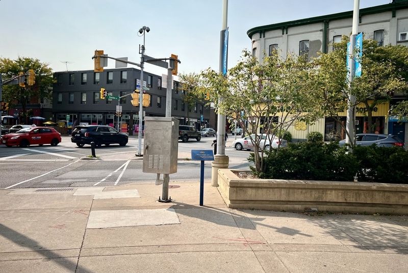
Photographed by Tim Boyd, October 3, 2024
1. Perry’s Corners, 1836 Marker
Erected by Town of Whitby.
Topics. This historical marker is listed in these topic lists: Roads & Vehicles • Settlements & Settlers. A significant historical year for this entry is 1836.
Location. 43° 52.802′ N, 78° 56.525′ W. Marker is in Whitby, Ontario, in Durham Region. It is at the intersection of Brock Street North and Dundas Street East, on the right when traveling north on Brock Street North. Touch for map. Marker is at or near this postal address: 101 Brock Street North, Whitby ON L1N 4H3, Canada. Touch for directions.

Regionally, this marker is in Greater Toronto, specifically on the Golden Horseshoe, in the York, Durham and Headwaters Area, and in the Toronto Metropolitan Area. It is also in Central Canada. Globally, it is in North America,
this page online
Other nearby markers. At least 8 other markers are within walking distance of this marker: First Dominion Bank Branch, 1871 (within shouting distance of this marker); The Great Fire of 1877 (about 90 meters away, measured in a direct line); Cross & Granger Fire, 1901 (about 90 meters away); Carnegie Public Library, 1913 (about 120 meters away); May Irwin, 1862-1938 (about 120 meters away); Sir John A. Macdonald, 1877 (about 120 meters away); William Till Building (1857-1860) (about 150 meters away); The Terrace (about 180 meters away). Touch for a list and map of all markers in Whitby.
Also see . . . The Story of Whitby’s Four Corners (durhamregion.com).
Whitby’s four corners were once known as Perry’s Corners in honour of one of Whitby’s earliest founders, Peter Perry. The spot at the northeast corner of Dundas and Brock streets was the roots of the downtown in the(Submitted on October 21, 2024, by Tim Boyd of Hamilton, Ontario.)1830s, after Mr. Perry arrived from Lennox and Addington County, in the Napanee area of Ontario. Mr. Perry opened a wholesale and retail store and a grain business that occupied six branches spanning from Port Whitby to Brooklin, Scugog and Lindsay.Photographed by Tim Boyd, October 3, 20242. Perry’s Corners, 1836 Marker

October 21, 2024
3. The “Four Corners” of Whitby (Perry’s Corners) ca 1863
Source: Whitby Liberary Archives (public domain)
Credits. This page was last revised on October 22, 2024. It was originally submitted on October 21, 2024, by Tim Boyd of Hamilton, Ontario. This page has been viewed 402 times since then and 66 times this year. Photos: 1, 2, 3. submitted on October 21, 2024, by Tim Boyd of Hamilton, Ontario. • Andrew Ruppenstein was the editor who published this page.
