Cherokee National Capitol

Registered National
Historic Landmark
under the provisions of the
Historic Sites Act of August 21, 1935
This site possesses exceptional value
in commemorating and illustrating
the history of the United States
U.S. Department of the Interior
National Park Service
1962
Topics and series. This historical marker is listed in these topic lists: Architecture • Government & Politics • Indigenous Peoples and Communities. In addition, it is included in the National Historic Landmarks, and the National Register of Historic Places (NRHP) series lists. A significant historical year for this entry is 1867.
Location. 35° 54.757′ N, 94° 58.241′ W. Marker is in Tahlequah, Oklahoma, in Cherokee County. It is on South Muskogee Avenue (Business U.S. 62) just north of East Keetoowah Street, on the right when traveling north. The marker is mounted at eye-level, directly on the subject building, just to the right of the west/front entrance. Touch for map. Marker is at or near this postal address: 101 South Muskogee Avenue, Tahlequah OK 74464, United States of America. Touch for directions.

Regionally, this marker is in the
this page online
Other nearby markers. At least 8 other markers are within walking distance of this marker: Cherokee Advocate (within shouting distance of this marker); Judge John Martin, Jr. (within shouting distance of this marker); John Ross ᎫᏫᏍᎫᏫ (within shouting distance of this marker); Veterans Memorial (within shouting distance of this marker); Replica of the Statue of Liberty (within shouting distance of this marker); John Brian Stapler (within shouting distance of this marker); Historic Tahlequah (within shouting distance of this marker); First Telephone in Oklahoma (within shouting distance of this marker). Touch for a list and map of all markers in Tahlequah.
Regarding Cherokee National Capitol. National Register

From the National Register Nomination: An enclosed porch, of brick in common bond, has been added to the center front bay of the first story and provides a vestibule entrance. This one story, gable-roof unit, carries a pediment and denticulated cornice similar to those on the main building.
From the National Register Nomination prepared by Francine Weiss:
The Cherokee Nation first established a republican form of government in 1820, while still occupying their ancestral lands in the southeastern United States. The Cherokee had brought with them to Indian Territory a high educational level, a bilingual standard, and a government modeled after that of the United States. In 1839 they established a capital at Tahlequah, and a constitution similar to the one they had brought with them from the East was adopted.The first gatherings in 1839 in the new capital city of Tahlequah were held in the open. Shortly thereafter, an open log shelter was built to house the council, and cabins for various government purposes were constructed along its flanks. By the mid-1840's, the open structure had been replaced by a log building to serve as the council house, and in 1845 a brick Supreme Court building was completed nearby. With the exception of the nearby Supreme Court Building, most of the public structures of Tahlequah were destroyed during the Civil War years.
In 1867, the National Cherokee Council
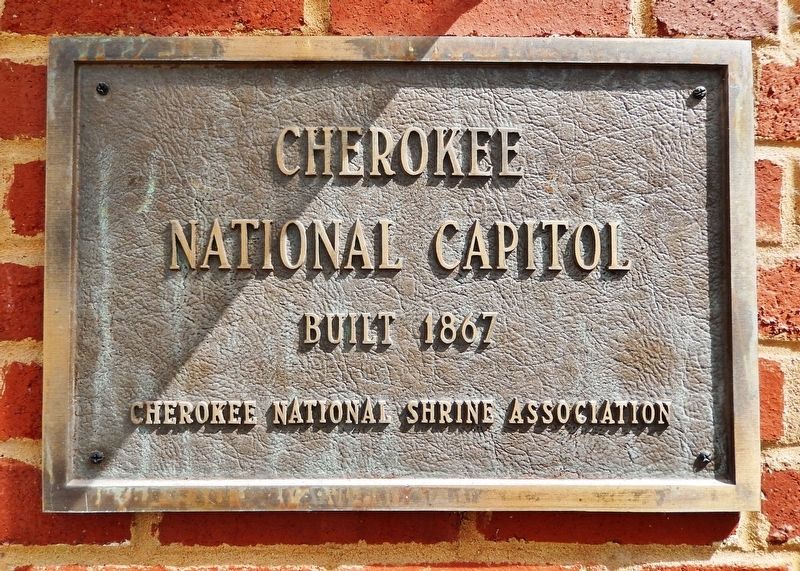
voted to approve construction of a permanent, brick Capitol Building. The Cherokee National Capitol building was constructed from 1867 to 1869 according to plans and specifications drawn up by C.W. Goodlander.Photographed by Cosmos Mariner, September 11, 20243. Cherokee National Capitol(mounted directly above the National Landmark marker)
Built 1867
Cherokee National Shrine AssociationBy the latter years of the 19th century white settlement had increased in the area, and the Cherokees fell under U.S. Government pressure to accept individual land allotments and to dissolve tribal government. In the early 1900's over the protests of the Cherokees and other Indian groups in the area, Cherokee sovereignty was abolished by the U.S. Government, and Oklahoma became a State in 1907. After its use as a tribal capitol ceased, the building became the Cherokee County Courthouse.
The Capitol stands as a symbol of the resourcefulness and flexibility of the Cherokee who, despite years of injustice adapted so successfully to the changing conditions brought on by European arrival in North America.
Related markers. Click here for a list of markers that are related to this marker.
Also see . . .
1. Cherokee National Capitol Building (Library of Congress).
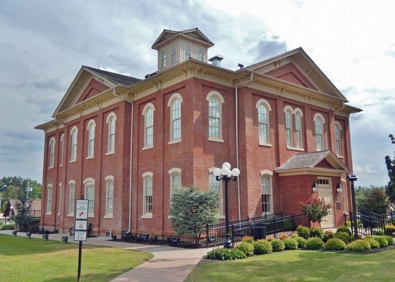
Excerpt: The Cherokee National Capitol, completed(Submitted on October 23, 2024, by Cosmos Mariner of Cape Canaveral, Florida.)and occupied by circa 1869, was constructed on the site which had served as the meeting place for the Cherokee Government since their arrival in Indian Territory in 1839. Built to replace its wooden predecessor (which had burned during the Civil War), it housed the Cherokee Supreme Court as well as the Cherokee legislature, which convened there for the longest unbroken period of time in its history. With statehood in 1907, the National Council lost its power as a lawmaker, and the building soon became the property of Cherokee County. Its Italianate appearance reflects the apparent time lag of popular architectural styles from East to West.Photographed by Cosmos Mariner, September 11, 20244. Cherokee National Capitol (northwest elevation)From the National Register Nomination: The structure is a well preserved, late example of the Italianate style, unusual in Oklahoma. With overall measurements of about 51 feet across its front and 68 feet along its side, the 2-story, rectangular building is five bays wide and 7 bays deep. The walls are of red brick, laid in common bond, with wooden trim, painted white.
2. Cherokee National Capitol (Wikiwand).
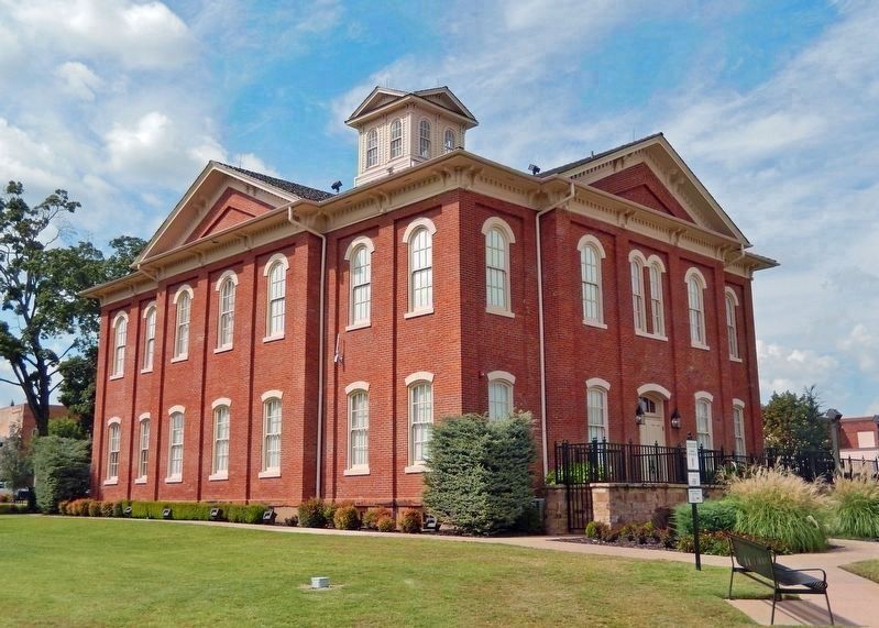
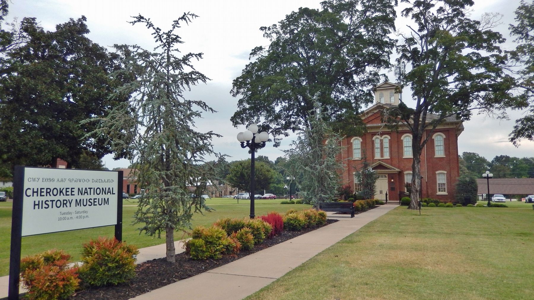
Excerpt: The Cherokee National Capitol (Cherokee: ᏣᎳᎩ ᎠᏰᎵ ᏧᏂᎳᏫᎢᏍᏗ ᎠᏓᏁᎸ), now the Cherokee National History Museum, is a historic tribal government building in Tahlequah, Oklahoma. It was designated a National Historic Landmark in 1961 for its role in the Nation's history.(Submitted on October 23, 2024, by Cosmos Mariner of Cape Canaveral, Florida.)In 2013, the nation began a restoration project to preserve the building's original appearance, including roof repairs with historical-era shingles, new decking, and new doors and windows.Photographed by Cosmos Mariner, September 11, 20245. Cherokee National Capitol (southeast elevation)From the National Register Nomination: A one-story, frame, Italianate cupola was added to the building after 1900. It is 10-feet square with double round arch windows on each side. Its roof consists of four intersecting pedimented gables. The present exterior appearance of the building probably dates to post-1928.
Credits. This page was last revised on July 15, 2025. It was originally submitted on October 23, 2024, by Cosmos Mariner of Cape Canaveral, Florida. This page has been viewed 215 times since then and 40 times this year. Photos: 1, 2, 3, 4, 5, 6. submitted on October 23, 2024, by Cosmos Mariner of Cape Canaveral, Florida.
