Thomaston in Knox County, Maine — The American Northeast (New England)
The Wealthiest Man in Town

Photographed by Darren Jefferson Clay, October 15, 2024
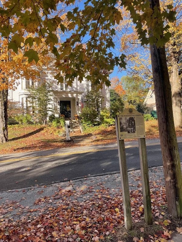
1. The Wealthiest Man in Town Marker
The Wealthiest Man in Town
Captain Samuel Watts was not only the wealthiest man in Thomaston, according to the United States Census report of 1840, he was also the wealthiest man in the United States. Three of the only seven millionaires in the country lived in Thomaston then; they were all ship builders. Watts owned this plot of land and the single story house to the south. The smaller house used to sit on this lot. When Watts decided that he should have a house that would better reflect his standing in the world, he purchased the land next door, moved his original house there, and built this magnificent home. It is the largest house in town. To understand its true dimensions, it is interesting to note that a modern day six-room ranch house could be erected in the front room which measures more then forty feet in length and over thirty feet in width.
The home is replete with exquisite woodwork and very deep crown moldings. In the interior photograph, taken in one corner of the dining room, the captain's daughter. Mary Jane Watts is pictured with friends. Miss Watts is the woman seated on the right.
L'homme le plus riche
this page online
D'après un rapport datant de 1840, le Capitaine Samuel Watts n'est pas seulement la plus grosse fortune de Thomaston, mais aussi l'homme le plus riche des Etats- Unis En fait, à l'époque, trois des sept millionnaires américains habitent ici et sont tous armateurs. Watts possède cette parcelle et une petite maison d'un étage. Il acquiert par la suite la parcelle voisine sur laquelle il déplace cette petite maison, afin de pouvoir construire cette superbe demeure, la plus grande de Thomaston, à l'image de sa position sociale. Ses dimensions sont telles que l'on pourrait, par exemple, construire, dans son salon principal d'environ 10 mètres sur 13, un petit pavillon de six pièces ! La maison est richement décorée de menuiseries très raffinées et de moulures d'une largeur exceptionnelle. Sur la photo prise dans la salle à manger on peut voir la fille du Capitaine, Mary Jane Watts, assise à droite et vêtue de blanc, en compagnie de ses amis.
Erected by The Museum in the Streets. (Marker Number 18.)
Topics. This historical marker is listed in these topic lists: Architecture • Industry & Commerce • Waterways & Vessels.
Location. 44° 4.592′ N,
Photographed by Darren Jefferson Clay, October 15, 2024
2. The Wealthiest Man in Town Marker

Regionally, this marker is in Midcoast Maine and on Penobscot Bay. It is also in the American Northeast, in New England, and on the Eastern Seaboard. Globally, it is in the North Atlantic Region, North America, the Western Hemisphere, the Western World, and the Anglosphere.
Other nearby markers. At least 8 other markers are within walking distance of this marker: Victorian Splendor (within shouting distance of this marker); An Overlock House (about 400 feet away, measured in a direct line); June 7, 1915 (approx. 0.2 miles away); Thomaston's Business Block (approx. 0.2 miles away); The Builders, the Captains and the Seamen of Thomaston Ships (approx. 0.2 miles away); Thomaston, Maine (approx. 0.2 miles away); A Case of Modern Technology (approx. 0.2 miles away); A Town Landmark (approx. 0.2 miles away). Touch for a list and map

Photographed by Darren Jefferson Clay, October 15, 2024
3. Captain Samuel Watts House
Credits. This page was last revised on October 31, 2024. It was originally submitted on October 26, 2024, by Darren Jefferson Clay of Duluth, Georgia. This page has been viewed 267 times since then and 60 times this year. Photos: 1, 2, 3. submitted on October 26, 2024, by Darren Jefferson Clay of Duluth, Georgia. • Michael Herrick was the editor who published this page.
