Payne - Phalen in Saint Paul in Ramsey County, Minnesota — The American Midwest (Upper Plains)
Tunnels to the Prairie
⎯⎯⎯
"I've Been Working on the Railroad..."
Photographed by McGhiever, June 12, 2019
1. Tunnels to the Prairie Marker
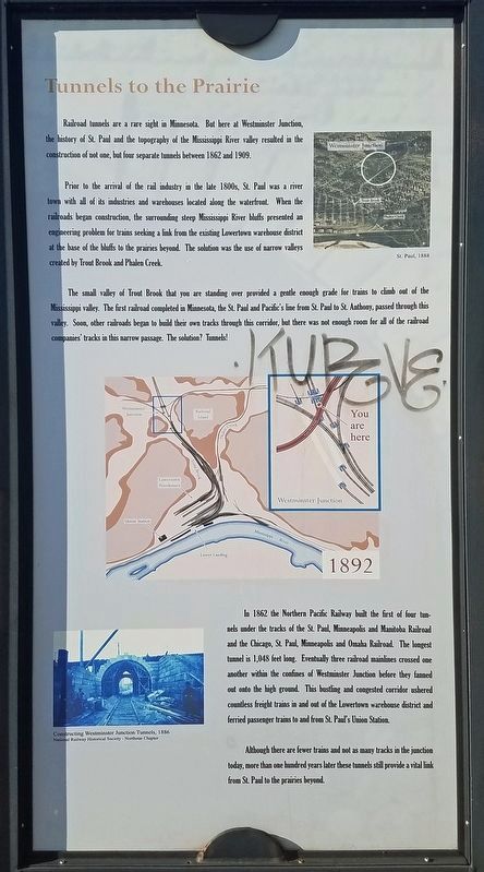
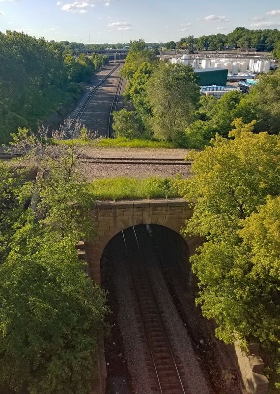
Railroad tunnels are a rare sight in Minnesota. But here at Westminster Junction, the history of St. Paul and the topography of the Mississippi River valley resulted in the construction of not one, but four separate tunnels between 1862 and 1909.
Prior to the arrival of the rail industry in the late 1800s, St. Paul was a river town with all of its industries and warehouses located along the waterfront. When the railroads began construction, the surrounding steep Mississippi River bluffs presented an engineering problem for trains seeking a link from the existing Lowertown warehouse district at the base of the bluffs to the prairies beyond. The solution was the use of narrow valleys created by Trout Brook and Phalen Creek.
[Caption:] St. Paul, 1888
The small valley of Trout Brook that you are standing over provided a gentle enough grade for trains to climb out of the Mississippi valley. The first railroad completed in Minnesota, the St. Paul and Pacific's line from St. Paul to St. Anthony, passed through this valley. Soon, other railroads began to build their own tracks through this corridor, but there was not enough room for all of the railroad companies' tracks in this narrow passage. The solution? Tunnels!
IN 1862 the Northern Pacific Railway built the first of four tunnels under the tracks of the St. Paul, Minneapolis and Manitoba Railroad and the Chicago, St. Paul, Minneapolis and Omaha Railroad. The longest tunnel is 1,048 feet long. Eventually three railroad mainlines crossed one another within the confines of Westminster Junction before they fanned out onto the high ground. This bustling and congested corridor ushered countless freight trains in and out of the Lowertown warehouse district and ferried passenger trains to and from St. Paul's Union Station.
[Caption:] Constructing Westminster Junction Tunnels, 1886
National Railway Historical Society - Nothstar Chapter
Although
this page online
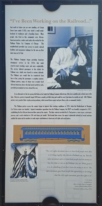
Just north of where you are now standing, on Cayuga Street (now under I-35E), once stood a small neighborhood of residences and a boarding house. Many people who lived in this community were African-American porters, waiters and cooks who worked for the Pullman Palace Car Company of Chicago. This neighborhood provided easy access to nearby railroad facilities and inexpensive lodgings for the men on their short stays in St. Paul.
The Pullman Company began providing luxurious sleepingcar service in the 1870s that made coast-to-coast traveling easier and more comfortable. The service allowed passengers to buy tickets for Pullman cars, which were leased to various railroads. The Pullman cars would then be transferred from line to line, giving the passengers a seamless journey. Pullman porters, many of whom were recently freed African-American slaves who had moved north for work, provided personalized services about
Photographed by McGhiever, June 12, 2019
2. "I've Been Working on the Railroad..." Marker
As an alternative to the low-paying field labor in the South, the Pullman Company offered of the best available jobs to black men at the time. However, porters frequently logged 400 hours a month, got little sleep and would be away from home for months on end. Still, Pullman porters were proud of their regular-paying positions, which earned them respect and gave them a role as community leaders.
The Pullman porters across the country began to improve their working conditions in 1925, when the Brotherhood of Sleeping Car Porters union was founded. Against tremendous opposition from the Pullman Company, the BSCP was formally recognized in 1937, establishing the first African-American labor union in the country. The labor contract provided the St. Paul porters a raise in pay, a grievance process, and a work reduction to 240 work hours per month. But beyond labor issues, the union's nationwide network of social activism enabled the union and its members to make major contributions to American civil rights and social justice.
"The civil rights movement saw to it that black people were able to do things legally, like ride on a Pullman car, say. But the labor movement saw to it that black people had the money to buy the ticket to ride on the Pullman cars, see? What good is it to do something, if you don't have the money to do it? The labor movement gave black people the opportunity to do things that the civil rights movement gave the right to do."
--E.D. Nixon as published in Miles of Smiles, Years of Struggles: Stories of the Black Pullman Porters (University of Illinois Press, 1989)
Topics. This historical marker is listed in these topic lists: African Americans • Bridges & Viaducts • Labor Unions • Railroads & Streetcars. A significant historical year for this entry is 1862.
Location. 44° 57.759′ N, 93° 5.179′ W.
Photographed by McGhiever, June 12, 2019
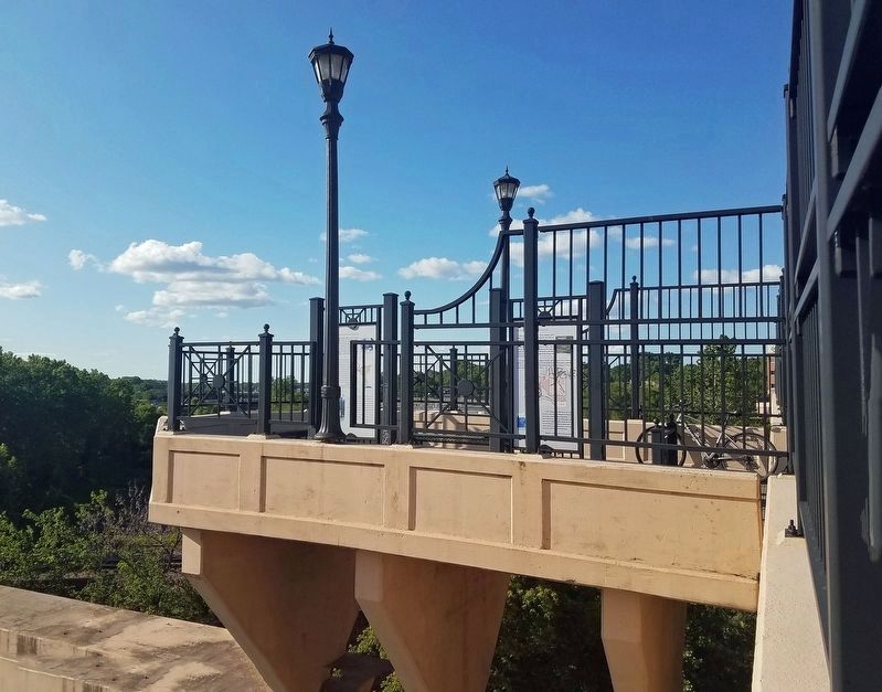
3. Marker (right) at the Westminster Junction overlook

Regionally, this marker is in the Twin Cities Metropolitan Area. It is also in the American Midwest, in the Corn Belt, and in the Great River Road Region. Globally, it is in North America, the Western Hemisphere, the Western World, and the Anglosphere. Historically, it finds itself in what was once Rupert’s Land, the territory of the Mississippian Culture, and the Louisiana Purchase.
Other nearby markers. At least 8 other markers are within walking distance of this marker: Living on Railroad Island / All Aboard! (here, next to this marker); Eastside Heritage Park (approx. ¾ mile away); Eastside Heritage / This Place in History (approx. 0.8 miles away); Al Avila (approx. 0.9 miles away); Marty Scott (approx.
Photographed by McGhiever, June 12, 2019
4. View from the Westminster Junction overlook
More about this marker. The marker can only be accessed by foot or bicycle as there is nowhere for cars to stop on the bridge.
Credits. This page was last revised on October 27, 2024. It was originally submitted on October 27, 2024, by McGhiever of Minneapolis, Minnesota. This page has been viewed 264 times since then and 38 times this year. Photos: 1, 2. submitted on October 27, 2024, by McGhiever of Minneapolis, Minnesota. 3. submitted on August 15, 2023, by McGhiever of Minneapolis, Minnesota. 4. submitted on October 27, 2024, by McGhiever of Minneapolis, Minnesota.
