Erie in Erie County, Pennsylvania — The American Northeast (Mid-Atlantic)
Erie Area Native Americans
Photographed by Dale K. Benington, August 1, 2009
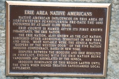
1. Erie Area Native Americans Marker
Erie County is named after its first known inhabitants, the Erie Nation.
The Erie Nation, also known as the Cat Nation, bordered other aboriginal territory in New York and Ohio. Most notable were the Seneca Nation, "Keepers of the Western Door" of the Five Nation Iroquois Confederacy, based in New York.
Disputes between the Iroquois and Erie resulted in conflict, ending with the Erie Nation being vanquished and assimilated by the Seneca.
Iroquois dominance of this region lasted until the 1790's when signed treaties safeguarded local settlement.
Topics. This historical marker is listed in this topic list: Indigenous Peoples and Communities. A significant historical year for this entry is 1492.
Location. 42° 8.246′ N, 80° 4.804′ W. Marker is in Erie, Pennsylvania, in Erie County. It is at the intersection of East Front Street and Parade Street, on the right when traveling west on East Front Street. This historical marker is located at the northern end of Parade Street, on the ridge that overlooks
this page online

Regionally, this marker is in Northwestern Pennsylvania. It is also in the American Northeast, in the Mid-Atlantic, in Appalachia, and specifically in Northern Appalachia. Globally, it is in North America, on the Great Lakes, in the Western Hemisphere, in the Western World, and in the Anglosphere. Historically, it finds itself in what was once the Viceroyalty of New France, the Haudenosaunee (Iroquois) Confederacy, and one of the original Thirteen Colonies.
Other nearby markers. At least 8 other markers are within walking distance of this marker: American Fort (here, next to this marker); Erie Heritage (here, next to this marker); Fort Presque Isle (here, next to this marker); Fort de la Presqu'ile (here, next to this marker); The Erie Stone (here, next to this marker); French Fort de la Presqu'isle - 1753 (here, next to this marker); Russian Town / Pycckое Cоседство (approx. 0.2 miles away); Hero of Gettysburg (approx. 0.3
Photographed by Dale K. Benington, August 1, 2009
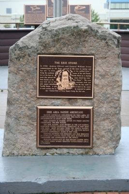
2. Erie Area Native Americans Marker
View of historic marker affixed to the bottom half of the "Erie Stone."
Related marker. Click here for another marker that is related to this marker. To better understand the relationship, study each marker in the order shown.
Photographed by Dale K. Benington, August 1, 2009
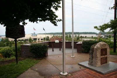
3. Erie Area Native Americans Marker
View of the historic marker situated on the "Erie Stone" at Erie Heritage Park.
Credits. This page was last revised on June 16, 2016. It was originally submitted on December 28, 2009, by Dale K. Benington of Toledo, Ohio. This page has been viewed 1,733 times since then and 40 times this year. Photos: 1, 2, 3. submitted on December 28, 2009, by Dale K. Benington of Toledo, Ohio.
