Near Richmond in Henrico County, Virginia — The American South (Mid-Atlantic)
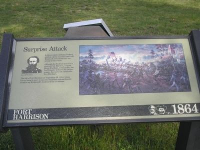
Surprise Attack
Fort Harrison – 1864
Photographed by Bill Coughlin, April 24, 2007
1. Surprise Attack Marker
Although the Federals are able to overrun Fort Harrison, General Hiram Burnham, commanding the lead brigade, is killed. His troops rename the captured earthworks Fort Burnham.
The fall of Fort Harrison on September 29, 1864, forces Lee to bring in more troops and build new entrenchments to stitch up Richmond’s weakened line of defense.
Erected by National Park Service, U.S. Department of the Interior.
Topics. This historical marker is listed in this topic list: War, US Civil. A significant historical date for this entry is September 29, 1864.
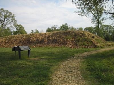
Location. This marker has been replaced by another marker nearby. It was located near 37° 25.608′ N, 77° 22.343′ W. Marker was near Richmond, Virginia, in Henrico County. It could be reached from Battlefield Park Road, on the left when traveling south. Marker is located on the walking trail of Fort Harrison in the Fort Harrison Unit of the Richmond National Battlefield Park. Touch for map. Marker was at or near this postal address: 8761 Battlefield Park Rd, Henrico
this page online

Regionally, this marker was in the Piedmont and in Central Virginia. It was also in the American South, specifically in the Upper South, and on the Eastern Seaboard. Globally, it was in the North Atlantic Region, North America, the Western Hemisphere, the Western World, and the Anglosphere. Historically, it found itself in what was once the territory of the Mississippian Culture, one of the original Thirteen Colonies, one of the Confederate States of America, and the Antebellum South.
Other nearby markers. At least 8 other markers are within walking distance of this location: A different marker also named Surprise Attack (here, next to this marker); Grant Under Fire (within shouting distance of this marker); "The Big Guns Spoke" (within shouting distance of this marker); A Unique Photograph (about 300 feet away, measured in a direct line); Counterattack (about 300 feet away); Confederate Counterattack (about 300 feet away); The Killing Fields (about 300 feet away); Bombproof (about 300 feet away).
Another marker is no longer nearby. Braving the Fire (was
Photographed by Bill Coughlin, April 24, 2007
2. Marker in Fort Harrison
More about this marker. The right of the marker features a painting of the Union assault on Fort Harrison. The left of the marker contains a photograph of General Hiram Burnham, for whom the captured fort was renamed.
Related marker. Click here for another marker that is related to this marker. New Marker At This Location also titled "Surprise Attack".
Also see . . .
1. Battlefield Tour - Ft Gilmer to Ft Brady. Richmond National Battlefield Park website. (Submitted on January 6, 2009, by Bill Coughlin of Woodland Park, New Jersey.)
2. Fort Harrison. Richmond Battlefields Association (Submitted on January 6, 2009, by Bill Coughlin of Woodland Park, New Jersey.)
Photographed by Bill Coughlin, April 24, 2007
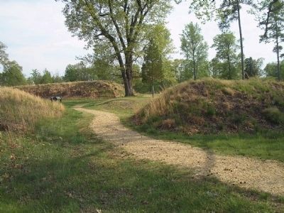
3. Marker on Fort Harrison Walking Trail
Marker can be seen here along the walking trail inside Fort Harrison.
Photographed by Bill Coughlin, April 24, 2007
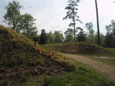
4. Confederate and Union Fortifications
After Union troops took Fort Harrison, they constructed a new series of fortifications. The earthworks to the left of the photo are Confederate earthworks, while those on the right were built by Federal troops.
Photographed by Bill Coughlin, April 24, 2007
5. Richmond National Battlefield Park
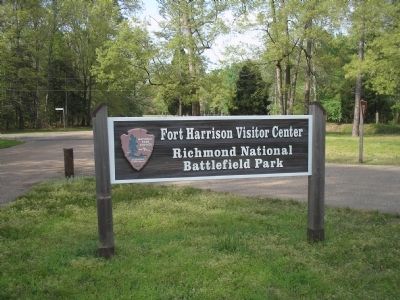
Marker is in the Fort Harrison Unit of the Richmond National Battlefield Park.
Credits. This page was last revised on November 4, 2024. It was originally submitted on January 6, 2009, by Bill Coughlin of Woodland Park, New Jersey. This page has been viewed 1,292 times since then and 26 times this year. Last updated on November 3, 2024, by Carl Gordon Moore Jr. of North East, Maryland. Photos: 1, 2, 3, 4, 5. submitted on January 6, 2009, by Bill Coughlin of Woodland Park, New Jersey. • Bernard Fisher was the editor who published this page.
