Guilford in South Central Region, Connecticut — The American Northeast (New England)
Oxen on the Farm
Photographed by Conrad Ward, June 12, 2024
1. Oxen on the Farm Marker
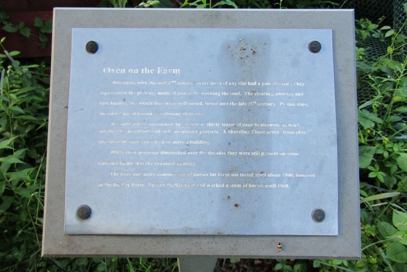
Beginning with the mid-17th century every farm of any size had a pair of oxen. They represented the primary mode of power for working the land. The clearing, plowing and cart hauling, for which they were well suited, lasted into the late 19th century. By this time, increased use of horses was slowing their use.
It would not be uncommon for twenty or thirty teams of oxen to assemble to work together for neighborhood and community projects. A Shoreline Times article from 1856, describes 60 oxen assembled to move a building.
While their presence diminished over the decades they were still present on some Guilford farms into the twentieth century.
The later and more common use of horses for farm use lasted until about 1940, however on the Dudley Farm, Nathan Dudley kept and worked a team of horses until 1968.
Erected by The Dudley Farm Museum.
Topics. This historical marker is listed in these topic lists: Agriculture • Animals.
Location. 41° 21.302′ N, 72° 43.134′ W. Marker is in Guilford in South Central Region, Connecticut. It can be reached from Durham
this page online

Regionally, this marker is in the Connecticut River Valley, on the Connecticut Shoreline, and in Greater New Haven. It is also in the American Northeast, in New England, and on the Eastern Seaboard. Globally, it is in the North Atlantic Region, North America, the Western Hemisphere, the Western World, and the Anglosphere. Historically, it finds itself in what was once New Haven County and also one of the original Thirteen Colonies.
Other nearby markers. At least 8 other markers are within walking distance of this marker: Chickens on the Farm (a few steps from this marker); Water Pumping System (within shouting distance of this marker); Farm Shed (within shouting distance of this marker); The Orchard (within shouting distance of this marker); Bunkhouse and Wagon Shed (within shouting distance of this marker); Ice House (within shouting distance of this marker); Sugarhouse
Photographed by Conrad Ward, June 12, 2024
2. Oxen on the Farm Marker
Also see . . . The Dudley Farm Museum. (Submitted on November 3, 2024.)
Credits. This page was last revised on May 19, 2026. It was originally submitted on November 3, 2024, by Conrad Ward of Guilford, Connecticut. This page has been viewed 179 times since then and 16 times this year. Photos: 1, 2. submitted on November 3, 2024, by Conrad Ward of Guilford, Connecticut. • Michael Herrick was the editor who published this page.
