
Guilford in South Central Region, Connecticut — The American Northeast (New England)
Water Pumping System
Photographed by Conrad Ward, January 1, 1980
1. Water Pumping System Marker
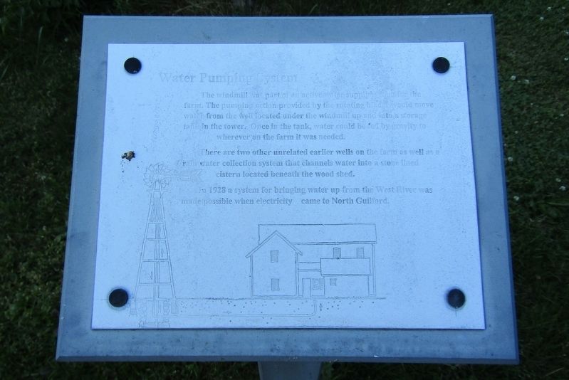
The windmill was part of an active water supply system for the farm. The pumping action provided by the rotating blade would move water from the well located under the windmill up and into a storage tank in the tower. Once in the tank, water could be fed by gravity to wherever on the farm it was needed.
There are two other unrelated earlier wells on the farm as well as a rain water collection system that channels water into a stone lined cistern located beneath the wood shed.
In 1928, a system for bringing water up from the West River was made possible when electricity came to North Guilford.
Erected by The Dudley Farm Museum.
Topics and series. This historical marker is listed in this topic list: Agriculture. In addition, it is included in the Windmills series list. A significant historical year for this entry is 1928.
Location. 41° 21.29′ N, 72° 43.171′ W. Marker is in Guilford in South Central Region, Connecticut. It can be reached from Durham Road (Connecticut Route 77) north of Route 80, on the right when traveling north. Located at the Dudley Farm Museum. Touch for map. Marker is at or near this postal
this page online

Regionally, this marker is in the Connecticut River Valley, on the Connecticut Shoreline, and in Greater New Haven. It is also in the American Northeast, in New England, and on the Eastern Seaboard. Globally, it is in the North Atlantic Region, North America, the Western Hemisphere, the Western World, and the Anglosphere. Historically, it finds itself in what was once New Haven County and also one of the original Thirteen Colonies.
Other nearby markers. At least 8 other markers are within walking distance of this marker: The Orchard (here, next to this marker); The Flower Gardens (a few steps from this marker); Barn Complex (within shouting distance of this marker); Farmhouse (within shouting distance of this marker); Dudley Farm Historic District (within shouting distance of this marker); Farm Shed (within shouting distance of this marker); Ice House (within shouting distance of this marker); Chickens on the Farm (within shouting distance of this marker). Touch for a list and map of all markers in Guilford.
Also see . . . The Dudley Farm Museum.
Photographed by Conrad Ward, June 12, 2024
2. Water Pumping System Marker
Credits. This page was last revised on May 19, 2026. It was originally submitted on November 3, 2024, by Conrad Ward of Guilford, Connecticut. This page has been viewed 130 times since then and 15 times this year. Photos: 1, 2. submitted on November 3, 2024, by Conrad Ward of Guilford, Connecticut. • Michael Herrick was the editor who published this page.
