Prospect in Waldo County, Maine — The American Northeast (New England)
Battery B
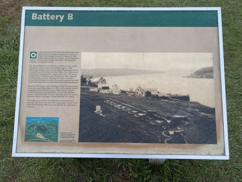
Photographed by Darren Jefferson Clay, October 15, 2024
1. Battery B marker
Over the 20 years that Fort Knox was under construction, plans for the fort changed and parts of it had to be rebuilt. Such changes occurred in Battery B. This battery, built in 1845 for 15 guns, was the first place ready for cannons. Even though the battery was essentially complete, no cannons arrived.
Fort Knox's Battery B and Battery A (530 feet to the south), still had no cannons when the Civil War began in 1861. Maine's government pressured the federal Department of War to properly arm Fort Knox and other Maine forts. The federal government responded, but complications arose. The cannon emplacements in Batteries A and B had been made originally for 32-pounder cannons. With improvements in cannon production techniques, the older 32-pounder cannons had been replaced with larger and more powerful 10-inch Rodman cannons.
Because of this change, crews working for Capt. Thomas Lincoln Casey, the supervising engineer in 1861, had to spend months rebuilding and reinforcing the gun emplacements. Finally, the first cannons to be installed here, two 10-inch Rodman cannons, arrived in 1863. Over the next three years, six
this page online
The single cannon barrel remaining here is from a 15-inch. Rodman. This barrel was one of the cannon parts "saved" from World War II salvage efforts and was left here for educational purposes.
Topics. This historical marker is listed in these topic lists: Forts and Castles • War, US Civil. A significant historical year for this entry is 1845.
Location. 44° 34.042′ N, 68° 48.158′ W. Marker is in Prospect, Maine, in Waldo County. It can be reached from Fort Knox Road (Maine Route 174) half a mile north of Acadia Highway (U.S. 1), on the right when traveling north. Located in the Fort Knox Historic Site. Touch for map. Marker is at or near this postal address: 740 Ft Knox Rd, Stockton Springs ME 04981, United States of America. Touch for directions.

Regionally, this marker is in Midcoast Maine and on Penobscot Bay. It is also in the American Northeast, in New England, and on the Eastern Seaboard. Globally, it is in the North Atlantic Region, North America, the Western Hemisphere, the Western World, and the Anglosphere.
Other nearby markers. At least 8 other markers

Photographed by Darren Jefferson Clay, October 15, 2024
2. Battery B marker
Also see . . . Fort Knox Historic Site & Penobscot Narrows Bridge & Observatory. (Submitted on November 4, 2024.)
Credits. This page was last revised on March 19, 2026. It was originally submitted on November 3, 2024, by Darren Jefferson Clay of Duluth, Georgia. This page has been viewed 185 times since then and 32 times this year. Photos: 1, 2. submitted on November 3, 2024, by Darren Jefferson Clay of Duluth, Georgia. • Bernard Fisher was the editor who published this page.
