Mutter Gottes in Covington in Kenton County, Kentucky — The American South (East South Central)
Craig Street Burying Ground
Photographed by Allen W. Bernard, November 5, 2024
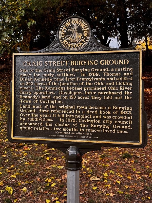
1. Craig Streey Burying Ground Marker
Site of the Craig Street Burying Ground, a resting place for early settlers. In 1789, Thomas and Dinah Kennedy came from Pennsylvania and settled on 200 acres at the junction of the Ohio and Licking rivers. The Kennedys became prominent Ohio River ferry operators. Developers later purchased the Kennedy's land, and on 150 acres they laid out the Town of Covington.
Land west of the original town became a Burying Ground, first referenced in a deed book of 1823. Over the years it fell into neglect and was crowded by subdivisions. In 1872, Covington city council announced the closing of the Burying Ground, giving relatives two months to remove loved ones.
Remains not claimed would be moved to Highland Cemetery and placed in a lot dedicated to "Pioneers of Covington." The removal project was stopped by legal challenges. In 1879 the Kentucky Court of Appeals confirmed the city's right to continue. At least 1600 graves were moved to Highland Cemetery. Thomas and Dinah Kennedy and others were reinterred in Covington's Linden Grove Cemetery.
Sixth Street and the railroad now cross this former burying ground. When the
this page online
Erected 2024 by Mutter Gottes Neighborhood Association.
Topics. This historical marker is listed in these topic lists: Cemeteries & Burial Sites • Settlements & Settlers. A significant historical year for this entry is 1823.
Location. 39° 5.041′ N, 84° 30.899′ W. Marker is in Covington, Kentucky, in Kenton County. It is in Mutter Gottes. It is at the intersection of Craig Street and 6th street, in the median on Craig Street. Touch for map. Marker is at or near this postal address: 230 W 6th St, Covington KY 41011, United States of America. Touch for directions.

Regionally, this marker is in Kentucky’s Outer Bluegrass. It is also in the American South, specifically in the Upper South, and in the Ohio River Valley. Globally, it is in North America, the Western Hemisphere, the Western World, and the Anglosphere. Historically, it finds itself in what was once the territory of the Mississippian Culture and also the Antebellum South.
Other nearby markers. At least 8 other markers are within walking distance

Photographed by Allen W. Bernard, November 5, 2024
2. Craig Street Burying Ground Marker

Photographed by Allen W. Bernard, November 5, 2024
3. Craig Street Burying Ground Marker
Credits. This page was last revised on July 6, 2025. It was originally submitted on November 5, 2024, by Allen W. Bernard of Cincinnati, Oh 45202-1736. This page has been viewed 445 times since then and 59 times this year. Photos: 1, 2, 3. submitted on November 5, 2024, by Allen W. Bernard of Cincinnati, Oh 45202-1736. • James Hulse was the editor who published this page.
