Downtown in Anchorage, Alaska — Northwest (North America)
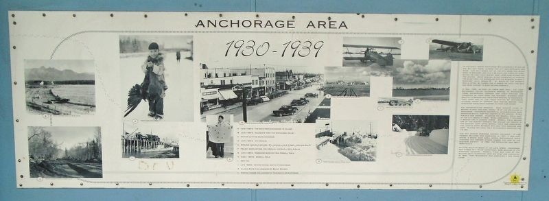
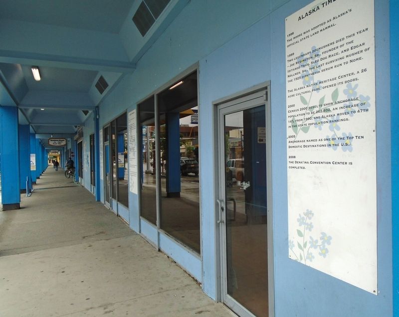
Anchorage Area 1930-1939
Photographed by William Fischer, Jr., August 12, 2024
1. Anchorage Area 1930-1939 Marker
In the early 1930's, Anchorage was accessible by rail or air, but any travel outside the city was expensive and slow. The only roads out of the city were the rough road to Spenard Lake and a 22 mile loop north of town. After the first light snows, most cars were stored for the winter. Snow removal often consisted of pushing the snow from the sidewalks into the streets, where it remained until break-up. At break-up the streets would often be closed for 2 weeks or until the mud had dried enough to make driving possible.
In May 1935, as part of FDR's New Deal, the first Matanuska Valley colonists arrived in Anchorage. These experienced farmers and their families had journeyed by train from the mid-west, steamer from Seattle to Seward and train from Seward to Anchorage. They were met at the train station by Anchorage citizens, feted at dinners and parties before they continued their train journey to their new homes.
Air transportation improved. Star Airways, later to become Alaska Airlines, owned 15 of the 39 planes in Anchorage. Anchorage residential neighborhoods were expanding south, past the airstrip at 9th Avenue.
this page online
The 4th Avenue business district expanded. A new Federal Building was completed in 1937, a new post office, 2 banks, many small shops, restaurants, movie theaters and grocery stores formed the core of the business district. In 1939, the population was about 3500 people.
Military build-up began in the late 1930's. Anchorage was chosen as a major operational base because of it's strategic location. Merrill Field was used by the military until Elmendorf Army Air Base was completed in 1940. Fort Richardson was completed a few years later.
[Photo captions, clockwise from bottom left, read]
A. Late 1930's. The road from Anchorage to Palmer
B. Late 1930's. Colonists farm the Matanuska Valley
C. Winter hunting near Anchorage
D. Late 1930's. 4th
Photographed by William Fischer, Jr., August 12, 2024
2. Anchorage Area 1930-1939 Marker
E. Airfield and golf course. 9th Avenue and E Street, looking south
F. Freight service from the original airfield at 9th Avenue
G. Late 1930's. Passenger service from Merrill Field
H. Early 1930's. Merrill Field
I. Dog taxi.
J. Late 1930's. Winter travel south of Anchorage
K. Alaska State flag designed by Benny Benson
L. Fishing tender and cannery at the mouth of Ship Creek
Erected by 4th Avenue Market Place.
Topics. This historical marker is listed in these topic lists: Agriculture • Air & Space • Industry & Commerce • Settlements & Settlers. A significant historical month for this entry is May 1935.
Location. 61° 13.122′ N, 149° 53.355′ W. Marker is in Anchorage, Alaska. It is in Downtown. It is on 4th Avenue, on the right when traveling west. Marker is under the covered 4th Avenue Market Place colonnade between E and C Streets. Touch for map. Marker is at or near this postal address: 333 West 4th Avenue, Anchorage AK 99501, United States of America. Touch for directions.

Regionally, this marker is in the Alaska Railroad Corridor, in the Athabascan Region, in the Prince William Sound, and in Southcentral Alaska. It is also on the American Pacific Coast. Globally, it is in North America, on the Ring of Fire, on the Pacific Rim, in the Western Hemisphere, in the Western World, and in the Anglosphere. Historically, it finds itself in what was once the Russian Empire.
Other nearby markers. At least 8 other markers are within walking distance of this marker: Iditarod Sled Dog Race History (a few steps from this marker); Anchorage Area 1916-1920 (a few steps from this marker); Anchorage Area 1920s (a few steps from this marker); Anchorage Area 1915 (a few steps from this marker); Anchorage Area Pre 1915 (within shouting distance of this marker); Alaska Territorial Guard (within shouting distance of this marker); Racing in the Footsteps of a Legend (within shouting distance of this marker); Anchorage Area 1940-1949 (within shouting distance of this marker). Touch for a list and map of all markers in Anchorage.
Credits. This page was last revised on November 5, 2024. It was originally submitted on November 5, 2024, by William Fischer, Jr. of Reynoldsburg, Ohio. This page has been viewed 287 times since then and 57 times this year. Photos: 1, 2. submitted on November 5, 2024, by William Fischer, Jr. of Reynoldsburg, Ohio.
