Thurmont in Frederick County, Maryland — The American Northeast (Mid-Atlantic)
Thurmont
War's Crossroads
| — | Gettysburg Campaign | — |

Photographed by Mike McKeown, November 5, 2024
1. Thurmont Marker
Elements of the armies returned to Thurmont after the Union victory at Gettysburg. On July 5, Confederate Gen. J.E.B. Stuart rested his cavalrymen for an hour outside of Thurmont to feed and water tired horses. Stuart learned of Union cavalry posted here to guard the pass over Catoctin Mountain to Cavetown, on present-day Rte. 77. The Confederates decided to bypass Thurmont on mountain paths and trails, but rumors spread widely that the Confederates had briefly occupied the town.
(captions)
Thurmont was known as Mechanicstown during the Civil War. Its current name means "Gateway to the Mountains," and came in use in 1894. Courtesy Thurmont Historical Society
Gen. John F. Reynolds • Gen. J.E.B. Stuart
DATELINE, MECHANICSTOWN
After the Battle of Gettysburg, a large portion of the Army of the Potomac passed through Thurmont in pursuit of the Army of Northern Virginia.
HEADQUARTERS THIRD CORPS, Mechanicstown, July 7, 1863-6.20 p. m.
Major-General SEDGWICK,
Commanding Right Wing, Army of the Potomac: GENERAL: I have the honor to state that this corps moved from its position at Gettysburg this morning at 3 o'clock, and reached Saint Joseph's College at 10 a. m., and found the Sixth Corps halted. and has followed the train to this place. It was detained there until 1 p.m. by the Sixth Corps and its train, and has followed the train to this place.
The head of my column has just reached here, and I have determined to halt and bivouac, starting at an early hour in the morning, as my artillery horses are reported very jaded for want of rest and forage.
The citizens report a force of 2,000 cavalry (Jenkins) on the ountain Road to Cavetown, Md. He was here Sunday, and took off much plunder.D. B. BIRNEY, Major-General, Commanding Third Corps.
Position of the Union Army of the Potomac June 29, 1863 (midday) How Union commander Gen. George G. Meade orders his army north with two objectives: Engage the Confederate army under the best possible conditions while protecting Washington, D.C. Learning that the Union army was close and getting closer, Confederate Gen. Robert E. Lee orders his army to consolidate somewhere near the Maryland-Pennsylvania border.
Erected by Maryland
this page online
Topics and series. This historical marker is listed in this topic list: War, US Civil. In addition, it is included in the Maryland Civil War Trails series list. A significant historical date for this entry is June 29, 1863.
Location. 39° 37.436′ N, 77° 24.695′ W. Marker is in Thurmont, Maryland, in Frederick County. It is at the intersection of North Church Street and West Main Street (Maryland Route 77), on the left when traveling north on North Church Street. Touch for map. Marker is at or near this postal address: 1 N Church St, Thurmont MD 21788, United States of America. Touch for directions.

Regionally, this marker is in the Washington Metropolitan Area and in Central Maryland. It is also in the American Mid-Atlantic. Globally, it is in North America, the Western Hemisphere, the Western World, and the Anglosphere. Historically, it finds itself in what was once one of the original Thirteen Colonies and also the Antebellum South.
Other nearby markers. At least 8 other markers are within walking distance of this marker: Creeger House (within shouting distance of this marker); Veterans Memorial (approx. 0.2 miles
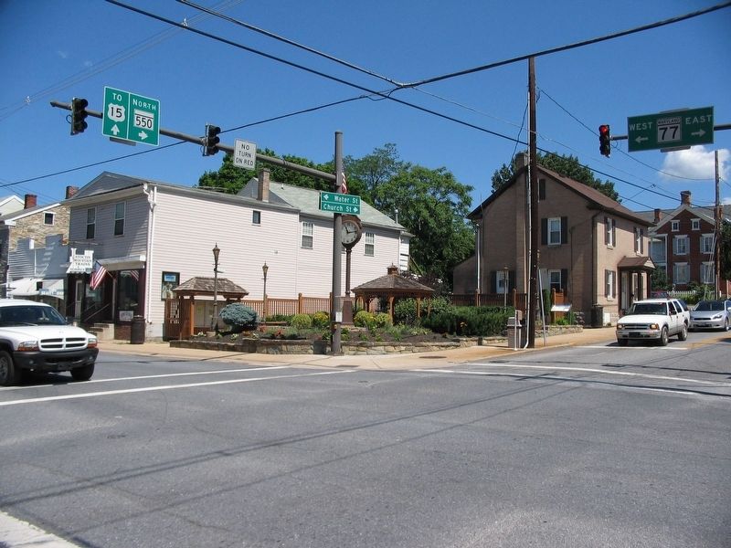
Photographed by Craig Swain, July 1, 2007
2. Mechanicsburg Town Square Park
Another marker is no longer nearby. Thurmont (was here, next to this marker but has been permanently removed).
Related marker. Click here for another marker that is related to this marker. Old CWT Marker At This Location also titled "Thurmont".
Credits. This page was last revised on November 6, 2024. It was originally submitted on November 5, 2024, by Mike McKeown of Baltimore, Maryland. This page has been viewed 351 times since then and 37 times this year. Photos: 1. submitted on November 5, 2024, by Mike McKeown of Baltimore, Maryland. 2. submitted on July 4, 2007, by Craig Swain of Leesburg, Virginia. • Bill Pfingsten was the editor who published this page.
