Downtown in Anchorage, Alaska — Northwest (North America)
Anchorage Area 1940-1949
Photographed by William Fischer, Jr., August 12, 2024
1. Anchorage Area 1940-1949 Marker
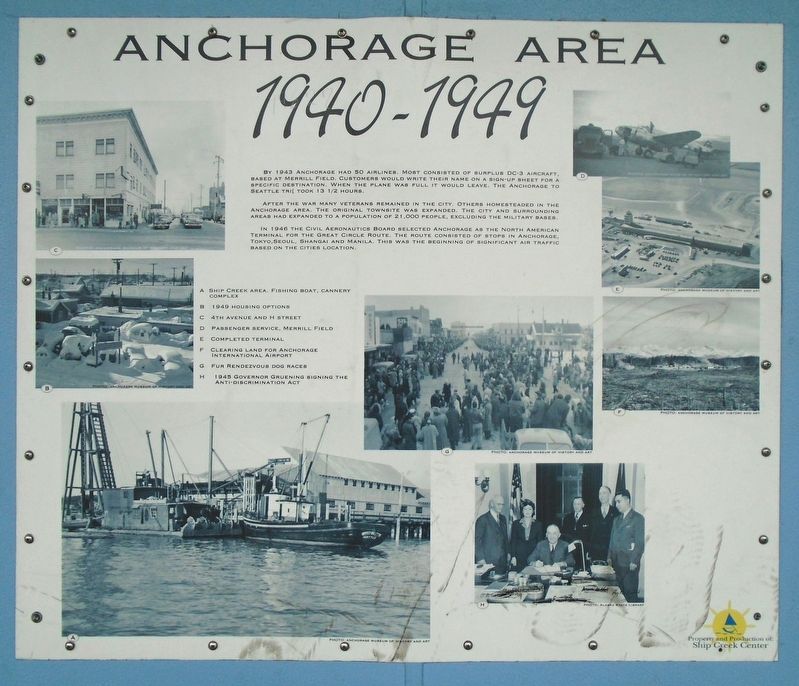
By 1943 [sic-probably 1948] Anchorage had 50 airlines. Most consisted of surplus DC-3 aircraft, based at Merrill Field. Customers would write their name on a sign-up sheet for a specific destination. When the plane was full it would leave. The Anchorage to Seattle tri[p] took 13 1/2 hours.
After the war many veterans remained in the city. Others homesteaded in the Anchorage area. The original townsite was expanded. The city and surrounding areas had expanded to a population of 21,000 people, excluding the military bases.
In 1946 the Civil Aeronautics Board selected Anchorage as the North American Terminal for the Great Circle Route. The route consisted of stops in Anchorage, Tokyo, Seoul, Shanghai and Manila. This was the beginning of significant air traffic based on the cities [sic-city's] location.
[Photo captions, clockwise from bottom left, read]
A. Ship Creek area. Fishing boat, cannery complex
B. 1949 housing options
C. 4th [A]venue and H [S]treet
D. Passenger service, Merrill Field
E. Completed terminal
F. Clearing land for Anchorage International Airport
G. Fur Rendevzous dog races
H. 1945 Governor
this page online
Erected by 4th Avenue Market Place.
Topics. This historical marker is listed in these topic lists: Air & Space • Immigration • Industry & Commerce • Settlements & Settlers. A significant historical year for this entry is 1948.
Location. 61° 13.122′ N, 149° 53.308′ W. Marker is in Anchorage, Alaska. It is in Downtown. It is on 4th Avenue, on the right when traveling west. Marker is under the covered 4th Avenue Market Place colonnade between C and D Streets. Touch for map. Marker is at or near this postal address: 333 West 4th Avenue, Anchorage AK 99501, United States of America. Touch for directions.

Regionally, this marker is in the Alaska Railroad Corridor, in the Athabascan Region, in the Prince William Sound, and in Southcentral Alaska. It is also on the American Pacific Coast. Globally, it is in North America, on the Ring of Fire, on the Pacific Rim, in the Western Hemisphere, in the Western World, and in the Anglosphere. Historically, it finds itself in what was once the Russian Empire.
Other nearby markers. At least 8 other markers are within walking

Photographed by William Fischer, Jr., August 12, 2024
2. Anchorage Area 1940-1949 Marker
Credits. This page was last revised on November 5, 2024. It was originally submitted on November 5, 2024, by William Fischer, Jr. of Reynoldsburg, Ohio. This page has been viewed 189 times since then and 25 times this year. Photos: 1, 2. submitted on November 5, 2024, by William Fischer, Jr. of Reynoldsburg, Ohio.
