Danvers in Essex County, Massachusetts — The American Northeast (New England)
The People

Photographed by Duane and Tracy Marsteller, October 1, 2024
1. The People Marker
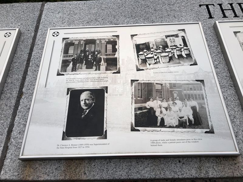
[Left panel, clockwise from top left]
• Five hospital Trustees and administrative staff, including Dr. Julia K. Casey, stand on the steps of the Central Administrative Building this this 1880s formal photograph.
• A class of attentive student nurses.
• A group of male and female attendants pose in this circa 1900 photo, while a patient peers out of the window behind them.
• Dr. Clarence A. Bonner (1889-1959) was Superintendent of the State Hospital from 1927 to 1954.
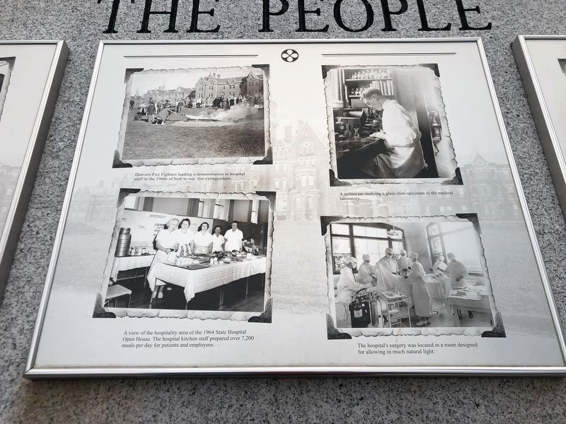
[Middle panel, clockwise from top left]
• Danvers Fire Fighters leading a demonstration to hospital staff in the 1960s of how to use fire extinguishers.
• A technician studying a glass slide specimen in the medical laboratory.
• The hospital's surgery was located in a room designed for allowing in much natural light.
• A view of the hospitality area of the 1964 State Hospital Open House. The hospital kitchen staff prepared over 7,200 meals per day for patients and employees.
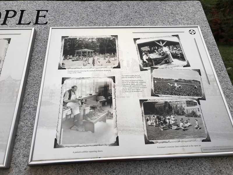
[Right panel, clockwise from top left]
• Female patients enjoying the outdoors behind the Kirkbride wings in the 1940s.
• An outdoor work crew of patients breaking for
this page online
• The State Hospital produced much of its own food including vegetables, dairy and meat. “Patients are permitted to work in the various hospital activities where they soon regain confidence in themselves.”
• A women's exercise class conducted in the open air.
• A patient-cobbler repairing shoes.
Topics. This historical marker is listed in this topic list: Science & Medicine. A significant historical year for this entry is 1927.
Location. 42° 34.78′ N, 70° 58.424′ W. Marker is in Danvers, Massachusetts, in Essex County. It is on Kirkbride Drive, on the right when traveling east. Marker is in the Danvers State Hospital Memorial Plaza in the Bradlee Danvers residential complex. Touch for map. Marker is at or near this postal address: 50 Kirkbride Dr, Danvers MA 01923, United States of America. Touch for directions.

Regionally, this marker is on the North Shore, in Greater Boston, and in the Merrimack Valley. It is also in the American Northeast, in New England, and on the Eastern Seaboard. Globally, it is in the North Atlantic Region, North America, the Western Hemisphere, the Western World, and the Anglosphere. Historically,
Photographed by Duane and Tracy Marsteller, October 1, 2024
2. The People Marker (left panel)
Other nearby markers. At least 8 other markers are within one mile of this marker, measured as the crow flies: The Institution (here, next to this marker); The Danvers State Hospital (here, next to this marker); National Historic Landmark (about 500 feet away, measured in a direct line); Derby Summer House (approx. 0.6 miles away); Village Training Field (approx. one mile away); Danvers Revolutionary War Memorial (approx. one mile away); Deacon Nathaniel Ingersoll (approx. one mile away); The 1681 Salem Village Parsonage (approx. 1.1 miles away). Touch for a list and map of all markers in Danvers.
Photographed by Duane and Tracy Marsteller, October 1, 2024
3. The People Marker (middle panel)
Photographed by Duane and Tracy Marsteller, October 1, 2024
4. The People Marker (right panel)

Photographed by Duane and Tracy Marsteller, October 1, 2024
5. The People Marker
The featured marker is on the right.
Credits. This page was last revised on November 10, 2024. It was originally submitted on November 10, 2024, by Duane and Tracy Marsteller of Murfreesboro, Tennessee. This page has been viewed 139 times since then and 24 times this year. Photos: 1, 2, 3, 4, 5. submitted on November 10, 2024, by Duane and Tracy Marsteller of Murfreesboro, Tennessee.
