Thurmont in Frederick County, Maryland — The American Northeast (Mid-Atlantic)
Recreation For All
Catoctin Furnace Iron Trail
Photographed by Allen C. Browne, October 30, 2024
1. Recreation For All Marker
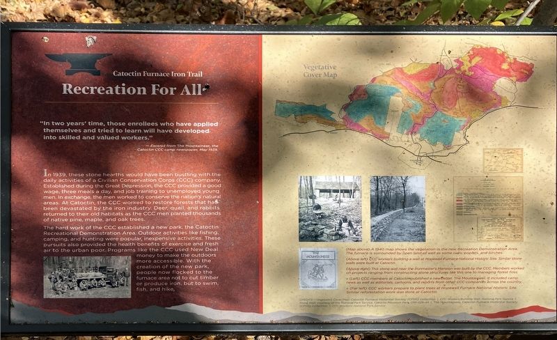
“In two years' time, those enrollees who have applied themselves and tried to learn will have developed, into skilled and valued workers.”
—Excerpt from The Mountaineer, the Catoctin CCC camp newspaper, May 1939.
In 1939, these stone hearths would have been bustling with the daily activities of a Civilian Conservation Corps (CCC) company. Established during the Great Depression, the CCC provided a good wage, three meals a day, and job training to unemployed young men. In exchange, the men worked to conserve the nation's natural areas. At Catoctin, the CCC worked to restore forests that had been devastated by the iron industry. Deer, quail, and rabbits returned to their old habitats as the CCC men planted thousands of native pine, maple, and oak trees.
The hard work of the CCC established a new park, the Catoctin Recreational Demonstration Area. Outdoor activities like fishing; camping, and hunting were popular, inexpensive activities. These pursuits also provided the health benefits of exercise and fresh air to the urban poor. Programs like the CCC used New Deal money to make the outdoors more accessible. With the
this page online
[Captions:]
(Map above) A 1940 map shows the vegetation in the new Recreation Demonstration Area. The furnace is surrounded by open land as well as some oaks, poplars, and birches.
(Above left) CCC workers building a wall at Hopewell Furnace National Historic Site. Similar stone walls were built at Catoctin.
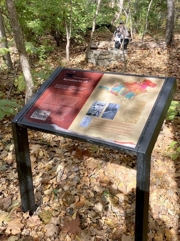
,br> (Above right) This stone wall near the ironmaster's Mansion was built by the CCC. Members worked on projects ranging from constructing stone structures like this one to managing forest fires.
« (Left) CCC members at Catoctin published a newsletter, The Mountaineer. It included camp news as well as editorials, cartoons, and reports from other CCC companies across the country.
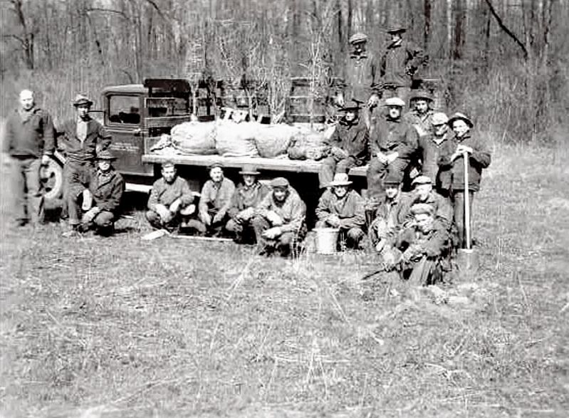
« (Far left) CCC workers prepare to plant trees at Hopewell Furnace National Historic Site. Similar reforestation work was done at Catoctin.
Erected by Catoctin Furnace Historical Society; William G. Pomeroy Foundation; Maryland Park Service; Maryland Department of Natural Resources.
Topics. This historical
Photographed by Allen C. Browne, October 30, 2024
2. Recreation For All Marker
Location. 39° 35.055′ N, 77° 26.072′ W. Marker is in Thurmont, Maryland, in Frederick County. It can be reached from the intersection of Catoctin Furnace Road and Kellys Store Road, on the right when traveling south. Touch for map. Marker is at or near this postal address: 10182 Catoctin Mountain Hwy, Thurmont MD 21788, United States of America. Touch for directions.

Regionally, this marker is in the Washington Metropolitan Area and in Central Maryland. It is also in the American Mid-Atlantic. Globally, it is in North America, the Western Hemisphere, the Western World, and the Anglosphere. Historically, it finds itself in what was once one of the original Thirteen Colonies and also the Antebellum South.
Other nearby markers. At least 8 other markers are within walking distance of this marker: A Lost Pond (within shouting distance of this marker); Waste Management (within shouting distance of this marker); A Fractured Landscape (about 300 feet away, measured in a direct line); Destruction and Renewal (about 400
Other markers no longer nearby. Slag Heaps (was within shouting distance of this marker but has been replaced with another marker now near it); Second Growth Forest (was about 400 feet away but has been replaced with another marker now near it); Raceway and Dam (was about 400 feet away but has been replaced with another marker now near it); Little Hunting Creek (was about 500 feet away but has been replaced with another marker now near it); Bowstring Arch Bridge (was about 600 feet away but has been replaced with another marker now near it).
Photographed by National Park Service
4. CCC Workers Planting Trees
CCC workers prepare to plant trees at Hopewell Furnace National Historic Site.
Similar reforestation work was done at Catoctin.
Credits. This page was last revised on May 18, 2026. It was originally submitted on November 10, 2024, by Allen C. Browne of Silver Spring, Maryland. This page has been viewed 131 times since then and 22 times this year. Photos: 1, 2. submitted on November 10, 2024, by Allen C. Browne of Silver Spring, Maryland. 3. submitted on May 18, 2026, by Devry Becker Jones of Washington, District of Columbia. 4. submitted on November 10, 2024, by Allen C. Browne of Silver Spring, Maryland.
