Shelbyville in Bedford County, Tennessee — The American South (East South Central)
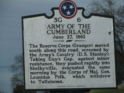
Army of the Cumberland
June 27, 1863
Photographed by Tom Gillard, December 30, 2009
1. Army of the Cumberland Marker
Erected by Tennessee Historical Commission. (Marker Number 3G 6.)
Topics and series. This historical marker is listed in this topic list: War, US Civil. In addition, it is included in the Tennessee Historical Commission series list.
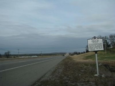
Location. 35° 37.192′ N, 86° 25.93′ W. Marker is in Shelbyville, Tennessee, in Bedford County. It is on Shelbyville Highway (Tennessee Route 231), on the left when traveling south. Touch for map. Marker is in this post office area: Christiana TN 37037, United States of America. Touch for directions.

Regionally, this marker is in Middle Tennessee. It is also in the American South and specifically in the Upper South. Globally, it is in North America, the Western Hemisphere, the Western World, and the Anglosphere. Historically, it finds itself in what
this page online
Other nearby markers. At least 8 other markers are within 8 miles of this marker, measured as the crow flies: Anatomy of a Campaign (approx. 4.8 miles away); The Eugene F. Strobel Town Hall (approx. 4.8 miles away); Shaker's Shocker No. 621314 (approx. 5.1 miles away); The Webb School (approx. 5.2 miles away); a different marker also named The Webb School (approx. 5.2 miles away); Culleoka Bell (approx. 5.3 miles away); Mary Shirley McGuire (approx. 7.4 miles away); a different marker also named Army of the Cumberland (approx. 7.8 miles away).
Photographed by Tom Gillard, December 30, 2009
2. Army of the Cumberland Marker
Credits. This page was last revised on June 16, 2016. It was originally submitted on December 31, 2009, by Tom Gillard of Tullahoma, Tennessee. This page has been viewed 2,426 times since then and 68 times this year. Photos: 1, 2. submitted on December 31, 2009, by Tom Gillard of Tullahoma, Tennessee. • Craig Swain was the editor who published this page.
