
Flossenbürg in Neustadt an der Waldnaab, Bavaria, Germany — Central Europe
SS-Wirtschaftsgebäude
⎯⎯⎯
SS Utility Building
Photographed by James Hulse, September 27, 2024
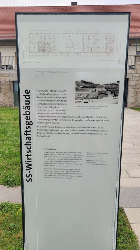
1. SS-Wirtschaftsgebäude / SS Utility Building Marker

1942 müssen Häftlinge für die SS ein Wirtschaftsgebäude errichten, das vor allem der Verpflegung der Wachmannschaften dient. Neben Küche, Speisesaal und Kantine beherbergt das Gebäude ein „Unterführerheim", den Aufenthaltsraum für Unteroffiziere. Im Untergeschoss befinden sich Lagerräume, Duschen und Toiletten. Für Offiziere stehen im sogenannten Führerheim in der vorgelagerten Baracke separate Räumlichkeiten zur Verfügung.
Nach der Befreiung des Konzentrationslagers nutzen die US-Armee und die Flüchtlingsverwaltung der Vereinten Nationen (UNRRA) die vorhandenen Einrichtungen weiter. Bis 2001 betreiben wechselnde Pächter und Eigentümer hier eine Gastwirtschaft.
Bildunterschriften
(Foto Nr. 1) Grundriss des SS-Wirtschaftsgebäudes, November 1942 (Ausschnitt), Bundesarchiv Berlin.
(Foto Nr. 2) Ehemaliges SS-Wirtschaftsgebäude (im Hintergrund), 1946, Association des déportés de Flossenbürg et Kommandos, Paris.
SS Utility Building
In 1942, prisoners were put to work constructing a utility building for the SS, primarily for use by camp guards. Along with a kitchen, dining hall and canteen, the building also housed a so-called Unterführerheim, or meeting room, for enlisted staff. The basement contained storage rooms, showers and toilets. SS officers used a separate Führerheim facility located in an adjacent barrack.
Following the liberation of the concentration camp, the facilities were utilized by the U.S. Army and the United Nations Relief and Rehabilitation Administration (UNRRA). Until the early 2000s, various tenants and proprietors operated a restaurant establishment at this site.
Captions
above: Floor plan of the SS utility building, November 1942 (excerpt), Federal Archives, Berlin.
below: Former SS utility building (in the background), 1946, Association des déporté de Flossenbürg et Kommandos, Paris.
Topics.
this page online
Location. 49° 44.223′ N, 12° 21.3′ E. Marker is in Flossenbürg, Bayern (Bavaria), in Neustadt an der Waldnaab. It is on Gedächtnisallee just east of Silberhüttenstraße. The marker is located at the northwestern section of the Flossenbürg Concentration Camp. Touch for map. Marker is at or near this postal address: Gedächtnisallee 5-7, Flossenbürg BY 92696, Germany. Touch for directions.

Regionally, it is in Europe, the European Union, Atlantic Europe, Central Europe, the Schengen Area, Western Europe, and the Western World. Historically, it finds itself in what was once the Holy Roman Empire and also the former West Germany.
Other nearby markers. At least 8 other markers are within walking distance of this marker: Burg / Castle (within shouting distance of this marker); Gemeinde Kz-Gedenkstätte / Concentration Camp Memorial Community (within shouting distance of this marker); Geschichte / Story (within shouting distance of this marker); Kommandantur / Commandant's Headquarters
Photographed by James Hulse, September 27, 2024
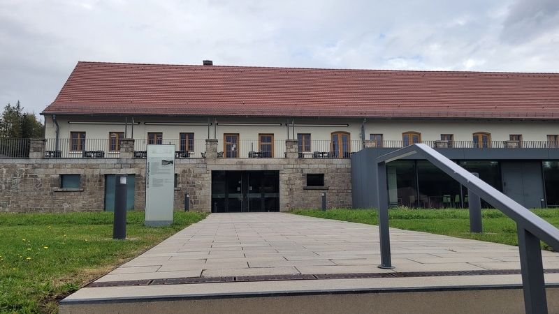
2. The SS Utility Building and Marker
More about this marker. The marker is located on the grounds of the Flossenbürg Concentration Camp Memorial.
Also see . . . Flossenbürg Concentration Camp. KZ-Gedenkstätte Flossenbürg
Before the establishment of the concentration camp, Flossenbürg was merely a small village in the Upper Palatinate forest. Beginning in the late 19th century, a number of quarries were opened in the area in order to exploit local granite deposits, and Flossenbürg developed into a workers’ village.(Submitted on November 13, 2024, by James Hulse of Medina, Texas.)
Photographed by James Hulse, September 27, 2024
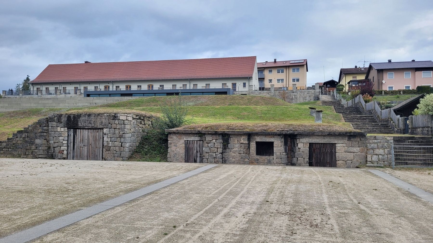
3. The SS Utility Building is located at the top of the hill (left side)
Credits. This page was last revised on September 30, 2026. It was originally submitted on November 13, 2024, by James Hulse of Medina, Texas. This page has been viewed 109 times since then and 30 times this year. Photos: 1, 2, 3. submitted on November 15, 2024, by James Hulse of Medina, Texas.
