Schuylkill Haven in Schuylkill County, Pennsylvania — The American Northeast (Mid-Atlantic)
Covered Bridge
Schuylkill Haven Heritage Trail
Photographed by William Fischer, Jr., November 12, 2024
1. Covered Bridge Marker
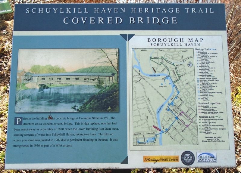
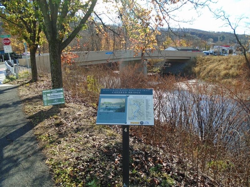
Prior to the building of the concrete bridge at Columbia Street in 1921, the structure was a wooden covered bridge. This bridge replaced one that had been swept away in September of 1850, when the lower Tumbling Run Dam burst, sending torrents of water into Schuylkill Haven, taking two lives. The dike on which you stand was created in 1902 due to persistent flooding in the area. It was strengthened in 1936 as part of a WPA project.
Borough Map [and] Heritage Trail [key]
Erected by Schuylkill River Heritage Towns & Tours, Schuylkill Haven Borough, and Our Haven Foundation. (Marker Number 4.)
Topics and series. This historical marker is listed in these topic lists: Bridges & Viaducts • Disasters • Waterways & Vessels. In addition, it is included in the Pennsylvania, Schuylkill Haven Heritage Trail series list. A significant historical month for this entry is September 1850.
Location. 40° 37.464′ N, 76° 10.479′ W. Marker is in Schuylkill Haven, Pennsylvania, in Schuylkill County. It is on Main Street north of Columbia Street (Pennsylvania Route 443), on the right when traveling south. Touch for map. Marker is at or
this page online

Regionally, this marker is in Pennsylvania’s Anthracite Coal Region. It is also in the American Northeast, in the Mid-Atlantic, in Appalachia, and specifically in Northern Appalachia. Globally, it is in North America, the Western Hemisphere, the Western World, and the Anglosphere. Historically, it finds itself in what was once the Haudenosaunee (Iroquois) Confederacy and also one of the original Thirteen Colonies.
Other nearby markers. At least 8 other markers are within walking distance of this marker: Columbia Hotel (within shouting distance of this marker); Bittle's Ice House (about 600 feet away, measured in a direct line); Stoyer's Dam (approx. 0.2 miles away); Parkway North (approx. 0.2 miles away); Parkway South (approx. 0.2 miles away); War Memorial (approx. ¼ mile away); Canal Street (approx. ¼ mile away); John Fincher (approx. ¼ mile away). Touch for a list and map of all markers in Schuylkill Haven.
Photographed by William Fischer, Jr., November 12, 2024
2. Covered Bridge Marker
Credits. This page was last revised on November 16, 2024. It was originally submitted on November 15, 2024, by William Fischer, Jr. of Reynoldsburg, Ohio. This page has been viewed 151 times since then and 15 times this year. Photos: 1, 2. submitted on November 15, 2024, by William Fischer, Jr. of Reynoldsburg, Ohio.
