Monroe in Fairfield County, Connecticut — The American Northeast (New England)
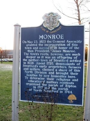
Monroe
[ front ]
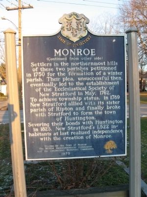
[ back ]
Settlers in the northernmost hills of these two parishes petitioned in 1750 for the formation of a winter parish. Their plea, unsuccessful then, eventually led to the establishment of the Ecclesiastical Society of New Stratford in May, 1762. To achieve township status, in 1789 New Stratford allied with its sister parish of Ripton and finally broke with Stratford to form the town of Huntington. Severing their bonds with Huntington in 1823, New Stratford’s 1,522 inhabitants at last realized independence with the creation of Monroe.
Erected by the Town of Monroe
The Monroe Sesquicentennial Commission
And the Connecticut Historical Commission
1973
Erected 1973 by Town of Monroe, Monroe Sesquicentennial Commission, Connecticut Historical Commission.
Topics. This historical marker is listed in these topic lists: Colonial Era • Settlements & Settlers. A significant historical month for this entry is May 1775.
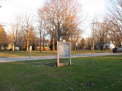
Location. 41° 19.956′ N, 73° 12.455′ W. Marker is in Monroe, Connecticut, in Fairfield County. Marker is at the intersection of Monroe Turnpike (Route 111) and Church Street, on the left when traveling north on Monroe Turnpike. Located on the Monroe Green. Touch for map. Marker is in this post office area: Monroe CT 06468, United States of America. Touch for directions.
Other nearby markers. At least 8 other markers are within 3 miles of this marker, measured as the crow flies. Barton L. Weller (within shouting distance of this marker); Monroe Veterans Memorial (about 300 feet away, measured in a direct line); Monroe World War II Memorial (about 300 feet away); Monroe World War I Memorial (about 300 feet away); Monroe Korean War Memorial (about 400 feet away); PFC John K. Goett (about 400 feet away); The Rochambeau Route 1781 – 82 (about 500 feet away); Bridgeport / Newtown Turnpike (approx. 3 miles away). Touch for a list and map of all markers in Monroe.
Credits. This page was last revised on June 16, 2016. It was originally submitted on January 1, 2010, by Michael Herrick of Southbury, Connecticut. This page has been viewed 1,475 times since then and 36 times this year. Photos: 1, 2, 3. submitted on January 1, 2010, by Michael Herrick of Southbury, Connecticut. • Syd Whittle was the editor who published this page.


