Thurmont in Frederick County, Maryland — The American Northeast (Mid-Atlantic)
Bob's Hill Trail — Patterson Family Memory Landscape
Catoctin Furnace Iron Trail
Photographed by Allen C. Browne, October 30, 2024
1. Bob's Hill Trail — Patterson Family Memory Landscape Marker
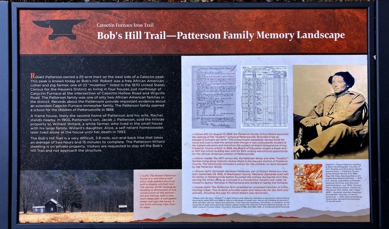
Robert Patterson owned a 25-acre tract on the west side of a Catoctin peak. This peak is known today as Bob's Hill. Robert was a free African American collier and pig farmer, one of 22 “mulattos”* listed in the 1870 United States Census for the Hauvers District as living in four houses just northwest of Catoctin Furnace at the intersection of Catoctin Hollow Road and Wigville Road. The Patterson family was one of only two African American families in the district. Records about the Pattersons provide important evidence about an extended Catoctin Furnace ironworker family. The Patterson family opened school for tne Children of Pattersonville in 1888.
A frame second home of Patterson and his wife, Rachel, stands nearby. In 1903, Patterson's son, Jacob J. Patterson, sold the hillside property to William Willard, a white farmer, who lived in the small house with his large family. Willard's daughter, Alice, a self-reliant homesteader, later lived alone at the house until her death in 1993.
The Bob's Hill Trail is a very difficult, 3.8-mile, out-and-back hike that takes an average of two hours and 15 minutes to complete.
this page online
[Captions:]
<< (Left) The Robert Patterson house is a one-and-a-half-story, side-gabled structure with a steeply pitched roof. The narrow, 12’x16’ rectangular dwelling is reminiscent of folk construction of the period—tall and narrow, with a one-room-deep plan. A corrugated metal roof caps the house. A low brick chimney rises from its edge.
<< (Above left) On August 15, 1888, the Frederick County School Board approved the opening of the “mulatto” school at Pattersonville “provided it has an average scholar per term.” The school board repeatedly found the way and means to care for even though it was undoubtedly located at the highest elevation and therefore the coldest ambient temperature of any Frederick County school. In 1890, the Board of Education sought a buyer and “sold the old school building and lot for $50, ending the opportunity for the African American children of Pattersonville.”
>> (Above middle) The 1870 census lists the Patterson family and other “mulatto” families living along Catoctin Hollow Road in the Hauvers District of Frederick County. The community included a school for the children on land donated by the Patterson family.
>> (Above right) Zachariah Abraham Patterson, son of Robert Patterson, was born September 28, 1836, in Washington County, Maryland. Zachariah lived with his family at Pattersonville before he joined the military during the Civil War, serving the Union Army as a private in Company C of the 7th Maryland Volunteers in Pennsylvania and working in nearby iron furnaces.
>> (Lower right) The Patterson farm straddled an unnamed tributary of Little Hunting Creek. This location provided water and resources for the farm and animals, including the pigs for which Robert was renowned.
*Please note the term “mulatto” is both archaic and offensive. However, it was used in these historic documents dated 1870 and 1888 to refer to individuals of mixed race. We do not condone its use and it does not align with our values and practices. If you have any questions, comments. or concerns or you would like to learn more about this history, please contact the Catoctin Furnace Historical Society. Inc. at 12670 Catoctin Furnace Road, Thurmont, Maryland 27788, 240-288-7396, or [email protected].
Erected by Catoctin
Photographed by Allen C. Browne, October 30, 2024
2. Bob's Hill Trail — Patterson Family Memory Landscape Marker
Topics. This historical marker is listed in these topic lists: African Americans • Agriculture. A significant historical year for this entry is 1870.
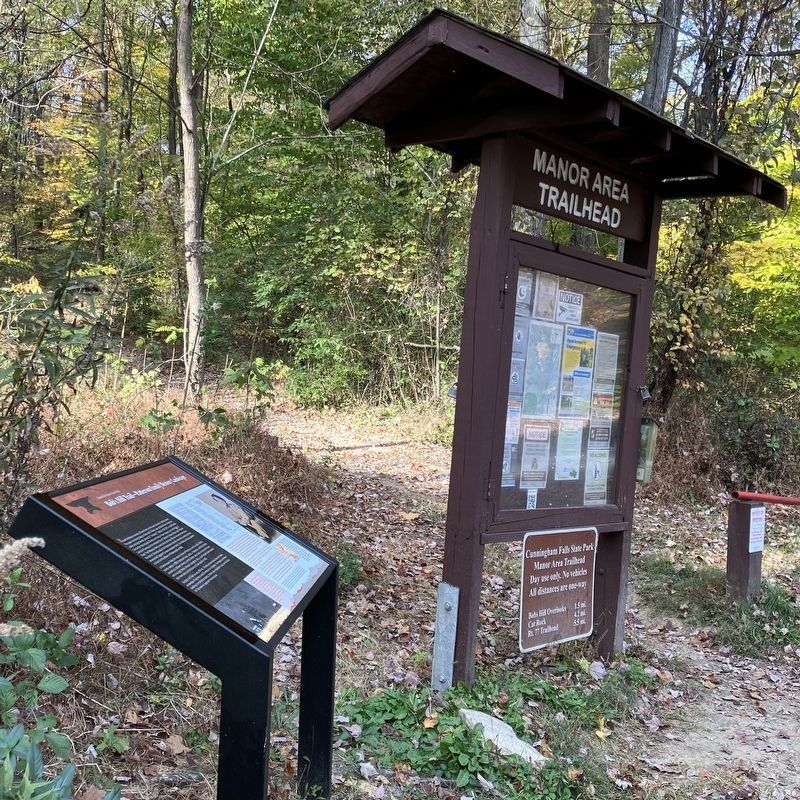
Location. 39° 35.328′ N, 77° 26.161′ W. Marker is in Thurmont, Maryland, in Frederick County. It is on Cunningham Falls Park Road. At the Manor Area Trailhead, Cunningham Falls State Park. Touch for map. Marker is at or near this postal address: 6727 Cunningham Falls Park Rd, Thurmont MD 21788, United States of America. Touch for directions.

Regionally, this marker is in the Washington Metropolitan Area and in Central Maryland. It is also in the American Mid-Atlantic. Globally, it is in North America, the Western Hemisphere, the Western World, and the Anglosphere. Historically, it finds itself in what was once one of the original Thirteen Colonies and also the Antebellum South.
Other nearby markers. At least 8 other markers are within walking distance of this marker: Walk Through History (approx. 0.2 miles away); The Ingredients For Iron (approx. ¼ mile away); Ruffed Lemur (approx. ¼ mile away); Dingo (approx. ¼ mile away); Macaws (approx. ¼ mile away); Australian Wetland Birds (approx. ¼ mile away); A Creek Rediscovered (approx. 0.3 miles away); Lucky Bird's Aviary (approx. 0.3 miles away). Touch for a list and map of all markers in Thurmont.
Other markers no longer nearby. Little Hunting Creek (was approx. 0.3 miles away but has been replaced with another marker now near it); Second Growth Forest (was approx. 0.3 miles away but has been replaced with another marker now near it).
Credits. This page was last revised on May 17, 2026. It was originally submitted on November 16, 2024, by Allen C. Browne of Silver Spring, Maryland. This page has been viewed 504 times since then and 82 times this year. Photos: 1, 2. submitted on November 16, 2024, by Allen C. Browne of Silver Spring, Maryland.
