Schuylkill Haven in Schuylkill County, Pennsylvania — The American Northeast (Mid-Atlantic)
Dock Street
Schuylkill Haven Northern Loop
Photographed by William Fischer, Jr., November 12, 2024
1. Dock Street Marker
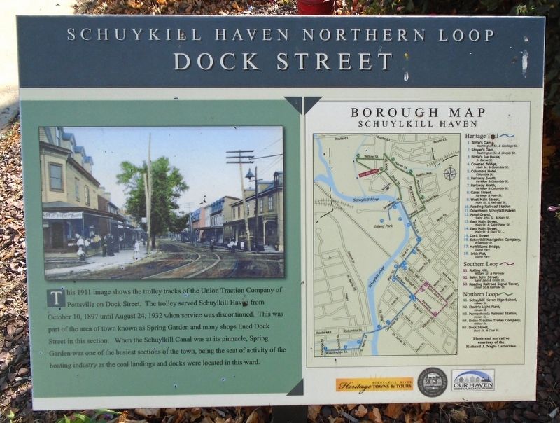
This 1911 image shows the trolley tracks of the Union Traction Company of Pottsville on Dock Street. The trolley served Schuylkill Haven from October 10, 1897 until August 24, 1932 when service was discontinued. This was part of the area of town known as Spring Garden and many shops lined Dock Street in this section. When the Schuylkill Canal was at its pinnacle, Spring Garden was one of the busiest sections of the town, being the seat of activity of the boating industry as the coal landings and docks were located in this ward.
Borough Map [and] Heritage Trail [key]
Erected by Schuylkill River Heritage Towns & Tours, Schuylkill Haven Borough, and Our Haven Foundation. (Marker Number N5.)
Topics and series. This historical marker is listed in these topic lists: Industry & Commerce • Railroads & Streetcars • Settlements & Settlers • Waterways & Vessels. In addition, it is included in the Pennsylvania, Schuylkill Haven Heritage Trail series list. A significant historical date for this entry is August 24, 1932.
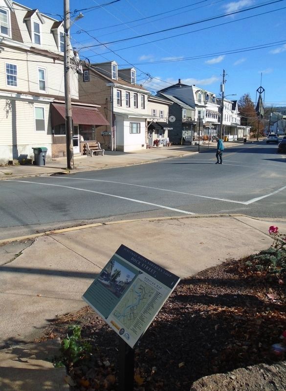
Location. 40° 38.132′ N, 76° 10.537′ W. Marker is in Schuylkill Haven, Pennsylvania, in Schuylkill
this page online

Regionally, this marker is in Pennsylvania’s Anthracite Coal Region. It is also in the American Northeast, in the Mid-Atlantic, in Appalachia, and specifically in Northern Appalachia. Globally, it is in North America, the Western Hemisphere, the Western World, and the Anglosphere. Historically, it finds itself in what was once the Haudenosaunee (Iroquois) Confederacy and also one of the original Thirteen Colonies.
Other nearby markers. At least 8 other markers are within walking distance of this marker: Pennsylvania Railroad Station (about 400 feet away, measured in a direct line); Jerusalem Evangelical Lutheran Church Labyrinth (about 500 feet away); Union Traction Trolley Company (about 700 feet away); Electric Light Plant (about 700 feet away); Schuylkill Navigation Company (approx. 0.2 miles away); McWilliams Bridge (approx.
Photographed by William Fischer, Jr., November 12, 2024
2. Dock Street Marker
Also see . . . Schuylkill Haven Trolleys. (Submitted on November 17, 2024, by William Fischer, Jr. of Reynoldsburg, Ohio.)
Credits. This page was last revised on November 17, 2024. It was originally submitted on November 17, 2024, by William Fischer, Jr. of Reynoldsburg, Ohio. This page has been viewed 267 times since then and 23 times this year. Photos: 1, 2. submitted on November 17, 2024, by William Fischer, Jr. of Reynoldsburg, Ohio.
