Near Sterling City in Sterling County, Texas — The American South (West South Central)
Foster Cemetery
(One Mile Southeast)
Photographed by Brian Anderson, August 10, 2024
1. Foster Cemetery Marker
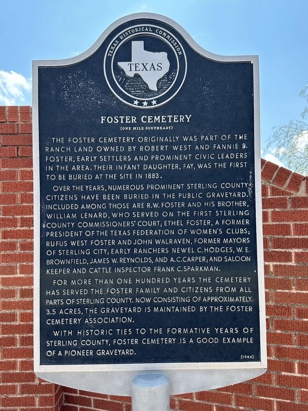
Over the years, numerous prominent Sterling County citizens have been buried in the public graveyard. Included among those are R. W. Foster and his brother, William Lenard, who served on the first Sterling County Commissioners Court; Ethel Foster, a former president of the Texas Federation of Women's Clubs; Rufus West Foster and John Walraven, former mayors of Sterling City; early ranchers Newel C. Hodges, W. E. Brownfield, James W. Reynolds, and A. Carper; and saloon keeper and cattle inspector Frank C. Sparkman.
For more than one hundred years the cemetery has served the Foster family and citizens from all parts of Sterling County. Now consisting of approximately 3.5 acres, the graveyard is maintained by the Foster Cemetery Association.
With historic ties to the formative years of Sterling County, Foster Cemetery is a good example of a pioneer graveyard.
Erected 1984 by Texas
this page online
Topics. This historical marker is listed in this topic list: Cemeteries & Burial Sites. A significant historical year for this entry is 1883.
Location. 31° 46.31′ N, 101° 1.795′ W. Marker is near Sterling City, Texas, in Sterling County. It is at the intersection of State Highway 163 and Foster Cemetary Road, on the right when traveling north on State Highway 163. Touch for map. Marker is in this post office area: Sterling City TX 76951, United States of America. Touch for directions.

Regionally, this marker is in Big Country. Globally, it is in North America, a Gulf of Mexico state, the Western Hemisphere, the Western World, and the Anglosphere. Historically, it finds itself in what was once New Spain, the Comanchería, the Republic of Texas, and one of the Confederate States of America.
Other nearby markers. At least 8 other markers are within 6 miles of this marker, measured as the crow flies: William Lenard Foster (approx. one mile away); Robert West Foster (approx. one mile away); Town of Cummins (approx. 4.8 miles away); Sterling County Jail (approx. 5.1 miles away); State Hotel – First State Bank

Photographed by Brian Anderson, August 10, 2024
2. Foster Cemetery Marker
Credits. This page was last revised on November 17, 2024. It was originally submitted on November 17, 2024, by Brian Anderson of New Albany, Ohio. This page has been viewed 446 times since then and 53 times this year. Photos: 1, 2. submitted on November 17, 2024, by Brian Anderson of New Albany, Ohio.
