Camarillo in Ventura County, California — The American West (Pacific Coastal)
Camarillo Grove Park History
Photographed by Craig Baker, November 15, 2024
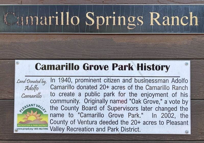
1. Camarillo Grove Park History Marker
In 1940, prominent citizen and businessman Adolfo Camarillo donated 20+ acres of the Camarillo Ranch to create a public park for the enjoyment of his community. Originally named "Oak Grove," a vote by the County Board of Supervisors later changed the name to "Camarillo Grove Park." In 2002, the County of Ventura deeded the 20+ acres to Pleasant Valley Recreation and Park District.
Erected by Pleasant Valley Recreation and Park District.
Topics. This historical marker is listed in these topic lists: Parks & Recreational Areas • Settlements & Settlers. A significant historical year for this entry is 1940.
Location. 34° 12.281′ N, 118° 58.261′ W. Marker is in Camarillo, California, in Ventura County. It is on Camarillo Springs Road one mile east of U.S. 101. Touch for map. Marker is at or near this postal address: 6800 Camarillo Springs Rd, Camarillo CA 93012, United States of America. Touch for directions.

Regionally, this marker is in Greater Los Angeles, on the Central Coast, and in the Transverse Ranges. It is also on the American Pacific Coast. Globally, it is in North America, on the Ring of
this page online
Other nearby markers. At least 8 other markers are within 4 miles of this marker, measured as the crow flies: Adolfo Camarillo Heritage Grove (approx. 2.8 miles away); Camarillo Ranch House (approx. 2.8 miles away); El Camino Real Bell (approx. 2.9 miles away); Rancho Sierra Vista (approx. 3.6 miles away); Stagecoach Inn and Sycamore Tree (approx. 3.8 miles away); Stagecoach Inn (approx. 3.8 miles away); Movie Making in Wildwood (approx. 4 miles away); The Somis School (approx. 4 miles away). Touch for a list and map of all markers in Camarillo.
Also see . . . Pleasant Valley Rec & Parks. - Park website shown on marker. (Submitted on November 17, 2024.)

Photographed by Craig Baker, November 15, 2024
2. Camarillo Grove Park History Marker
Credits. This page was last revised on November 17, 2024. It was originally submitted on November 17, 2024, by Craig Baker of Sylmar, California. This page has been viewed 381 times since then and 59 times this year. Photos: 1, 2. submitted on November 17, 2024, by Craig Baker of Sylmar, California.
