Pelican Rapids in Otter Tail County, Minnesota — The American Midwest (Upper Plains)
The Land We're On
a reflection of history

October 24, 2024
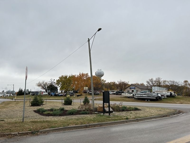
1. The Land We're On Marker
Dakota and Ojibwe Homeland
Archaeologists have documented human activity within Minnesota to at least 11,000 years ago. By the 1600s, when the first French explorers reached present-day Minnesota, the two main groups of people now occupying the region had been living here for centuries; the Dakota and the Ojibwe. Minnesota (from the Dakota 'Mni Sota Makoce') is center to the Dakota creation story and is also an important place within traditional Ojibwe history.
The Dakota and Ojibwe flourished across the Pelican Rapids area including the land now defined by the eight modern townships identified on the stone marker at this site. Beginning with the First Treaty of Prairie du Chien in 1825, this land was divided by a treaty boundary line running diagonally through parts of what eventually became Maplewood, Lida, Pelican, and Scambler Townships, with the Dakota people to the south and west of this line and the Ojibwe to the north and east.
By the end of the 1800s, through often unscrupulous and unfair treaties with the US government, both the Dakota and Ojibwe had been largely removed from their lands to reservations,
this page online
The Land Divided
Following the Revolutionary War, a system was devised to divide up the large areas of land west of the original 13 states to the Mississippi River, including portions of modern-day Minnesota. The foundations of what would become the Public Land Survey System (PLSS) were originally proposed by Thomas Jefferson in 1784. This system was intended to facilitate the distribution of land to Euro-American settlers as the American frontier pushed ever westward, resulting in the systematic displacement of Native American peoples living in its path.
The existing systems of land division in early, colonial America often resulted in irregular shaped parcels that were difficult to define. The PLSS established a much simpler, rectangular system of land division that is evident within the development patterns of much of the midwestern and western United States

October 24, 2024
2. The Land We're On Marker, from the west
The Land Settled
By the end of the 1800s the land had been divided into farms and small communities, including Pelican Rapids, largely by immigrants of Norwegian, Swedish, and German descent. Schools, churches, stores and markets were built. The abundance of water power in the region and the arrival of railroads made the area a center of the flour milling and lumber industries. Then, as today, visitors marveled at the natural beauty of the forests, prairies, lakes, and rivers that would make it the recreational destination it has become.
What are Townships?
The PLSS defined townships as areas of land 6 miles wide by 6 miles long. Each township is comprised of 36 sections. Each section is one mile square. The village of Pelican Rapids as originally platted (see the map to the right) is largely contained within one section of Pelican Township.
Captions:
Right: Ojibwe woman, about 1885.
Above: Dakota summer lodge, 1846-1848. Watercolor painting by Seth Eastman.
Images courtesy of Minnesota Historical Society
Left and above: Examples of the 1884 plat maps for several of the surrounding townships.
Plat map images courtesy of Otter Tail County Historical Society
Left and below: Early 20th century scenes from Pelican Rapids and the surrounding townships.
Photo courtesy of Otter Tail County Historical Society
Pelican Rapids Village
Historical Marker Wayside
History
The
October 24, 2024
3. The Land We're On Marker
Construction of the wayside by the Minnesota Highway Department (now MnDOT) began in June of 1946 and the marker was dedicated on Sept. 22, 1946.
Did You Know...?
The grassy area behind the stone marker once extended over 400 feet further to the north and originally comprised a much larger wayside! It was planted with a variety of shade trees and offered a large area for public gatherings.
Captions:
Pelican Rapids Historical Marker Wayside, circa 1947, looking north.
Minnesota Highway Department engineers reviewing construction of the stone marker, circa 1946.
For more information about this and other Historic Roadside Properties throughout Minnesota, please visit: mndot.gov/roadsides/historic
Erected by Minnesota

October 24, 2024
4. Pelican Rapids Village Historical Markers
Topics. This historical marker is listed in these topic lists: Indigenous Peoples and Communities • Settlements & Settlers. A significant historical year for this entry is 1825.
Location. 46° 34.82′ N, 96° 5.007′ W. Marker is in Pelican Rapids, Minnesota, in Otter Tail County. It is on County Highway 9 north of U.S. 59, on the right when traveling north. Located at the Pelican Rapids Village Historical Marker Wayside area. Touch for map. Marker is in this post office area: Pelican Rapids MN 56572, United States of America. Touch for directions.

Regionally, this marker is in the American Midwest and in the Corn Belt. Globally, it is in North America, the Western Hemisphere, the Western World, and the Anglosphere. Historically, it finds itself in what was once Rupert’s Land, the territory of the Mississippian Culture, and the Louisiana Purchase.
Other nearby markers. At least 8 other markers are within 4 miles of this marker, measured as the crow flies: Mill Stones (here, next to this marker); Pelican Rapids Village (a few steps from this marker); Mill Pond Suspension Bridge (approx. 0.7 miles away); Arrival of the Railroad at Pelican Rapids (approx. 0.7 miles away); The World's Largest Pelican (approx. ¾ mile away); Pelican Rapids (approx. ¾ mile away); Minnesota Woman (approx. 2½ miles away); Churches & Cemeteries (approx. 3.3 miles away). Touch for a list and map of all markers in Pelican Rapids.
Related marker. Click here for another marker that is related to this marker.
Also see . . . Pelican Rapids Village Historical Marker - MNDOT Historic Roadside Structures Inventory (PDF). (Submitted on November 18, 2024.)
Credits. This page was last revised on November 18, 2024. It was originally submitted on November 18, 2024. This page has been viewed 299 times since then and 36 times this year. Photos: 1, 2, 3, 4. submitted on November 18, 2024.
