Cape Girardeau in Cape Girardeau County, Missouri — The American Midwest (Upper Plains)
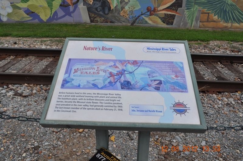
Nature's River
Photographed by Sandra Hughes, August 12, 2012
1. Nature's River Marker
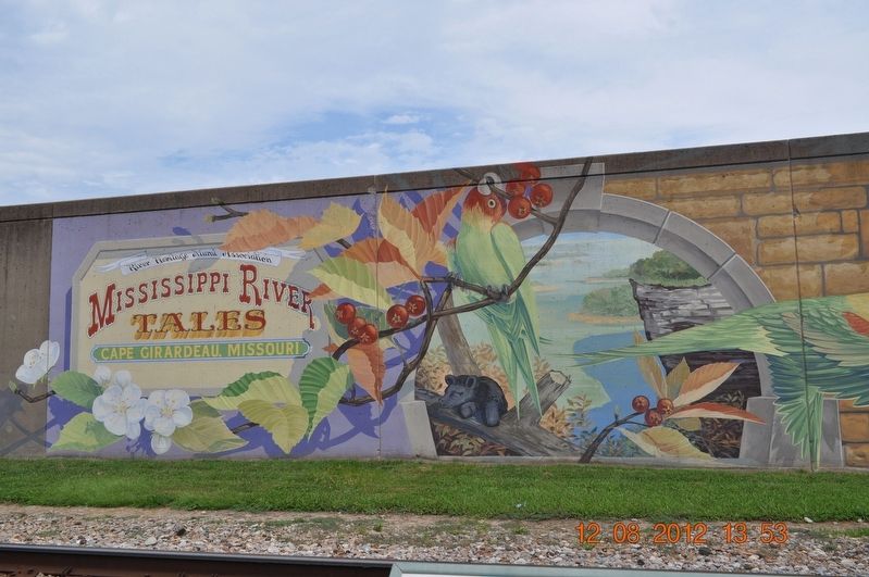
Before humans lived in this area, the Mississippi River Valley was a great wide wetland teaming with plant and animal life. The hawthorn plant, with its brilliant blossoms and bright red berries, became the Missouri state flower. The Carolina parakeet, once prevalent in the river valley, had generally vanished by 1900.
The last known member of the species died on February 21, 1918 in the Cincinnati Zoo.
Panel Sponsors:
John, Jerrianne and Murielle Wyman
Erected by Mississippi River Tales River Heritage Mural Association Cape Giradeau Missiour Where the river turns a thousand tales.
Topics. This historical marker is listed in these topic lists: Animals • Environment. A significant historical date for this entry is February 21, 1918.
Location. This marker has been replaced by another marker nearby. It was located near 37° 18.375′ N, 89° 31.048′ W. Marker was in Cape Girardeau, Missouri, in Cape Girardeau County. It was on North Water Street. Marker is located along Water Street in front of the Mural Wall next to the Mississippi River. Touch for map. Marker was at or near this postal address: 20 N Water St, Cape Girardeau
this page online

Regionally, this marker was in Southeast Missouri. It was also in the American Ozarks, in the Lewis & Clark Corridor, in the Corn Belt, and in the Great River Road Region. Globally, it was in North America, the Western Hemisphere, the Western World, and the Anglosphere. Historically, it found itself in what was once the territory of the Mississippian Culture, the Louisiana Purchase, and the Antebellum South.
Other nearby markers. At least 8 other markers are within walking distance of this location: A different marker also named Nature's River (here, next to this marker); 1200 (a few steps from this marker); Reflecting the River (within shouting distance of this marker); 1673 (within shouting distance of this marker); a different marker also named 1673 (within shouting distance of this marker); a different marker also named 1735 (within shouting distance of this marker); Pook's Turtles (within shouting distance of this marker); a different marker also named 1793 (within shouting distance of this marker). Touch for a list and map of all markers in Cape Girardeau.
Other
Photographed by Sandra Hughes, August 12, 2012
2. Nature's River Marker
Related marker. Click here for another marker that is related to this marker. This marker has been replaced with the linked marker.
Also see . . .
1. Carolina parakeet. The Carolina parakeet (Conuropsis carolinensis) or Carolina conure was a small green neotropical parrot with a bright yellow head, reddish orange face and pale beak native to the eastern, midwest and plains states of the United States and was the only indigenous parrot within its range, as well as one of only two parrots native to the United States (the other being the thick-billed parrot). It was found from southern New York and Wisconsin to Kentucky, Tennessee and the Gulf of Mexico, from the Atlantic seaboard to as far west as eastern Colorado. It lived in old-growth forests along rivers and in swamps.[2]

Photographed by Edward Troxel, November 16, 2024
3. Nature's River Marker
2. Wetland. A wetland is a land area that is saturated with water, either permanently or seasonally, such that it takes on the characteristics of a distinct ecosystem.[2] The primary factor that distinguishes wetlands from other land forms or water bodies is the characteristic vegetation of aquatic plants,[3][4] adapted to the unique hydric soil. Wetlands play a number of roles in the environment, principally water purification, flood control, carbon sink and shoreline stability. Wetlands are also considered the most biologically diverse of all ecosystems, serving as home to a wide range of plant and animal life.[5] (Submitted on September 1, 2017, by Sandra Hughes Tidwell of Killen, Alabama, USA.)
3. Mississippi River Tales Mural.

Photographed by Edward Troxel, November 16, 2024
4. Nature's River Marker
Credits. This page was last revised on February 6, 2025. It was originally submitted on August 30, 2017, by Sandra Hughes Tidwell of Killen, Alabama, USA. This page has been viewed 322 times since then and 19 times this year. Last updated on November 22, 2024, by Edward Troxel of Creal Springs, Illinois. Photos: 1, 2. submitted on August 30, 2017, by Sandra Hughes Tidwell of Killen, Alabama, USA. 3, 4. submitted on November 22, 2024, by Edward Troxel of Creal Springs, Illinois. • J. Makali Bruton was the editor who published this page.
