Schießhaus in Bayreuth, Bavaria, Germany — Central Europe
Sternplatz
Photographed by James Hulse, October 2, 2024
1. Sternplatz Marker

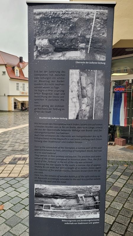
Erst bei der Sanierung des Sternplatzes trat zwischen zwei Leitungen ein schmaler Mauerzug aus Buckelquadern, die nicht zweitverwendet waren, zu Tage. Sie liegen in ihrer ursprünglichen Baugrube. Lage und Ausrichtung der Steine ent sprechen historischen Plänen. Somit gelang der erstmalige Nachweis der Torburg im Osten der Stadt.
Mit Verlassen des Sternplatzes nach Süden, lassen sich auf einem schmalen Streifen von ca. 80 cm Breite, aber 10 m Länge, erneut die aus der Opernstraße bekannte Abfolge von Brand- und Zerstörungshorizonten nachweisen. Auch hier existieren die Überreste von Holzgebäuden des 14.Jh. Entsprechend reichte Bayreuth in weiteren Umfang nach Osten hinweg über Stadtmauer und Graben hinaus.
Bildunterschriften
(Foto Nr. 1) Überreste der äußeren Vorburg
(Foto Nr. 2) Bruchteil der äußeren Vorburg
(Foto Nr. 3) Bebauungsreste und Zerstörungshorizonte außerhalb von Stadtmauer und -graben
Rückseite
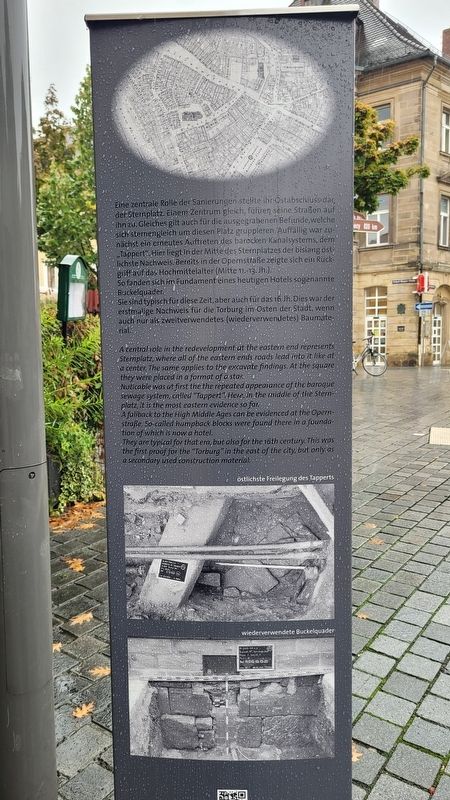
Eine zentrale Rolle der Sanierüngen stellte ihr Ostabschluss dar, der Sternplatz. Einem Zentrum gleich, führen seine Straßen auf ihn zu. Gleiches gilt auch für die ausgegrabenen Befunde, welche sich sternengleich um diesen Platz gruppieren. Auffällig war zunächst ein erneutes Auftreten des barocken Kanalsystems, dem „Tappert". Hier liegt in der Mitte des Sternplatzes der bisiang östlichste Nachweis. Bereits in der Opernstraße zeigte sich ein Rückgriff auf das Hochmittelalter (Mitte 11.-13. Jh.). So fanden sich im Fundament eines heutigen Hotels sogenannte Buckelquader. Sie sind typisch für diese Zeit, aber auch für das 16. Jh. Dies war der erstmalige Nachweis für die Torburg im Osten der Stadt, wenn auch nur als zweitverwendetes (wiederverwendetes) Baumaterial.
Bildunterschriften
(Foto Nr. 1) östlichste Freilegung des Tapperts
(Foto Nr. 2) wiederverwendete Buckelquader
During
this page online
Captions
(Photo #1) Remains of the outer bailey
(Photo #2) Fraction of the outer bailey
(Photo #3) Remains of buildings and destruction horizons outside the city walls and moat
Reverse Side
A central role in the redevelopment at the eastern end represents Sternplatz, where all of the eastern ends roads lead into it like at a center. The same applies to the excavate findings. At the square they were placed in a format of a star. Noticable
Photographed by James Hulse, October 2, 2024
2. Sternplatz Marker - Reverse Side
Captions
(Photo #1) easternmost exposure of the Tappert
(Photo #2) reused humpback blocks
Erected by Bavarian State Ministry for Housing, Construction and Transport.
Topics. This historical marker is listed in these topic lists: Anthropology & Archaeology • Industry & Commerce • Settlements & Settlers.
Location. 49° 56.611′ N, 11° 34.685′ E. Marker is in Bayreuth, Bayern (Bavaria). It is in Schießhaus. It is at the intersection of Opernstraße and Badstraße, on the right when traveling north on Opernstraße. The marker is located at the intersection of several streets. Touch for map. Marker is at or near this postal address: Opernstraße 12, Bayreuth BY 95444, Germany. Touch for directions.

Regionally, this marker is in German Franconia. Globally, it is in Europe, the European Union, Atlantic Europe, Central Europe, the Schengen Area, Western Europe, and the Western World. Historically, it finds itself in what was once the Holy Roman Empire and also the former West Germany.
Other nearby markers. At least 8 other markers are within walking distance of this marker: In den Escherhäusern: Zürich II / In the Escherhäuser: Zürich II (within shouting distance of this marker); Zwei Intendanten / Two Directors: Lüttichau (mit Frau) und Bronsart von Schellendorf
Photographed by James Hulse, October 2, 2024
3. The view of the Sternplatz Marker along the street
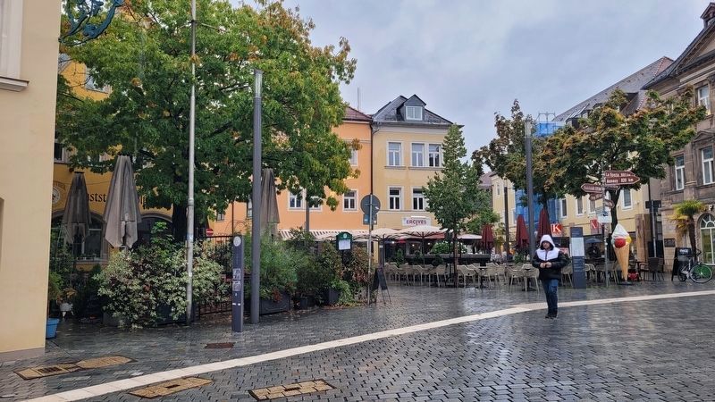
The marker is located on the left side near the street light.
Another marker is no longer nearby. Drei Schweizer/Three Swiss: Sulzer, Müller, Ott-Usteri (was within shouting distance of this marker but has been permanently removed).
Also see . . . Sternplatz (German language). Bayerisches Staatsministerium für Wohnen, Bau und Verkehr
English Translation - Sternplatz got its name from the layout of the streets. Five streets meet here in a radial pattern. The square used to be called Maximiliansplatz or Kutscherplatz. In the middle of Sternplatz you could see a Tappert figure. When reading this extract from the excavation report, even laypeople will realize the enthusiasm with which the findings are recorded for posterity.(Submitted on November 26, 2024, by James Hulse of Medina, Texas.)
Credits. This page was last revised on November 26, 2024. It was originally submitted on November 22, 2024, by James Hulse of Medina, Texas. This page has been viewed 91 times since then and 6 times this year. Photos: 1, 2, 3. submitted on November 26, 2024, by James Hulse of Medina, Texas.
