Parowan in Iron County, Utah — The American Mountains (Southwest)
Establishing a Community
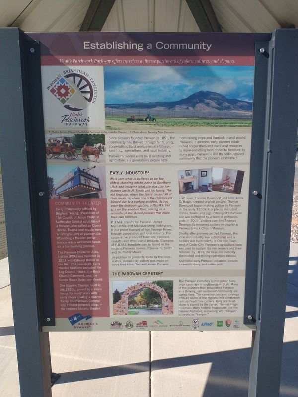
Photographed by Tom Bosse, July 29, 2024
1. Establishing a Community Marker
[Caption]: Utah’s Patchwork Parkway offers travelers a diverse patchwork of colors, cultures, and climates.
[Caption]: Photo below: Pioneer Parade in Parowan & the Aladdin Theater. Photo above: Farming Near Parowan
Since pioneers founded Parowan in 1851, the community has thrived through faith, unity, cooperation, hard work, resourcefulness, ranching, agriculture, and local industry.
Parowan’s pioneer roots lie in ranching and agriculture. For generations, people have been raising crops and livestock in and around Parowan. In addition, early pioneers established cooperatives and used local resources to make everything from dishes to furniture. In many ways, Parowan is still the self-sustained community that the pioneers established.
Early Industries
Walk into what is believed to be the oldest standing adobe home in Southern Utah and imagine what life was like for pioneer Jessie N. Smith and his family. The old fireplace, where the family cooked all of their meals, is where one of the children got burned due to a cooking accident. As you enter the bedroom upstairs, a P.U.M.I bed sits on the wooden floor, serving
this page online
P.U.M.I. stands for Parowan United Mercantile and Manufacturing Institution. It is a prime example of how Parowan thrived through cooperation and local industry. The cooperative produced furniture, cabinets, caskets, and other useful products. Examples of P.U.M.I furniture can be found in the historic Parowan homes of Jessie N. Smith and Dr. Priddy Meeks.
In addition to products made by the cooperative, native-clay pottery was made on wood-fired kilns. Two well-known Parowan craftsmen, Thomas Davenport and later Amos C. Hatch, created original pottery. Thomas Davenport began making pottery in Parowan in the early 1850s. His pieces included dishes, bowls, and jugs. Davenport’s Parowan kiln was excavated by a team of archaeologists in 2009. Visitors can find Thomas Davenport’s renowned pottery on display at Parowan’s Rock Church Museum.
Shortly after pioneers settled Parowan, the local iron industry was established and a furnace was built nearby in Old Iron Town, west of Cedar City. Parowan’s agriculture base was used to sustain the iron workers and their families.
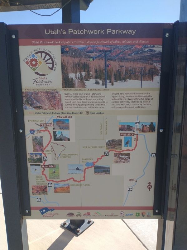
Photographed by Tom Bosse, July 29, 2024
2. Utah’s Patchwork Parkway
Additional early Parowan industries include a sawmill, dairy, and cotton mill.
Community Theater
Every community settled by Brigham Young (President of The Church of Jesus Christ of Latter-day Saints) established a theater, also called an Opera House. Drama and music were an integral part of pioneer life. Attending a theater performance was a welcomed break for a hardworking pioneer.
The Parowan Dramatic Association (PDA) was founded in 1851 with Edward Dalton as the first PDA president. Early local theater locations included the Log Council House, the Rock Church Basement, and the Opera House (later torn down).
The Aladdin Theater, built in the 1920s, served as a movie house for many years with early shows costing a quarter. Today, the Parowan Community Theater presents plays in the restored historic theater.
The Parowan Cemetery
The Parowan Cemetery is the oldest European cemetery in southwestern Utah. Many of the pioneers that established Parowan as a thriving, self-sustained community are buried here. The cemetery contains carvings from

Photographed by Tom Bosse, July 29, 2024
3. Establishing a Community Marker
Topics. This historical marker is listed in these topic lists: Arts, Letters, Music • Cemeteries & Burial Sites • Industry & Commerce • Settlements & Settlers. A significant historical year for this entry is 1851.
Location. 37° 50.349′ N, 112° 49.217′ W. Marker is in Parowan, Utah, in Iron County. It is at the intersection of South Cyn Road (U.S. 143) and East 200 South Street, on the right when traveling south on South Cyn Road. Touch for map. Marker is in this post office area: Parowan UT 84761, United States of America. Touch for directions.

Regionally, this marker is in Color Country. It is also in the American Mountain West and on the Colorado Plateau. Globally, it is in North America, the Rocky Mountains, the Western Hemisphere, the Western World, and the Anglosphere. Historically, it finds itself in what was once New Spain and also Mexico’s Alta California.
Other nearby markers. At
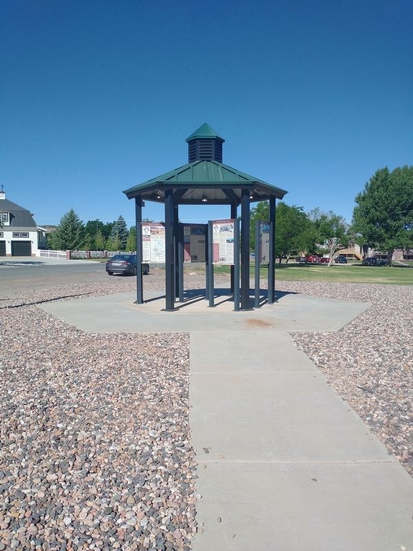
Photographed by Tom Bosse, July 29, 2024
4. Establishing a Community Marker
Related markers. Click here for a list of markers that are related to this marker.
Also see . . .
1. Parowan, Utah. (Submitted on November 23, 2024, by Tom Bosse of Jefferson City, Tennessee.)
2. Deseret alphabet. (Submitted on November 23, 2024, by Tom Bosse of Jefferson City, Tennessee.)
Credits. This page was last revised on November 26, 2024. It was originally submitted on November 23, 2024, by Tom Bosse of Jefferson City, Tennessee. This page has been viewed 222 times since then and 21 times this year. Photos: 1, 2, 3, 4. submitted on November 23, 2024, by Tom Bosse of Jefferson City, Tennessee. • Andrew Ruppenstein was the editor who published this page.
