Downtown in Omaha in Douglas County, Nebraska — The American Midwest (Upper Plains)
Missouri River Flooding
April 8, 1881
| — | Nebraska Silver Jackets Historical Marker | — |

Photographed by McGhiever, November 16, 2024
1. Missouri River Flooding Marker
On this day, three men attempted to reach safety by crossing floodwaters on a skiff through a break in a temporary berm. The current, which was flowing at volumes never seen since, pushed them into the main channel. Thaddeus Wren was rescued but Michael Cunningham and Nicholas Keenan drowned.
At a crest of 34.22 feet, the 1881 Missouri River Flood is the first flood in recorded history to impact Omaha. The highest recorded crest was 40.20 feet on April 18, 1952 and on July 2, 2011, the river crested at 36.29 feet.
To learn more about Omaha's flood history and how you can protect your family visit: floods.dnr.nebraska.gov
Silver Jackets brings together federal, state, and local agencies to collaborate in reducing flood risk
Erected by Nebraska Silver Jackets.
Topics. This historical marker is listed in these topic lists: Disasters • Waterways & Vessels. A significant historical date for this entry is April 8, 1881.
Location. 41° 15.806′ N, 95° 55.419′ W. Marker is in Omaha, Nebraska, in Douglas County. It is in Downtown. It is on Riverfront Drive, on the right when traveling north. The marker is at Lewis and Clark
this page online

Regionally, this marker is in Eastern Nebraska. It is also in the American Midwest, in the Lewis & Clark Corridor, in the Corn Belt, and on the prairies. Globally, it is in North America, the Western Hemisphere, the Western World, and the Anglosphere. Historically, it finds itself in what was once the Louisiana Purchase.
Other nearby markers. At least 8 other markers are within walking distance of this marker: Labor (a few steps from this marker); Missouri River Flood (within shouting distance of this marker); People, Places, and Stories (about 500 feet away, measured in a direct line); Preserving Our Heritage (about 500 feet away); Westwardly by the Waters (about 600 feet away); Nature exerted herself to butify the Senery (about 700 feet away); Capt. Lewis…will…give us accounts of new things only (about 700 feet away); the Council was held (about 700 feet away). Touch for a list and map of all markers in Omaha.
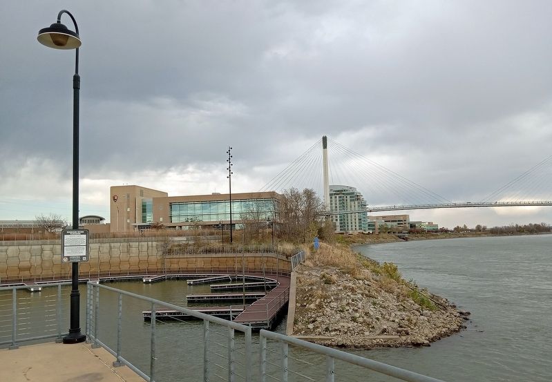
Photographed by McGhiever, November 16, 2024
2. Missouri River Flooding Marker overlooking Riverfront Marina and the Bob Kerrey Pedestrian Bridge
Credits. This page was last revised on November 24, 2024. It was originally submitted on November 24, 2024, by McGhiever of Minneapolis, Minnesota. This page has been viewed 358 times since then and 46 times this year. Photos: 1, 2. submitted on November 24, 2024, by McGhiever of Minneapolis, Minnesota.
