Winnsboro in Fairfield County, South Carolina — The American South (South Atlantic)
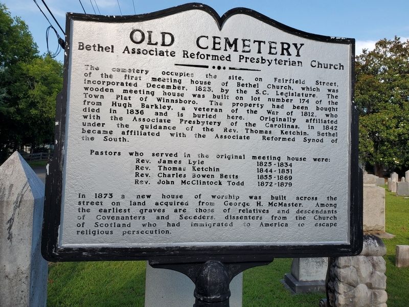
Old Cemetery
Bethel Associate Reformed Presbyterian Church
Photographed by Mark Parker, July 3, 2023
1. Old Cemetery Marker
Rev. James Lyle 1825-1834
Rev. Thomas Ketchin 1844-1851
Rev. Charles Bowen Betts 1855-1869
Rev. John McClintock Todd 1872-1879
In 1873 a new house of worship was built across the street on land acquired from George H. McMaster. Among the earliest graves are those of relatives and descendants of Covenanters and Seceders. dissenters from the Church of Scotland who had immigrated to America to escape religious persecution.
Topics. This historical marker is listed in these topic lists: Cemeteries & Burial Sites
this page online
Location. 34° 23.063′ N, 81° 5.357′ W. Marker is in Winnsboro, South Carolina, in Fairfield County. It is at the intersection of Fairfield Street and North Vanderhorst Street, on the right when traveling east on Fairfield Street. The marker is inside the fence on the Fairfield Street side of the cemetery property. Touch for map. Marker is in this post office area: Winnsboro SC 29180, United States of America. Touch for directions.

Regionally, this marker is in the Midlands and in the Olde English District. It is also in the American South and specifically in the Deep South. Globally, it is in North America, the Western Hemisphere, the Western World, and the Anglosphere. Historically, it finds itself in what was once the territory of the Mississippian Culture, one of the original Thirteen Colonies, one of the Confederate States of America, and the Antebellum South.
Other nearby markers. At least 8 other markers are within walking distance of this marker: Williford House (about 600 feet away, measured in a direct line); St. Paul Baptist Church
Photographed by Mark Parker, July 3, 2023
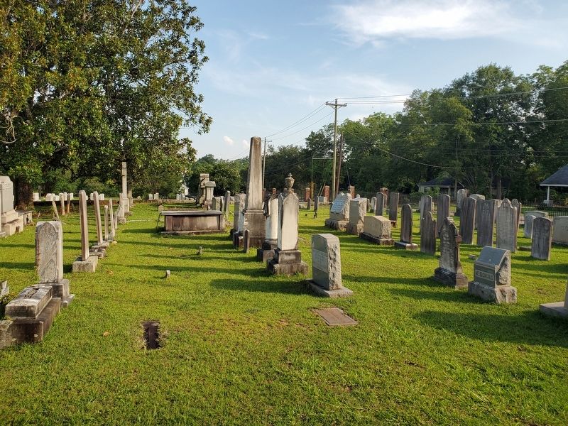
2. View of the Old Cemetery from Fairfield Street
Credits. This page was last revised on December 19, 2024. It was originally submitted on November 27, 2024, by Mark Parker of Hickory, North Carolina. This page has been viewed 307 times since then and 35 times this year. Photos: 1, 2. submitted on November 27, 2024, by Mark Parker of Hickory, North Carolina. • Bill Pfingsten was the editor who published this page.
