Fort Payne in DeKalb County, Alabama — The American South (East South Central)
Fort Payne’s Fort
Photographed by Tim Carr, June 15, 2008
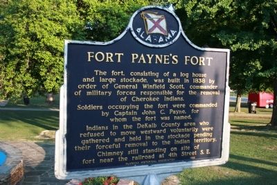
1. Fort Payne’s Fort Marker
The fort, consisting of a log house and large stockade, was built in 1838 by order of General Winfield Scott, commander of military forces responsible for the removal of Cherokee Indians.
Soldiers occupying the fort were commanded by Captain John C. Payne, for whom the fort was named.
Indians in the DeKalb County area who refused to move westward voluntarily were gathered and held in the stockade pending their forceful removal to the Indian territory.
Chimney still standing on site of fort near the railroad at 4th Street S. E.
Erected 1983 by Alabama Historical Association.
Topics and series. This historical marker is listed in these topic lists: Forts and Castles • Indigenous Peoples and Communities • Military. In addition, it is included in the Alabama Historical Association series list. A significant historical year for this entry is 1838.
Location. Marker has been reported missing. It was located near 34° 26.615′ N, 85° 43.199′ W. Marker was in Fort Payne, Alabama, in DeKalb County. It was on Gault Avenue North (U.S. 11) east of 4th Street, on the right when traveling east. Marker is located
this page online

Regionally, this marker was in North Alabama. It was also in the American South, specifically in the Deep South, in Appalachia, and specifically in Southern Appalachia. Globally, it was in North America, a Gulf of Mexico state, the Western Hemisphere, the Western World, and the Anglosphere. Historically, it found itself in what was once the original Cherokee Nation, the territory of the Mississippian Culture, one of the Confederate States of America, and the Antebellum South.
Other nearby markers. At least 8 other markers are within walking distance of this location: Whittler's Corner (within shouting distance of this marker); Alabama (within shouting distance of this marker); Confederate Monument (within shouting distance of this marker); Fort Payne Opera House (about 400 feet away); Sequoyah | Socks | Song | Scenery (about 500 feet away); Fort Payne Residential Historic District (about 800 feet away); Main Street Historic District (approx. 0.3 miles away);
Photographed by Tom Bosse, November 25, 2016
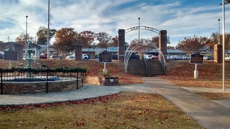
2. Fort Payne’s Fort Marker
The Fort Payne’s Fort Marker is located on the left.
Other markers no longer nearby. Sequoyah (was here, next to this marker but has been confirmed missing); Wills Town Mission (was here, next to this marker but has been confirmed missing); Boom Town Historic District (was about 300 feet away, measured in a direct line but has been confirmed missing).
Also see . . . Landmark's Projects The Old Fort Site. (Submitted on February 27, 2010, by Timothy Carr of Birmingham, Alabama.)
Photographed by Tim Carr, June 15, 2008
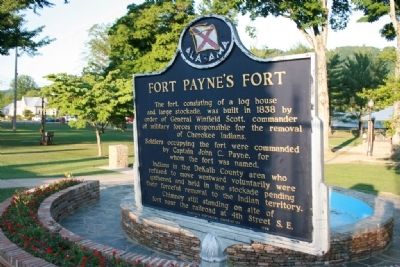
3. Fort Payne’s Fort Marker by fountain
Credits. This page was last revised on December 17, 2024. It was originally submitted on February 27, 2010, by Timothy Carr of Birmingham, Alabama. This page has been viewed 3,218 times since then and 94 times this year. Last updated on November 29, 2024, by Edward Troxel of Creal Springs, Illinois. Photos: 1. submitted on February 27, 2010, by Timothy Carr of Birmingham, Alabama. 2. submitted on November 27, 2016, by Tom Bosse of Jefferson City, Tennessee. 3. submitted on February 27, 2010, by Timothy Carr of Birmingham, Alabama. • James Hulse was the editor who published this page.
