Fort Payne in DeKalb County, Alabama — The American South (East South Central)
Wills Town Mission
Photographed by Tim Carr, June 15, 2008
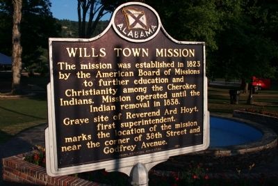
1. Wills Town Mission Marker
The mission was established in 1823 by the American Board of Missions to further education and Christianity among the Cherokee Indians. Mission operated until the Indian removal in 1838.
Grave site of Reverend Ard Hoyt, first superintendent, marks the location of the mission near the corner of 38th Street and Godfrey Avenue.
Erected 1983 by Alabama Historical Association.
Topics and series. This historical marker is listed in these topic lists: Education • Indigenous Peoples and Communities • Religion & Religious Structures. In addition, it is included in the Alabama Historical Association series list. A significant historical year for this entry is 1823.
Location. Marker has been reported missing. It was located near 34° 26.615′ N, 85° 43.199′ W. Marker was in Fort Payne, Alabama, in DeKalb County. It was on Gault Avenue North (U.S. 11) east of 4th Street, on the right when traveling east. Marker is located in Union Park near the water fountain. Touch for map. Marker was in this post office area: Fort Payne AL 35968, United States of America. Touch for directions.

Regionally, this marker was in North
this page online
Other nearby markers. At least 8 other markers are within walking distance of this location: Whittler's Corner (within shouting distance of this marker); Alabama (within shouting distance of this marker); Confederate Monument (within shouting distance of this marker); Fort Payne Opera House (about 400 feet away); Sequoyah | Socks | Song | Scenery (about 500 feet away); Fort Payne Residential Historic District (about 800 feet away); Main Street Historic District (approx. 0.3 miles away); Cherokee Indian Removal (approx. 0.3 miles away). Touch for a list and map of all markers in Fort Payne.
Other markers no longer nearby. Sequoyah (was here, next to this marker but has been confirmed
Photographed by Tom Bosse, November 25, 2016
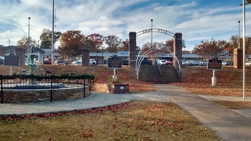
2. Wills Town Mission Marker
The Wills Town Mission Marker is the middle marker.
Credits. This page was last revised on December 11, 2024. It was originally submitted on February 27, 2010, by Timothy Carr of Birmingham, Alabama. This page has been viewed 2,489 times since then and 44 times this year. Last updated on November 29, 2024, by Edward Troxel of Creal Springs, Illinois. Photos: 1. submitted on February 27, 2010, by Timothy Carr of Birmingham, Alabama. 2. submitted on November 27, 2016, by Tom Bosse of Jefferson City, Tennessee. • Devry Becker Jones was the editor who published this page.
