Hilton Beach in Algoma District, Ontario — Central Canada (North America)
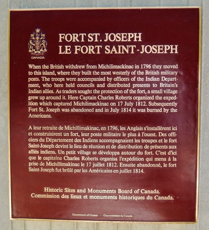
Fort St. Joseph
⎯⎯⎯
Le Fort Saint-Joseph
Photographed by Cosmos Mariner, June 10, 2024
1. Fort St. Joseph / Le Fort Saint-Joseph Marker

this page online
Erected by Historic Sites and Monuments Board of Canada/Commission des lieux et monuments historiques du Canada.
Topics and series. This historical marker is listed in these topic lists: Forts and Castles • Indigenous Peoples and Communities • Settlements & Settlers • War of 1812. In addition, it is included in the Canada, Historic Sites and Monuments Board series list. A significant historical year for this entry is 1796.
Location. 46° 3.885′ N, 83° 56.74′ W. Marker is in Hilton Beach, Ontario, in Algoma District. It can be reached from Fort Road 3 kilometers west of A Line Road. The marker is located in front of the Fort St. Joseph National Historic Site Visitor Center. Touch for map. Marker is at or near this postal address: 185 Fort Road, Hilton Beach ON P0R 1G0, Canada. Touch for directions.

Regionally, this marker is in the Sault Ste. Marie and Algoma Area and in Northern Ontario. It is also in Central Canada. Globally, it is in North America, in the Great North Woods, on the Great Lakes, on Lake Superior’s North Shore, in the Western Hemisphere, in the Western World,

Photographed by Cosmos Mariner, June 10, 2024
2. Fort St. Joseph / Le Fort Saint-Joseph Marker
Looking east from near the parking lot; the Fort St. Joseph National Historic Site Visitor Center is in the background.
Other nearby markers. At least 8 other markers are within walking distance of this marker: Fort St. Joseph (within shouting distance of this marker); Major Intersection/Une intersection importante (about 150 meters away, measured in a direct line); Inside the Walls/À l'intérieur des remparts (about 150 meters away); Build it Better/Une construction améliorée (about 150 meters away); Land of Little Comfort / Un Territoire offrant peu de confort (about 150 meters away); Want to be a Soldier?/Vous voulez être un soldat? (about 180 meters away); The Importance of Friends/L'importance des amis (about 180 meters away); Making Do/Se débrouiller avec les moyens du bord (about 210 meters away). Touch for a list and map of all markers in Hilton Beach.
Related markers. Click here for a list of markers that are related to this marker. Fort Saint Joseph National Historic Site
Also see . . .
1. Fort St. Joseph National Historic Site of Canada.

Photographed by Cosmos Mariner, June 10, 2024
3. Fort St. Joseph National Historic Site entrance
Turn west here from A Line Road to access the Fort St. Joseph historic site. The visitor center is 3 kilometers west of this gate.
Excerpt: Fort St. Joseph was designated a National Historic Site of Canada in 1923 because: it symbolizes the commercial and military alliance that existed between the British and the First Nation Peoples of the western Great Lakes region in the aftermath of the American Revolutionary War through the War of 1812; the site contains a remarkable assemblage of archaeological features which in their undeveloped state reveal part of the complex pattern of military, domestic and commercial life – Aboriginal and European - in this frontier outpost; the ruins of the fortifications and the archaeological resources dating from the 1796-1812 period are considered to be of national significance.(Submitted on November 30, 2024, by Cosmos Mariner of Cape Canaveral, Florida.)
2. Fort St. Joseph (Wikipedia).
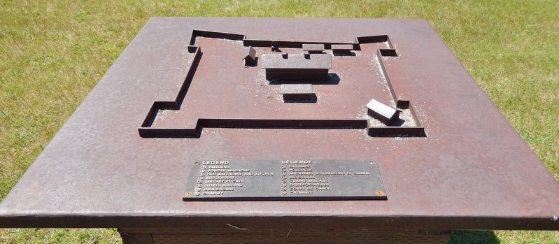
Excerpt: Fort St. Joseph is a former British outpost on the southernmost point of St. Joseph Island in Ontario, Canada, on Lake Huron. The fort consisted of a blockhouse, powder magazine, bakery building, Indian council house and storehouse surrounded by a palisade. Situated on approximately 325 hectares along the St.(Submitted on November 30, 2024, by Cosmos Mariner of Cape Canaveral, Florida.)Marys River, Fort St. Joseph was the staging ground for the initial attack in the War of 1812. The fort was an important regional military outpost and a significant meeting place for trade and commerce in the region.Photographed by Cosmos Mariner, June 10, 20244. Fort Saint Joseph Model

Photographed by Cosmos Mariner, June 10, 2024
5. Fort Saint Joseph Blockhouse Ruins
Credits. This page was last revised on September 1, 2026. It was originally submitted on November 30, 2024, by Cosmos Mariner of Cape Canaveral, Florida. This page has been viewed 224 times since then and 30 times this year. Photos: 1, 2, 3. submitted on November 30, 2024, by Cosmos Mariner of Cape Canaveral, Florida. 4, 5. submitted on September 1, 2026, by Cosmos Mariner of Cape Canaveral, Florida.
