Fort Washington in Prince George's County, Maryland — The American Northeast (Mid-Atlantic)
St. John’s Church
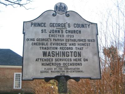
Prince George’s County
| — | Erected 1723 | — |
Photographed by F. Robby, December 1, 2004
1. Prince George's County - St. John's Church Marker
Credible evidence and honest
tradition record that
Washington
attended services here on
numerous occasions.
Erected 1932 by St. John's Church Congregation, George Washington Bi-Centennial.
Topics and series. This historical marker is listed in these topic lists: Colonial Era • Religion & Religious Structures. In addition, it is included in the Former U.S. Presidents: #01 George Washington, and the George Washington Slept Here series lists. A significant historical year for this entry is 1723.
Location. 38° 45.321′ N, 77° 0.056′ W. Marker is in Fort Washington, Maryland, in Prince George's County. It is on Broad Creek Church Road 0.1 miles south of Oxon Hill Road, on the right when traveling south. Marker is on the grounds of the church. Touch for map. Marker is at or near this postal address: 9801 Livingston Rd, Fort Washington MD 20744, United States of America. Touch for directions.

Regionally, this marker is in the Washington Metropolitan Area. It is also in the American South, specifically in the Upper South, in the Mid-Atlantic, and on the Eastern Seaboard.
this page online
Other nearby markers. At least 8 other markers are within 2 miles of this marker, measured as the crow flies: 40 Members of the Col. John Addison Family (within shouting distance of this marker); Broad Creek Historic District (approx. 0.8 miles away); Site of Silesia School (approx. 1.3 miles away); Welcome To Fort Foote (approx. 1.6 miles away); “Coach” James W. Crawford (approx. 1.7 miles away); Reporting for Duty (approx. 1.7 miles away); Another Shot (approx. 1.7 miles away); New Forts for a New War (approx. 1.7 miles away). Touch for a list and map of all markers in Fort Washington.
Other markers no longer nearby. Fort Foote (was approx. 1.6 miles away but has been reported to have been replaced with another marker now near it); a different marker also named Fort Foote (was approx. 1.7 miles away but has been reported to have been replaced with another marker now near it); King's Depression Carriage
Photographed by Richard E. Miller, November 2007
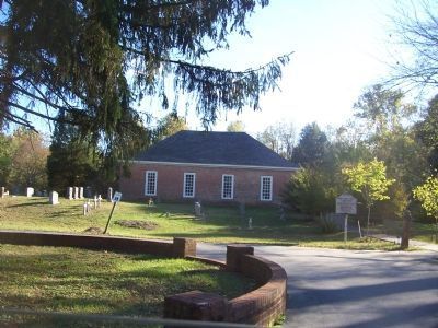
2. St. John's Church and Marker
St. John's Church, Broad Creek Historic District, Prince George's County, MD
Photographed by F. Robby, December 1, 2004
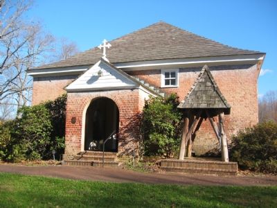
3. St. John's Church
Internet Archive
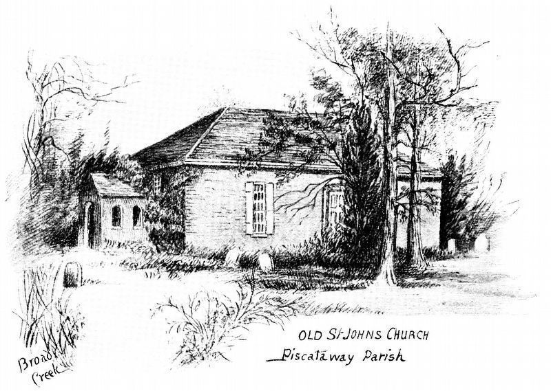
4. Old St. John's Church
Piscataway Parish
Broad Creek
Piscataway Parish
Broad Creek
From One Hundred Years Ago; or The Life and Times of Rev Walter Dulany Addison 1769-1848 by Elizabeth Hesselius Murray 1895.
Credits. This page was last revised on December 29, 2024. It was originally submitted on November 18, 2007, by F. Robby of Baltimore, Maryland. This page has been viewed 2,901 times since then and 59 times this year. Last updated on December 3, 2024, by Rico Ramirez of Prince Frederick, Maryland. Photos: 1. submitted on November 18, 2007, by F. Robby of Baltimore, Maryland. 2. submitted on December 18, 2007, by Richard E. Miller of Oxon Hill, Maryland. 3. submitted on November 18, 2007, by F. Robby of Baltimore, Maryland. 4. submitted on January 9, 2020, by Allen C. Browne of Silver Spring, Maryland. • Devry Becker Jones was the editor who published this page.
