
Frankfort in Franklin County, Kentucky — The American South (East South Central)
Daniel Boone - Pioneer
⎯⎯⎯
Grave of Daniel Boone
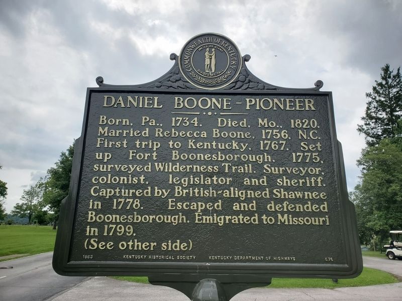
Photographed by Mark Parker, July 20, 2023
1. Daniel Boone - Pioneer side of the marker
Grave of Daniel Boone
Erected 1963 by Rotary International, District 761, Kentucky Historical Society, Kentucky Department of Highways. (Marker Number 576.)
Topics and series. This historical marker is listed in these topic lists: Cemeteries & Burial Sites • Exploration • Settlements & Settlers • War, US Revolutionary. In addition, it is included in the Rotary International series list. A significant historical date for this entry is September 13, 1845.
Location. 38° 11.865′ N, 84° 52.008′ W.
this page online

Regionally, this marker is in Kentucky’s Bluegrass Region. It is also in the American South and specifically in the Upper South. Globally, it is in North America, the Western Hemisphere, the Western World, and the Anglosphere. Historically, it finds itself in what was once the territory of the Mississippian Culture and also the Antebellum South.
Other nearby markers. At least 8 other markers are within walking distance of this marker: Frankfort Cemetery (within shouting distance of this marker); Frankfort (about 300 feet away); Governor William Gobel (about 700 feet away); Our Confederate Dead (approx. 0.2 miles away); The Trabue Family Vault (approx. ¼ mile away); Daniel Boone & Rebecca Boone (approx. ¼ mile away); Daniel Boone's Grave

Photographed by Mark Parker, July 20, 2023
2. Grave of Daniel Boone side of the Marker
Another marker is no longer nearby. Daniel Boone - Pioneer / Grave of Daniel Boone (was about 300 feet away, measured in a direct line but has been permanently removed).
Credits. This page was last revised on December 4, 2024. It was originally submitted on December 3, 2024, by Mark Parker of Hickory, North Carolina. This page has been viewed 256 times since then and 42 times this year. Photos: 1, 2. submitted on December 3, 2024, by Mark Parker of Hickory, North Carolina. • James Hulse was the editor who published this page.
Editor’s want-list for this marker. A wide view photo of the marker and the surrounding area together in context. • Can you help?
