
Stuttgart-West , Baden-Württemberg, Germany — Central Europe
Birkenkopf (Monte Scherbelino)
Photographed by Andrew Ruppenstein, September 13, 2024
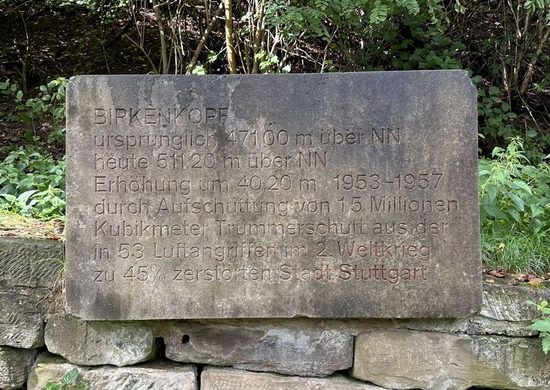
1. Birkenkopf (Monte Scherbelino) Marker

heute 511,20 m über NN
Erhöhung um 40,20 m 1953-1957
durch Aufschüttung von 1.5 Millionen
Kubikmeter Trümmerschutt aus der
in 53 Luftangriffen im 2. Weltkrieg
zu 45% zerstörten Stadt Stuttgart
Originally 471.00 meters above sea level, today 511.20 meters above sea level. Increased by 40.20 meters 1953-1957 by piling up 1.5 million cubic meters of rubble from the city of Stuttgart, which was 45% destroyed by 53 air raids in World War II.
Topics. This historical marker is listed in these topic lists: Man-Made Features • War, World II.
Location. 48° 45.87′ N, 9° 7.979′ E. Marker is in Stuttgart, Baden-Württemberg. It is in Stuttgart-West. It can be reached from Geißeichstraße. The marker is on the trail to the top of the Birkenkopf, about 100 meters in from the parking lot. Touch for map. Marker is in this post office area: Stuttgart BW 70197, Germany. Touch for directions.

Regionally, this marker is in German Swabia. Globally, it is in Europe, the European Union, Atlantic Europe, Central
this page online
Other nearby markers. At least 8 other markers are within 5 kilometers of this marker, measured as the crow flies: Birkenkopf (Monte Scherbelino) World War II Memorial (about 150 meters away, measured in a direct line); Hans Christian Andersen (approx. 2.6 kilometers away); Karl Heinrich Ulrichs (approx. 2.8 kilometers away); Friedrich E. Vogt (approx. 3.2 kilometers away); Robert Walser (approx. 3.3 kilometers away); Rest eines Rundturms / Remains of a Round Tower (approx. 3.4 kilometers away); Neue Kanzlei / New Chancellery (approx. 3.5 kilometers away); Stuttgardia (approx. 3.5 kilometers away). Touch for a list and map of all markers in Stuttgart.
Also see . . . Birkenkopf (Wikipedia). Excerpt:
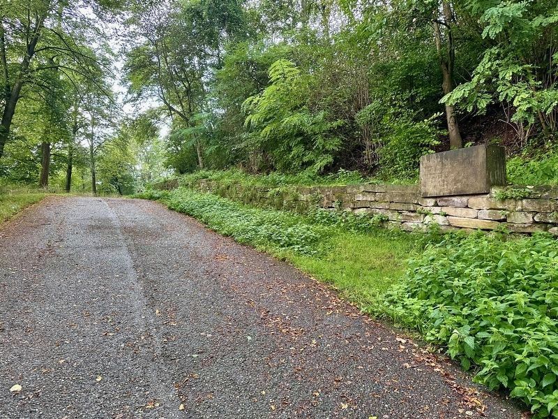
During the war, 53 Allied bombing missions destroyed over 45% of Stuttgart, and nearly the entire city center. Between 1953 and 1957, 1.5 million cubic meters of rubble were cleared and moved to the hill, which resulted in an increase in(Submitted on December 4, 2024.)height of around 40 meters. At the summit there are many recognizable facades from ruined buildings. The locals colloquially call the Birkenkopf "Monte Scherbelino", which roughly translates as "Mount Shards" but in an expression alluding to Italian…Photographed by Andrew Ruppenstein, September 13, 20242. Birkenkopf (Monte Scherbelino) Marker - wide viewThe marker is much closer to the parking lot than to the top, but it’s less than a 10 minute walk total, bottom to top.
Photographed by Andrew Ruppenstein, September 13, 2024
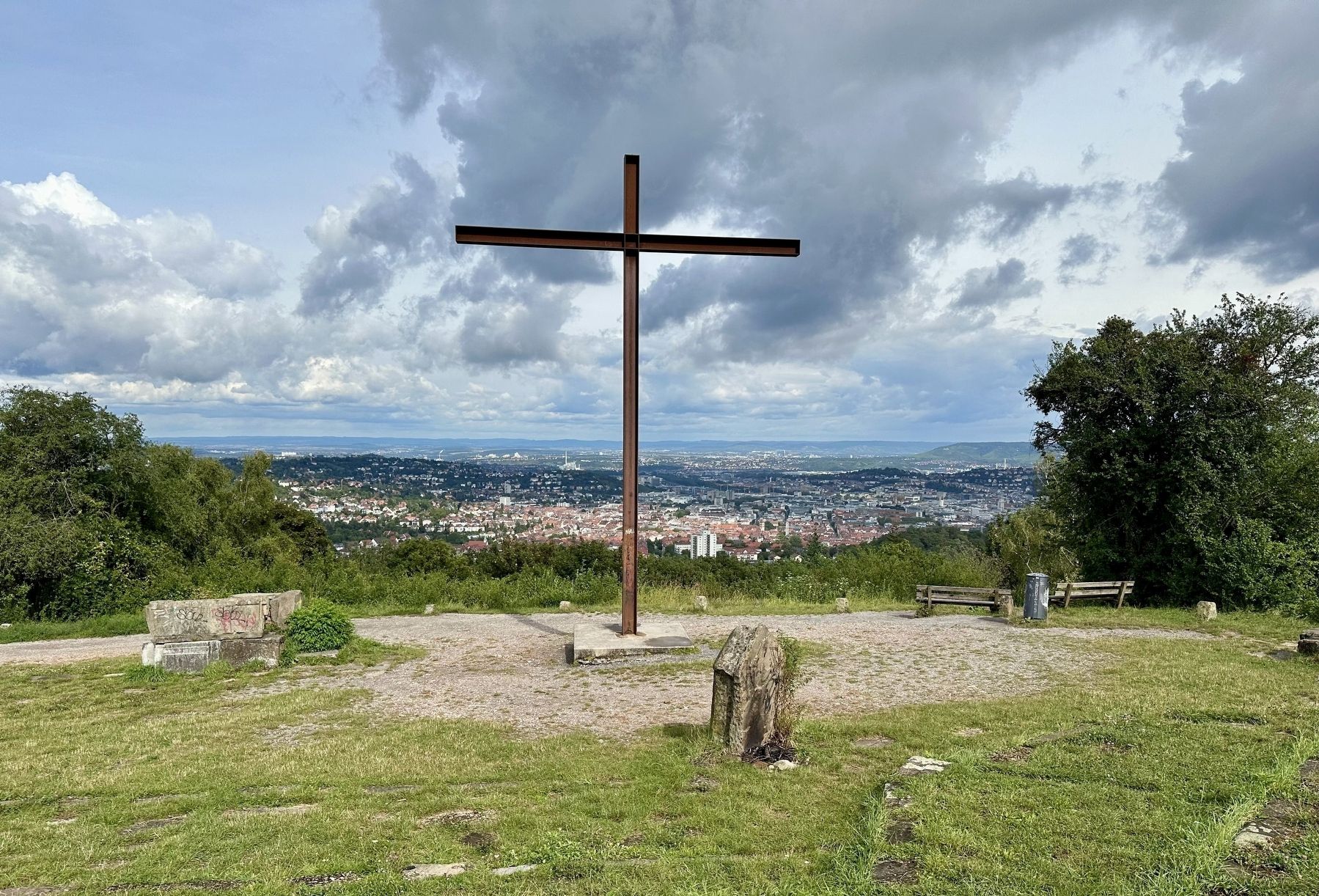
3. Birkenkopf (Monte Scherbelino) - view from the top
The Birkenkopf is a prominent hill in Stuttgart, Germany. At an elevation of 511 meters, is almost 260 meters higher than city centre. It is in part a Schuttberg, an artificial hill built from the ruins and rubble from World War II. - Wikipedia
Credits. This page was last revised on December 4, 2024. It was originally submitted on December 4, 2024, by Andrew Ruppenstein of Lamorinda, California. This page has been viewed 141 times since then and 37 times this year. Photos: 1, 2, 3. submitted on December 4, 2024, by Andrew Ruppenstein of Lamorinda, California.
